Gescher

Last updated
Gescher
Gescher Rathaus.jpg
Townhall of Gescher
Flagge Gescher.svg
DEU Gescher COA.svg
Location of Gescher within Borken district
Gescher in BOR.svgHeidenBocholtBorkenHeekGronau
Germany adm location map.svg
Red pog.svg
Gescher
North Rhine-Westphalia location map 01.svg
Red pog.svg
Gescher
Coordinates: 51°57′25″N7°0′20″E / 51.95694°N 7.00556°E / 51.95694; 7.00556 Coordinates: 51°57′25″N7°0′20″E / 51.95694°N 7.00556°E / 51.95694; 7.00556
Country Germany
State North Rhine-Westphalia
Admin. region Münster
District Borken
Subdivisions6
Government
   Mayor (202025) Anne Kortüm [1] (Ind.)
Area
  Total80.78 km2 (31.19 sq mi)
Elevation
59 m (194 ft)
Population
 (2021-12-31) [2]
  Total17,186
  Density210/km2 (550/sq mi)
Time zone UTC+01:00 (CET)
  Summer (DST) UTC+02:00 (CEST)
Postal codes
48712
Dialling codes 02542
02863 (Hochmoor)
Vehicle registration BOR
Website www.gescher.de

Gescher is a municipality in the district of Borken, in North Rhine-Westphalia, Germany. It is located near the border with the Netherlands. It is most often known for its bell work, and it includes a Museum of Bells.

Contents

Geography

Gescher is surrounded by farming communities and can be seen as more of a rural town.

Farming Communities and Suburbs

Farming Communities and suburbs belonging to Gescher include:

Location

Gescher is located in the western half of the Regierungsbezirk , Münsterland. It finds itself within the District of Borken, just to the south of Stadtlohn. To the east lies the District of Coesfeld, and the Dutch border can be found to the west.

The river, Berkel runs through Gescher and used to be used extensively to deliver goods between Dutch towns and Münster.

History

The early history of Gescher starts as a connecting stop on a postal route running from Muenster to the Netherlands. In 1570, Gescher suffered an enormous village-wide fire that destroyed the entire town. During the time of reconstruction, many looters came over from the Netherlands to take advantage of the unfortunate situation. After the Second World War, Gescher was under the control of Mr. Ball and the British sovereignty in Germany. Gescher was under the authority of Kreis Coesfeld up until 1975 when Gescher was pulled into Kreis Borken.

Population Changes over the Years

Population Changes 1834-2002 Population Statistics Gescher.png
Population Changes 1834-2002
YearPopulation
18343,784
18463,807
18493,790
18553,876
18583,806
18644,002
18713,912
18853,962
YearPopulation
18904,048
19004,206
19054,486
19145,219
19265,943
19397,223
195010,177
196110,795
YearPopulation
198114,397
199015,092
199516,154
200016,851
200517,146
201017,164
201116,869
201216,889

Local council (Rat)

Elections in 2014: Vote share and seats

Infrastructure

Transportation

Private

The Bundesautobahn 31 connects Gescher with the Ruhr Region and the North Sea.

The Bundesstrasse 525 connects Gescher with the Dutch border and Nottuln/Bundesautobahn 43.

Public

Bus

Westfalenbus operates a few scheduled bus services through Gescher:

LineRoute
R51 Coesfeld - GescherHochmoor - VelenBorken - Rhede - Bocholt
R61 Vreden - Stadtlohn - Gescher - Hochmoor - Coesfeld
776 Ahaus - Gescher - Hochmoor
N7 Stadtlohn - Gescher - Rosendahl - Billerbeck - Havixbeck - Münster
Rail

Up until 1985, Gescher was on the railroad offering services between Empel and Muenster. The old train station building can still be seen on the southside of Gescher.

Air

The closest general aviation airport is Stadtlohn-Vreden Airport, located about 15 kilometers from Gescher. The closest airport with scheduled commercial traffic is Münster Osnabrück Airport, which is located about 50 kilometers away from Gescher. A way bigger alternative is the Düsseldorf Airport, which is located about 85 kilometers from Gescher.

Sons and daughters of the city

Photos

Related Research Articles

Steinfurt is a Kreis (district) in the northern part of North Rhine-Westphalia, Germany. Neighboring districts are Bentheim, Emsland, district-free Osnabrück and the Osnabrück district, Warendorf, district-free Münster, Coesfeld, Borken.

Borken is a Kreis (district) in the northwestern part of North Rhine-Westphalia, Germany in the Münster region. Neighboring districts are Steinfurt, Coesfeld, Recklinghausen, Wesel, Cleves, Bentheim in the Lower Saxony and the Dutch provinces Gelderland and Overijssel. The two biggest cities are Bocholt and Gronau.

<span class="mw-page-title-main">Borken, North Rhine-Westphalia</span> Town in North Rhine-Westphalia, Germany

Borken is a town and the capital of the district of the same name, in North Rhine-Westphalia, Germany.

<span class="mw-page-title-main">Coesfeld (district)</span> District in North Rhine-Westphalia, Germany

Coesfeld is a Kreis (district) in the northwestern part of North Rhine-Westphalia, Germany, west of the city of Münster. Neighboring districts are Steinfurt, district-free Münster, Warendorf, district-free Hamm, Unna, Recklinghausen, Borken.

Warendorf is a Kreis (district) in the northern part of North Rhine-Westphalia, Germany. Neighboring districts are Steinfurt, Osnabrück (district), Gütersloh, Soest, district-free city Hamm, Coesfeld and the district-free city Münster.

Recklinghausen is a Kreis (district) in the centre of North Rhine-Westphalia, Germany. It is surrounded by the neighbouring districts of Borken, Coesfeld, Unna, Gelsenkirchen, Bottrop, and Wesel. The district administration is located in the city of the same name.

Kleve or Kreis Kleve is a Kreis in the Lower Rhine region of northwestern North Rhine-Westphalia, Germany. Neighbouring districts are Borken, Wesel, and Viersen in Germany, and the Dutch provinces of Limburg and Gelderland.

<span class="mw-page-title-main">Berkel</span> River in Germany

The Berkel is a river in the Netherlands and Germany. It is a right tributary of the IJssel.

<span class="mw-page-title-main">Coesfeld</span> Town in North Rhine-Westphalia, Germany

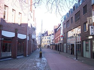
Coesfeld is the capital of the district of Coesfeld in the German state of North Rhine-Westphalia.

<span class="mw-page-title-main">Stadtlohn</span> Town in North Rhine-Westphalia, Germany

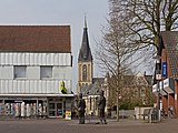
Stadtlohn is a city in western Münsterland in the northwest of North Rhine-Westphalia, and is a district town of the Borken administrative district. The city had a population of 20,746 inhabitants as of 2020. The River Berkel flows through the city on its way to the Netherlands.

<span class="mw-page-title-main">Kaarst</span> Town in North Rhine-Westphalia, Germany

Kaarst is a town in Germany. It lies in the district of Rhein-Kreis Neuss in North Rhine-Westphalia. It is 5 km west of Neuss and 12 km east of Mönchengladbach.

<span class="mw-page-title-main">Nottuln</span> Municipality in North Rhine-Westphalia, Germany

Nottuln is a municipality in the district of Coesfeld in the state of North Rhine-Westphalia, Germany.

<span class="mw-page-title-main">Ahaus</span> Town in North Rhine-Westphalia, Germany

Ahaus is a town in the district of Borken in the state of North Rhine-Westphalia, Germany. It is located near the border with the Netherlands, lying some 20 km south-east of Enschede and 15 km south from Gronau. Ahaus is the location of one of Germany's interim storage facilities for radioactive spent fuel.

<span class="mw-page-title-main">Gronau, North Rhine-Westphalia</span> Town in North Rhine-Westphalia, Germany

Gronau (German pronunciation: [ˈɡʁoːnaʊ]; officially Gronau , is a town in the district of Borken in North Rhine-Westphalia, Germany. It is located near the border with the Netherlands, approx. 10 km east of Enschede. Documentary evidence of Gronau dates to 1365.

<span class="mw-page-title-main">Isselburg</span> Town in North Rhine-Westphalia, Germany

Isselburg is a town in the district of Borken, in North Rhine-Westphalia, Germany. It is located on the river Issel, near the border of the Netherlands, and approximately 10 km west of Bocholt.

<span class="mw-page-title-main">Legden</span> Municipality in North Rhine-Westphalia, Germany

Legden is a municipality in the district of Borken, in North Rhine-Westphalia, Germany. It is located between Ahaus and Coesfeld.

<span class="mw-page-title-main">Havixbeck</span> Municipality in North Rhine-Westphalia, Germany

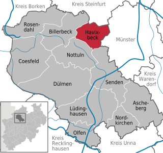
Havixbeck is a municipality situated on the north-east edge of the Baumberge in the district of Coesfeld, in northern North Rhine-Westphalia, Germany. It is located approximately 15 km west of Münster.

<span class="mw-page-title-main">Senden, North Rhine-Westphalia</span> Municipality in North Rhine-Westphalia, Germany

Senden is a municipality in the district of Coesfeld, in North Rhine-Westphalia, Germany.

<span class="mw-page-title-main">Dortmund–Enschede railway</span>

The Dortmund–Enschede railway is an international railway connecting the eastern Ruhr district of Germany to Enschede in the Netherlands, which was built by the Dortmund-Gronau-Enschede Railway Company.

<span class="mw-page-title-main">Coesfeld (Westf) station</span>

Coesfeld Station (Westphalia) is the main railway station of the town of Coesfeld and an important transport hub in western Münsterland in the German state of North Rhine-Westphalia. It is a junction station on the Dortmund–Enschede, Essen-Coesfeld and Empel-Rees–Münster lines.

References

  1. Wahlergebnisse in NRW Kommunalwahlen 2020, Land Nordrhein-Westfalen, accessed 19 June 2021.
  2. "Bevölkerung der Gemeinden Nordrhein-Westfalens am 31. Dezember 2021" (in German). Landesbetrieb Information und Technik NRW . Retrieved 20 June 2022.