Gettysburg, Preble County, Ohio

Last updated

Ebenezer Mennonite Church Gettysburg Ebenezer Mennonite Church.jpg
Ebenezer Mennonite Church

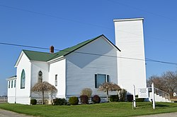
Gettysburg is an unincorporated community in Preble County, in the U.S. state of Ohio. The National Trail Local School K-12 complex is located on U.S. Route 40 in Gettysburg. [1]

History

Gettysburg was laid out in 1832 when the National Road was extended to that point. [2] The community was named after Gettysburg, in Pennsylvania, the native state of a first settler. [3] A post office called Gettysburg was established in 1837, and remained in operation until 1858. [4]

Related Research Articles

<span class="mw-page-title-main">Preble County, Ohio</span> County in Ohio, United States

Preble County is a county located in the U.S. state of Ohio. As of the 2020 census, the population was 40,999, down 3.0% from the 2010 census population of 42,270. Its county seat is Eaton. The county was formed on February 15, 1808, from portions of Butler and Montgomery Counties. It is named for Edward Preble, a naval officer who fought in the American Revolutionary War and against the Barbary Pirates.

<span class="mw-page-title-main">Fairhaven, Ohio</span> Unincorporated community in Ohio, U.S.

Fairhaven is an unincorporated community in eastern Israel Township, Preble County, Ohio, United States. It lies along State Route 177 at its intersection with Israel-Somers Road. Four Mile Creek, which feeds into Acton Lake in southern Preble County, runs on the western edge of Fairhaven. It is located 10½ miles southwest of Eaton, the county seat of Preble County. The community is part of the Dayton Metropolitan Statistical Area. Fairhaven Church and Fairhaven Community Church are both located in Fairhaven along State Route 177. Fairhaven Community Church hosts a free annual Dinner Drama for the community. Fairhaven is home to the historic Bunker Hill house, a stop along the Underground Railroad.

Brennersville is an unincorporated community in Preble County, in the U.S. state of Ohio.

Brinley is an unincorporated community in Preble County, in the U.S. state of Ohio.

Browns is an unincorporated community in Preble County, in the U.S. state of Ohio.

Enterprise is an unincorporated community in Preble County, in the U.S. state of Ohio.

Ebenezer is an unincorporated community in Preble County, in the U.S. state of Ohio.

Greenbush is an unincorporated community in Preble County, in the U.S. state of Ohio.

Hamburg is an unincorporated community in Preble County, in the U.S. state of Ohio.

Ingomar is an unincorporated community in Preble County, in the U.S. state of Ohio.

Dadsville is an unincorporated community in Preble County, in the U.S. state of Ohio.

Muttonville is an unincorporated community in Preble County, in the U.S. state of Ohio.

New Lexington is an unincorporated community in Perry County, in the U.S. state of Ohio.

New Westville is an unincorporated community in Preble County, in the U.S. state of Ohio.

Sugar Valley is an unincorporated community in Preble County, in the U.S. state of Ohio.

Talawanda Springs is an unincorporated community in Preble County, in the U.S. state of Ohio.

West Florence is an unincorporated community in Preble County, in the U.S. state of Ohio.

West Sonora is an unincorporated community in Preble County, in the U.S. state of Ohio.

Wheatville is an unincorporated community in Preble County, in the U.S. state of Ohio.

Hagerstown is an extinct town in Preble County, in the U.S. state of Ohio.

References

  1. U.S. Geological Survey Geographic Names Information System: Gettysburg, Preble County, Ohio
  2. Lowry, Robert Eaton (1915). History of Preble County, Ohio: Her People, Industries and Institutions. B.F. Bowen. p. 284.
  3. History of Preble County, Ohio, with illustrations and biographical sketches. H. Z. Williams & Bro. 1881. p. 272.
  4. "Preble County". Jim Forte Postal History. Archived from the original on December 22, 2015. Retrieved December 18, 2015.

39°50′26″N84°43′14″W / 39.84056°N 84.72056°W / 39.84056; -84.72056