Himachal Pradesh is a state in the northern part of India. Situated in the Western Himalayas, it is one of the thirteen mountain states and is characterized by an extreme landscape featuring several peaks and extensive river systems. Himachal Pradesh is the northernmost state of India and shares borders with the union territories of Jammu and Kashmir and Ladakh to the north, and the states of Punjab to the west, Haryana to the southwest, Uttarakhand to the southeast and a very narrow border with Uttar Pradesh to the south. The state also shares an international border to the east with the Tibet Autonomous Region in China. Himachal Pradesh is also known as Dev Bhoomi, meaning 'Land of Gods' and Veer Bhoomi which means 'Land of the Brave'.

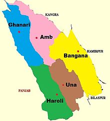
Una district is a district in the Indian state of Himachal Pradesh. Una shares its border with the Hoshiarpur and Rupnagar districts of Punjab and Kangra, Hamirpur, and Bilaspur districts of Himachal Pradesh. The terrain is generally plain with semi hills.

Mandi district is one of the central districts of Himachal Pradesh state in northern India. The town of Mandi is the headquarters of the district.

Manali is a town, near Kullu town in Kullu district in the Indian state of Himachal Pradesh. It is situated in the northern end of the Kullu Valley, formed by the Beas River. The town is located in the Kullu district, approximately 270 kilometres (170 mi) north of the state capital of Shimla and 544 kilometres (338 mi) northeast of the national capital of New Delhi. With a population of 8,096 people recorded in the 2011 Indian census Manali is the beginning of an ancient trade route through Lahaul (H.P) and Ladakh, over the Karakoram Pass and onto Yarkand and Hotan in the Tarim Basin of China. Manali is a popular tourist destination in India and serves as the gateway to the Lahaul and Spiti district as well as the city of Leh in Ladakh.

Kasauli is a town and cantonment, located in the Solan district of the Indian state of Himachal Pradesh. The cantonment was established by the British Raj in 1842 as a Colonial hill station, 25 km (16 mi) from Solan, 77 km (48 mi) from Shimla, 58 km (36 mi) from Chandigarh, and 94 km (58 mi) from Ambala Cantt (Haryana), an important railway junction of North India.

Bagpat district, also spelled as Baghpat district, is one of the 75 districts of the Indian state of Uttar Pradesh, with headquarters at the town of Baghpat. It is within the National Capital Region.It falls under the National Capital Region of Delhi. it is one of the most Sugarcane producing District in Uttar Pradesh. It also referred as Jatland due to high density of Jat Caste peoples.The Biggest Khap Panchayat named Desh Khap of Tomar clan ,Tomar Khap have 84 villages in the District.
Nalagarh is a city and a municipal committee, near the city of Solan in Solan district in the Indian state of Himachal Pradesh.
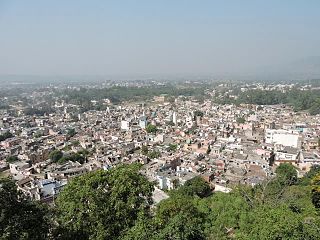
Una is a Municipal Council City in Una district in the Indian state of Himachal Pradesh. It serves as the headquarters of Una district. There are 11 wards under Municipal Council. Una City is home to the Kila, which is a historical fort and an ancestral home of the descendants of the first guru of the Sikhs, Guru Nanak.

Khalilabad is a city and a municipal board in Sant Kabir Nagar district in the Indian state of Uttar Pradesh. It is the district headquarters of Sant Kabir Nagar district.

Yamunanagar district is one of the 22 districts of the Indian state of Haryana. The district came into existence on 1 November 1989 and occupies an area of 1,756 square kilometres (678 sq mi). Yamunanagar town is the district headquarters.

Hamirpur is a Municipal Council and the headquarters of Hamirpur district in the Indian state of Himachal Pradesh. It is covered by Shivalik Ranges. Hamirpur is located in the Lower West Central Outer Himalayas at an average elevation of 790 M above sea level. Far northern High Altitude Dhauladhar Ranges overlook the city. It is also a major junction on National Highway 3 While National Highway 103 starts at Here. Hamirpur is Famous for its High literacy rate, Educational Institutions and Traditional Festival Of Hamir Utsav. Hamirpur City is spread from Jhaniari to Bhota along NH 3 and NH 103 and is a prominent commercial centre for the district. It is Connected to the National Capital with regular HRTC Volvo and ordinary Buses. The nearest Airport is Kangra Airport and Mohali International Airport While the nearest Railway is in Una at 79 km. Hamirpur City is surrounded by Pine tree forests and has a good city infrastructure ranging from Quality Educational Institutions, NIT, State Universities and Skill Learning centres.
Gagret is a nagar panchayat in Tehsil Ghanari of Una district in the state of Himachal Pradesh, India. It is situated in plains of Una.

Naraingarh is a city, municipal committee and assembly constituency in the Ambala district of the Indian state of Haryana, located on the border with the Indian state of Himachal Pradesh. Due to its geographical location, the Naraingarh plays an important role in local tourism, being located 39 km from Ambala city, the district headquarter, 52 km of Chandigarh, the state capital, 144 km of Shimla, and 230 km of New Delhi.
Naraini is a town and Nagar panchayat in Banda district in the Indian state of Uttar Pradesh. It is the one of the four tehsils of Banda District.
Jogindernagar, or Jogindar Nagar, is a municipality, and a sub district in Mandi district in the Indian state of Himachal Pradesh. Named after Raja Joginder Sen, the hill station is the terminus of the 163-kilometre-long (101 mi) Kangra Valley narrow-gauge railway. Jogindernagar is the third-largest city in the Mandi district. The only city in Asia with three hydro-electric power stations, its nickname is "The City of Powerhouses".
Chalet is a village situated nearby town of Daulatpur Chowk in Ghanari tehsil, Una district in Himachal Pradesh, India.
Bhawarna is a town in Kangra district, Himachal Pradesh, India. 11 kilometres (6.8 mi) from Palampur. The postal code for Bhawarna is 176083.
Joh is a village located in Una district, in the Indian state of Himachal Pradesh. Joh's population was 851 as of 2011, of which 416 are male and 435 are female. The village is located 15 km (9.3 mi) from the taluk headquarters of Amb and 53 km (33 mi) from the district headquarters of Una. The village is also near Pong Dam, Chintpurni temple.

Kumarsain, also known as Kumharsain, is a sub-division, a tehsil and a town in Shimla District in the Indian state of Himachal Pradesh. Formerly under the British Raj, it was the capital of princely state of Kumharsain, which was one of the several states of the Punjab States Agency.It is about 80 km from Shimla and famous for apple and cherry orchards.
Barsar is a historical town which has its roots linked to the Sidh Shri Baba Balak Nath Ji, a Hindu deity located in the Hamirpur district of Himachal Pradesh. Located primarily on the Foothills Of Western Shivalik Range Of The Outer Himalayas on National Highway 503 A, it is a major Business and Educational Hub in the district. Barsar Hilltop overlooks Lake Govind Sagar due South West and The Dhauladhar Himalayas due north. Founded by Rajput Prince as a Princely state, used their clan name Barsar as the name of state. After separation of India it was merged in India. Now it is also a part of Himachal Pradesh. Barsar is one of the most developing and enhancing educational locations in the state and it also serves as one of five tehsil headquarters in the Hamirpur district. Barsar Hilltop separates Hamirpur to Una District at an elevation of 1015 M above sea level.