
Gandhinagar is the capital of the state of Gujarat in India. Gandhinagar is located approximately 23 km north of Ahmedabad, on the west central point of the Industrial corridor between Delhi, the political capital of India, and Mumbai, the financial capital of India.

Bopal is an area in Ahmedabad City, located in the state of Gujarat, India. In 2015, Bopal and its neighbouring area, Ghuma, were merged and granted municipality status.

Mehsana, also spelled Mahesana, is a city and municipality in Mehsana district, in the Indian state of Gujarat. Established in 14th century, the city was under Gaekwads of Baroda State from 18th century to the independence of India in 1947. The municipality was established in 1919–20. The town has population of about 185,000. Dairy, oil and natural gas are major industries while there are several small and medium enterprises in the city.
Vallabh Vidyanagar, also known as V.V.Nagar, is a town and a municipality in Anand district in the Indian state of Gujarat. It is located between Ahmedabad and Vadodara, 6 km (3.7 mi) from the town of Anand. V.V.Nagar is renowned as an educational hub of Gujarat and is home to the prestigious Sardar Patel University.

Anand is the administrative centre of Anand District in the state of Gujarat, India. It is administered by Anand Municipality. It is part of the region known as Charotar, consisting of Anand and Kheda districts.
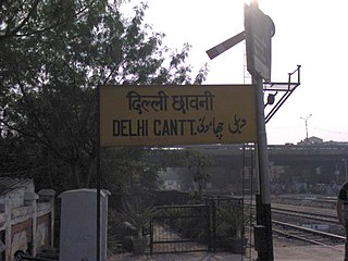
Delhi Cantonment is a Class I Cantonment Board established in 1914. The area of the Cantonment is 10,452 acres (42.30 km2) and the population of the Cantonment as per the 2011 census is 110,351.
Navapur is a nagar panchayat (municipality) and headquarters for Navapur Taluka in Nandurbar district, in the state of Maharashtra, India.
Bavla is a town, and a municipality, in Ahmedabad district, in the state of Gujarat, India.
Chandkheda is a well-developed area in northwestern Ahmedabad. It is situated on west of Sabarmati River.
Dahegam is a city and a municipality in Gandhinagar district in the state of Gujarat, India.
Dhanera is a city in Banaskantha district in the northern part of the state of Gujarat, India. Longitude 240 – 310 degree North and latitude 120 – 020 degree east. It is close to the city of Deesa.Dhanera is an ancient part of Gujarat. Formerly Dhakha was a village and later Dhanera Nagar was established. Establishment of Dhanera town Devda Rajputs in the 16th century Did. Dhanera kingdom was first found by Devda's and they ruled it for more than 500 years and Dhanera was founded around approximately 710 years ago by Devda kings. Currently, it has a population of more than 60,000 and comes under Municipality. It is 32 km away from Deesa
Karera is a municipality or Nagar Parishad in the Shivpuri district of the Indian state of Madhya Pradesh.

Ekta Nagar is a census town in Narmada district in the Indian state of Gujarat. This town is famous tourist location, as Statue of Unity is located here. The town also has a Ekta Nagar railway station
Lambha is a census town in Ahmadabad district in the Indian state of Gujarat.
Mahemdavad is a town with municipality in the Kheda district in the Indian state of Gujarat. Mahemdavad is situated on the Vatrak River bank. The nearest city is Kheda. It is 30 km from largest city of Gujarat, Ahmedabad.
Vadnagar is a town and municipality in the Mehsana district of the state of Gujarat in India. It just about 35 km from Mehsana city. Its ancient name was Anartapura, and was also known as Anandapura. It was a Buddhist location visited by Xuanzang in 640 C.E. Historian and archaeologist Alexander Cunningham has identified Anandapura with the town of Vadnagar.
Vejalpur is a Census Town in the New West Zone of the metropolitan city of Ahmedabad in the Indian state of Gujarat.
Khopala is a village and a grampanchayat in Botad district in the state of Gujarat, India. Khopala is situated near Gadhada.
Ghatlodia is one of the 182 Legislative Assembly constituencies of Gujarat state in India. It is part of Ahmedabad district and it came into existence after 2008 delimitation. It is a segment of Gandhinagar.

Bhat is a village in Daskroi Taluka in Ahmedabad district of Gujarat State, India. Bhat is located near the bank of the Sabarmati River, 24 km towards west from District headquarters Ahmedabad, 5 km from Daskroi and 49 km from State capital Gandhinagar.

