| Glen Falls | |
|---|---|
 | |
 Interactive map of Glen Falls | |
| Location | Williamsville, Erie County, NY, U.S. |
| Coordinates | 42°57′50″N78°44′38″W / 42.964°N 78.744°W |
| Type | Cascade |
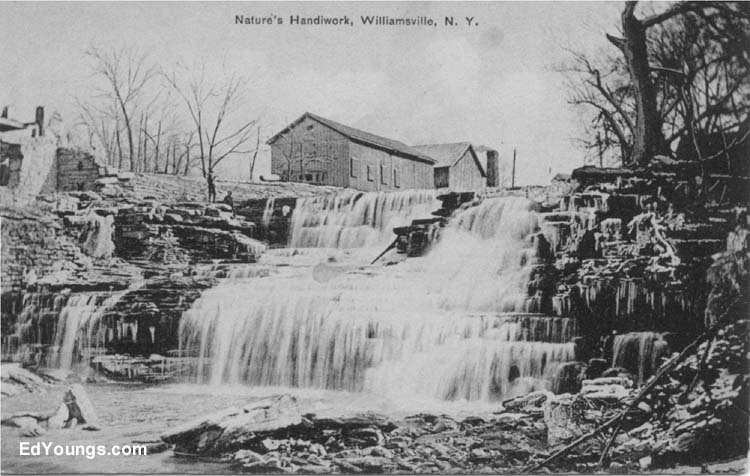
| Total height | 30 feet (9.1 m) |
| Watercourse | Ellicott Creek |
Glen Falls is a small waterfall located on Ellicott Creek in the village of Williamsville, New York. The hydropower provided by the falls made it an ideal site for a number of early watermills used to grind grist and to power sawmills. [1]
Contents
One of the earliest settlers of what is now Williamsville, Jonas Williams, owned two mills on opposite sides of Ellicott Creek. [1] The name of these mills, Williams Mills, eventually transformed into the name of the village in which the falls is located, Williamsville. The falls has a vertical drop of approximately 30 feet (9.1 m). [2] The vertical drop is part of the Onondaga Escarpment, a portion of which runs through Williamsville. Today, the falls forms part of the eastern border of Glen Park.
Glen Falls has a very similar name to the city of Glens Falls, which is located in the far eastern portion of New York State, over 200 miles (320 km) from Williamsville.