Ellicott Creek

Last updated
Ellicott Creek
Ellicott Creek in Williamsville, New York.jpg
Ellicott Creek in Williamsville, New York.
USA New York relief location map.svg
Red pog.svg
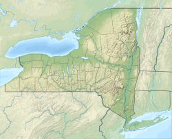
Location of the mouth of Ellicott Creek in New York
EtymologyNamed for Joseph Ellicott, surveyor and land agent.
Location
CountryUnited States
State New York
County Genesee County, Erie County
City Tonawanda
Physical characteristics
Source 
  location Genesee County
  coordinates 42°54′15″N78°23′49″W / 42.90417°N 78.39694°W / 42.90417; -78.39694 [1] [2]
  elevation1,000 ft (300 m)
Mouth Tonawanda Creek
  location
Erie County
  coordinates
43°1′16″N78°52′37″W / 43.02111°N 78.87694°W / 43.02111; -78.87694 [2]
  elevation
562 ft (171 m) [3]
Length45 mi (72 km) [4]
Discharge 
  average100 cu ft/s (2.8 m3/s)

Ellicott Creek is a stream in Western New York, United States. It is a tributary of Tonawanda Creek, which in turn flows into the Niagara River.

Contents

Course

Ellicott Creek originates in southwest corner of Genesee County, just northeast of Darien Lakes State Park, in the Town of Darien. It flows generally west, crossing into Erie County and the Town of Alden. It crosses the northern edge of the Town of Lancaster, flowing through the community of Bowmansville in the northwest part of Lancaster.

Continuing west, Ellicott Creek enters the Town of Cheektowaga. There it passes by the toxic Pfohl Brothers Landfill and the Buffalo Niagara International Airport. The creek turns to the northwest at the airport. It flows under one of the runways via a tunnel. It then turns more directly north and enters the Village of Williamsville and the Town of Amherst.

At Williamsville's Island Park Ellicott Creek splits briefly into two channels, one of which contains floodgates. The other channel was historically used to divert water into flumes for powering mills just downstream. Below the floodgates the creek flows rapidly north, passing under State Route 5 and falling over the Onondaga Escarpment at Glen Falls in Amherst State Park.

After Glen Falls, Ellicott Creek continues flowing generally north and northwest through Amherst. It passes by several golf courses and then through the northern edge of the campus of the University at Buffalo, after which the creek turns to the west and crosses under Interstate 990 (Lockport Expressway).

Just west of I-990 the creek splits into two channels for about 1.25 miles (2.01 km). The northern channel is deeper, has been more thoroughly channelized and is bordered by commercial land use, while the southern channel is fairly sinuous and contains more trees in the riparian zone. [5]

After these channels rejoin, Ellicott Creek it enters the Town of Tonawanda and passes through Ellicott Creek Park. Ellicott Creek continues west for approximately 3 miles (4.8 km) before emptying into Tonawanda Creek in the City of Tonawanda. This portion of Tonawanda Creek is also part of the Erie Canal. Tonawanda Creek then empties into the Niagara River. The distance from the mouth of Ellicott Creek to the Niagara River is about 0.5 miles (0.80 km).

History

Ellicott Creek is named after Joseph Ellicott, an important agent of the Holland Land Company. Ellicott played a significant role in opening Western New York up for settlement after the Iroquois ceded their claims in the 1780s, more significantly in the Big Tree Treaty with the Seneca nation. Elicott surveyed most of Holland Purchase into townships and saleable land parcels.

Natural history

Niagara River surface fluctuations influence creek water level up to 7 miles (11 km) upstream of the mouth of Ellicott Creek. [6]

Ellicott Creek Bike Path

Ellicott Creek Bike Path Lone walker on Ellicott Creek Trailway, University at Buffalo North Campus, Amherst, New York - 20221212.jpg
Ellicott Creek Bike Path

Ellicott Creek Bike Path follows the creek in the Town of Amherst, near the University at Buffalo (UB) and flows under Interstate 990 before leaving Amherst by crossing U.S. Route 62 (Niagara Falls Boulevard) to enter the Town of Tonawanda at Ellicott Creek Park.

In 1990, the Ellicott Creek Bike Path was the last known location where Linda Yalema UB sophomore running on the pathwas alive before being raped and killed by Altemio Sanchez.[ citation needed ]

See also

Related Research Articles

<span class="mw-page-title-main">Erie County, New York</span> County in New York, United States

Erie County is a county along the shore of Lake Erie in western New York State. As of the 2020 census, the population was 954,236. The county seat is Buffalo, which makes up about 28% of the county's population. Both the county and Lake Erie were named for the regional Iroquoian language-speaking Erie tribe of Native Americans, who lived in the area before 1654. They were later pushed out by the more powerful Iroquoian nations tribes.

<span class="mw-page-title-main">Amherst, New York</span> Town in New York, United States

Amherst is a town in Erie County, New York, United States. It is a suburb of Buffalo. As of 2020, the town had a total population of 129,595. This represents an increase from 122,366 as reported in the 2010 census. It is the 14th most populated City/Town in New York.

<span class="mw-page-title-main">Williamsville, New York</span> Village in New York, United States

Williamsville is a village in Erie County, New York, United States. The population was 5,423 at the 2020 census. The village is named after Jonas Williams, an early settler. It is part of the Buffalo-Niagara Falls metropolitan area.

<span class="mw-page-title-main">North Tonawanda, New York</span> City in New York, United States

North Tonawanda is a city in Niagara County, New York, United States. The population was 31,568 at the 2010 census. It is part of the Buffalo–Niagara Falls Metropolitan Statistical Area. The city is named after Tonawanda Creek, its south border.

<span class="mw-page-title-main">Wheatfield, New York</span> Town in New York, United States

Wheatfield is a town in Niagara County, New York, United States. The population was 18,117 at the 2010 census. The name stems from the agricultural use of the town lands, the growing of wheat.

<span class="mw-page-title-main">Tonawanda (town), New York</span> Town in New York, United States

Tonawanda is a town in Erie County, New York, United States. As of the 2020 census, the town had a population of 72,636. The town is at the north border of the county and is the northern inner ring suburb of Buffalo. It is sometimes referred to, along with its constituent village of Kenmore, as "Ken-Ton". The town was established in 1836, and up to 1903 it included what is now the city of Tonawanda.

<span class="mw-page-title-main">Tonawanda Creek</span> River in New York, United States

Tonawanda Creek is a small tributary of the Niagara River in Western New York, United States. After rising in Wyoming County, the stream flows through Genesee County before forming part of the boundary between Erie County and Niagara County.

<span class="mw-page-title-main">Interstate 990</span> Highway in New York

Interstate 990 (I-990) is an auxiliary Interstate Highway located entirely within the town of Amherst in Erie County, New York, in the United States. It runs in a roughly north–south direction for 6.35 miles (10.22 km) through the southwestern and central parts of Amherst from an interchange with I-290 north of Buffalo to an intersection with New York Route 263 south of Lockport. The highway serves as a connection between Buffalo, the University at Buffalo, and Lockport. Like I-590 in nearby Rochester, I-990 does not physically meet I-90, its parent Interstate Highway; instead, the highway makes the connection by way of a "sibling" highway (I-290). I-990 is the highest numbered Interstate Highway in the US.

<span class="mw-page-title-main">Interstate 290 (New York)</span> Highway in New York

Interstate 290 (I-290) is a 9.8-mile-long (15.8 km) auxiliary Interstate Highway in the Buffalo–Niagara Falls metropolitan area. It connects I-190 in Tonawanda with I-90 in Williamsville, via Amherst. It provides a route to Niagara Falls and Canada from the east that bypasses the city of Buffalo. I-290 also connects to I-990 and, through this connection, provides access to the Amherst campus of the University at Buffalo. Its official name is the Youngmann Memorial Highway, but, locally, it is colloquially referred to as "the 290" and "the Youngmann". The highway provides the fastest road link between Toronto and the heavily-populated Northeastern US via I-90.

<span class="mw-page-title-main">Church station (Buffalo Metro Rail)</span> Light rail station in Buffalo, New York, US

Church is a Buffalo Metro Rail station located in the 300 block of Main Street in the Free Fare Zone, which allows passengers free travel between Erie Canal Harbor and Fountain Plaza. Passengers continuing northbound past Fountain Plaza are required to have proof-of-payment. Church is the closest to the Buffalo Metropolitan Transportation Center, located two blocks east at Ellicott and North Division Streets.

<span class="mw-page-title-main">New York State Route 324</span> State highway in western New York, US

New York State Route 324 (NY 324) is an east–west state highway located in the western portion of New York in the United States. Officially, NY 324 begins at NY 384 in Niagara Falls and overlaps Interstate 190 south to Grand Island, where it separates from I-190 and continues southward as Grand Island Boulevard. As signed, however, NY 324 begins at the southern end of the official overlap and is contained entirely within Erie County. At the southern edge of Grand Island, NY 324 joins I-190 to cross over to the mainland, where it runs due east across three towns before reaching its eastern end at a junction with NY 5 in the town of Clarence.

<span class="mw-page-title-main">New York State Route 263</span> State highway in Erie County, New York, US

New York State Route 263 (NY 263) is a state highway located entirely within the town of Amherst in Erie County, New York, in the United States. It extends from just north of the northeast corner of the city of Buffalo in a roughly northeast direction almost straight to just south of the north county line. The road is named Millersport Highway north of Eggert Road in Amherst for the community at its northern terminus. The section between its southern terminus at U.S. Route 62 (US 62) and the Eggert Road intersection is named Grover Cleveland Highway.

<span class="mw-page-title-main">New York State Route 265</span> State highway in western New York, US

New York State Route 265 (NY 265) is a 19.75-mile (31.78 km) long state highway located in the western part of New York in the United States. NY 265 is a north–south route that roughly parallels the western parts of the Niagara River in Erie County and Niagara County. For much of its southern course, it is more frequently referred to by its longtime name, Military Road, which dates back to 1801 as a road to connect the city of Black Rock and Fort Niagara near Lake Ontario.

<span class="mw-page-title-main">New York State Route 270</span> State highway in western New York, US

New York State Route 270 (NY 270) is a north–south state highway in western New York in the United States. It runs through rural and wooded areas of the town of Amherst in Erie County and the town of Pendleton in Niagara County. The southern terminus of the route is at an intersection with NY 263 south of the hamlet of Getzville. Its northern terminus is at a junction with NY 31 and NY 93 west of the city of Lockport. The entirety of NY 270 is known as Campbell Boulevard, named after New York State Senator William W. Campbell of the Niagara–Orleans district.

<span class="mw-page-title-main">Proposed expansion of the Buffalo Metro Rail</span> Grass-roots organization in Buffalo, New York

Since the Buffalo Metro Rail light rail was proposed in the 1970s, there have been multiple proposals for expanding the system, which is currently a single 6.4-mile (10.3 km) long line. Public officials, agencies and advocacy groups have created plans, with the most recent and extensive being an extension to the town of Amherst. Groups have formed on both sides of the issue.

<span class="mw-page-title-main">Great Lakes Seaway Trail</span> Scenic route along Lake Erie in the U.S. states of Pennsylvania and New York

The Great Lakes Seaway Trail, formerly named and commonly known as the Seaway Trail, is a 518-mile (834 km) National Scenic Byway in the northeastern United States, mostly contained in New York but with a small segment in Pennsylvania. The trail consists of a series of designated roads and highways that travel along the Saint Lawrence Seaway—specifically, Lake Erie, the Niagara River, Lake Ontario, and the Saint Lawrence River. It begins at the Ohio state line in rural Erie County, Pennsylvania, and travels through several cities and villages before ending at the Seaway International Bridge northeast of the village of Massena in St. Lawrence County, New York. It is maintained by the non-profit Seaway Trail, Inc.

<span class="mw-page-title-main">Geography of New York (state)</span> State of the United States

The geography of New York (state) varies widely. Most of New York is dominated by farms, forests, rivers, mountains, and lakes. New York's Adirondack Park is larger than any U.S. National Park in the contiguous United States. Niagara Falls, on the Niagara River as it flows from Lake Erie to Lake Ontario, is a popular attraction. The Hudson River begins near Lake Tear of the Clouds and flows south through the eastern part of the state without draining lakes George or Champlain. Lake George empties at its north end into Lake Champlain, whose northern end extends into Canada, where it drains into the Richelieu River and then the St. Lawrence. Four of New York City's five boroughs are on the three islands at the mouth of the Hudson River: Manhattan Island, Staten Island, and Brooklyn and Queens on Long Island.

<span class="mw-page-title-main">New York State Route 356</span> Former state highway in New York State

New York State Route 356 (NY 356) was an east–west state highway in Erie County, New York, in United States. The final western terminus of the route was at an intersection with U.S. Route 62 (US 62) on the Tonawanda–Amherst town line. Its eastern terminus was at a junction with NY 270 in the Amherst hamlet of Getzville. When NY 356 was first assigned in the 1930 renumbering of state highways in New York, it began at NY 384 in the city of Tonawanda. It was truncated to US 62 in 1980 and removed entirely on January 7, 1988. The former routing of NY 356 east of the Tonawanda city limits is now maintained by Erie County.

<span class="mw-page-title-main">U.S. Route 62 in New York</span> Segment of American highway

U.S. Route 62 is a part of the U.S. Highway System that travels from the United States–Mexico border at El Paso, Texas, to Niagara Falls, New York. In the U.S. state of New York, US 62 extends 102.77 miles (165.39 km) from the New York–Pennsylvania border south of Jamestown to an intersection with New York State Route 104 in downtown Niagara Falls, bypassing the city of Jamestown and serves the cities of Buffalo and Niagara Falls, along with several villages. It is the only north–south mainline U.S. highway in Western New York. US 62 was extended into New York c. 1932 and originally was concurrent with the state highways that had previously been designated along its routing—namely NY 18, NY 60, NY 83 and NY 241. These concurrencies were eliminated individually during the 1940s and 1960s. The last of the four concurrencies, with NY 18 from Dayton to Niagara Falls, was removed c. 1962. US 62 has one special route, US 62 Business, located in Niagara Falls. US 62 Business is a former routing of US 62 within the city and was once NY 62A.

<span class="mw-page-title-main">Transportation in Buffalo, New York</span>

Transportation in Buffalo, New York is dominated by automobile use, but other modes of transportation exist in the city.

References

  1. Source elevation derived from Google Earth search using GNIS source coordinates.
  2. 1 2 U.S. Geological Survey Geographic Names Information System: Ellicott Creek
  3. Mouth elevation derived from Google Earth search using GNIS mouth coordinates.
  4. Calculated in Google Earth
  5. Mapping of aquatic and ripiarian habitats of Ellicott and Tonawanda Creeks Archived 2016-12-12 at the Wayback Machine , New York Power Authority
  6. Upper Niagara River Tributary Backwater Study, New York Power Authority