Gmina Białobrzegi Białobrzegi Commune | |||
---|---|---|---|
Gmina | |||
| |||
Coordinates(Białobrzegi): 51°39′N20°57′E / 51.650°N 20.950°E Coordinates: 51°39′N20°57′E / 51.650°N 20.950°E | |||
Country | |||
Voivodeship | Masovian | ||
County | Białobrzegi | ||
Seat | Białobrzegi | ||
Area | |||
• Total | 78.93 km2 (30.48 sq mi) | ||
Population (2006) | |||
• Total | 10,278 | ||
• Density | 130/km2 (340/sq mi) | ||
• Urban | 7,320 | ||
• Rural | 2,958 | ||
Website | http://www.bialobrzegi.pl/ |
Gmina Białobrzegi is an urban-rural gmina (administrative district) in Białobrzegi County, Masovian Voivodeship, in east-central Poland. Its seat is the town of Białobrzegi, which lies approximately 63 kilometres (39 mi) south of Warsaw.
The gmina is the principal unit of the administrative division of Poland, similar to a municipality. As of 2010 there were 2,478 gminy throughout the country. The word gmina derives from the German word Gemeinde, meaning "community".
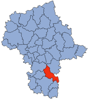
Białobrzegi County is a unit of territorial administration and local government (powiat) in Masovian Voivodeship, east-central Poland. It came into being on January 1, 1999, as a result of the Polish local government reforms passed in 1998. Its administrative seat and largest town is Białobrzegi, which lies 63 kilometres (39 mi) south of Warsaw. The only other town in the county is Wyśmierzyce, lying 10 km (6 mi) west of Białobrzegi.
Mazovian Voivodeship or Mazovia Province is the largest and most populous of the 16 Polish provinces, or voivodeships, created in 1999. It occupies 35,579 square kilometres (13,737 sq mi) of east-central Poland, and has 5,324,500 inhabitants. Its principal cities are Warsaw in the centre of the Warsaw metropolitan area, Radom (226,000) in the south, Płock (127,000) in the west, Siedlce (77,000) in the east, and Ostrołęka (55,000) in the north. The capital of the voivodeship is the national capital, Warsaw.
The gmina covers an area of 78.93 square kilometres (30.5 sq mi), and as of 2006 its total population is 10,278 (out of which the population of Białobrzegi amounts to 7,320, and the population of the rural part of the gmina is 2,958).
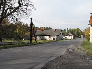
Apart from the town of Białobrzegi, Gmina Białobrzegi contains the villages and settlements of Brzeska Wola, Brzeźce, Budy Brankowskie, Dąbrówka, Jasionna, Kamień, Kolonia Brzeźce, Leopoldów, Mikówka, Okrąglik, Pohulanka, Stawiszyn, Sucha, Suski Młynek, Szczyty and Wojciechówka.
Brzeska Wola is a village in the administrative district of Gmina Białobrzegi, within Białobrzegi County, Masovian Voivodeship, in east-central Poland. It lies approximately 7 kilometres (4 mi) south-east of Białobrzegi and 67 km (42 mi) south of Warsaw.
Brzeźce is a village in the administrative district of Gmina Białobrzegi, within Białobrzegi County, Masovian Voivodeship, in east-central Poland. It lies approximately 5 kilometres (3 mi) north-east of Białobrzegi and 61 km (38 mi) south of Warsaw.
Budy Brankowskie is a village in the administrative district of Gmina Białobrzegi, within Białobrzegi County, Masovian Voivodeship, in east-central Poland. It lies approximately 8 kilometres (5 mi) north-east of Białobrzegi and 58 km (36 mi) south of Warsaw.
Gmina Białobrzegi is bordered by the gminas of Promna, Radzanów, Stara Błotnica, Stromiec, Warka and Wyśmierzyce.
Gmina Promna is a rural gmina in Białobrzegi County, Masovian Voivodeship, in east-central Poland. Its seat is the village of Promna, which lies approximately 4 kilometres (2 mi) north of Białobrzegi and 60 km (37 mi) south of Warsaw.
Gmina Radzanów is a rural gmina in Białobrzegi County, Masovian Voivodeship, in east-central Poland. Its seat is the village of Radzanów, which lies approximately 14 kilometres (9 mi) south-west of Białobrzegi and 75 km (47 mi) south of Warsaw.
Gmina Stara Błotnica is a rural gmina in Białobrzegi County, Masovian Voivodeship, in east-central Poland. Its seat is the village of Stara Błotnica, which lies approximately 11 kilometres (7 mi) south of Białobrzegi and 76 km (47 mi) south of Warsaw.
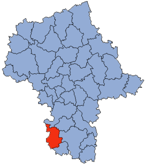
Grójec County is a unit of territorial administration and local government (powiat) in Masovian Voivodeship, east-central Poland. It came into being on January 1, 1999, as a result of the Polish local government reforms passed in 1998. Its administrative seat and largest town is Grójec, which lies 40 kilometres (25 mi) south of Warsaw. The county contains three other towns: Warka, 25 km (16 mi) east of Grójec, Nowe Miasto nad Pilicą, 34 km (21 mi) south-west of Grójec, and Mogielnica, 22 km (14 mi) south-west of Grójec.
Kozienice County is a unit of territorial administration and local government (powiat) in Masovian Voivodeship, east-central Poland. It came into being on January 1, 1999, as a result of the Polish local government reforms passed in 1998. Its administrative seat and only town is Kozienice, which lies 81 kilometres (50 mi) south-east of Warsaw.
Przysucha County is a unit of territorial administration and local government (powiat) in Masovian Voivodeship, east-central Poland. It came into being on January 1, 1999, as a result of the Polish local government reforms passed in 1998. Its administrative seat and only town is Przysucha, which lies 98 kilometres (61 mi) south of Warsaw.
Gmina Kock is an urban-rural gmina in Lubartów County, Lublin Voivodeship, in eastern Poland. Its seat is the town of Kock, which lies approximately 23 kilometres (14 mi) north-west of Lubartów and 46 km (29 mi) north of the regional capital Lublin.
Gmina Stężyca is a rural gmina in Ryki County, Lublin Voivodeship, in eastern Poland. Its seat is the village of Stężyca, which lies approximately 28 kilometres (17 mi) west of Ryki and 81 km (50 mi) north-west of the regional capital Lublin.
Gmina Stromiec is a rural gmina in Białobrzegi County, Masovian Voivodeship, in east-central Poland. Its seat is the village of Stromiec, which lies approximately 10 kilometres (6 mi) east of Białobrzegi and 65 km (40 mi) south of Warsaw.
Gmina Wyśmierzyce is an urban-rural gmina in Białobrzegi County, Masovian Voivodeship, in east-central Poland. Its seat is the town of Wyśmierzyce, which lies approximately 10 kilometres (6 mi) west of Białobrzegi and 67 km (42 mi) south of Warsaw.
Gmina Warka is an urban-rural gmina in Grójec County, Masovian Voivodeship, in east-central Poland. Its seat is the town of Warka, which lies approximately 25 kilometres (16 mi) east of Grójec and 50 km (31 mi) south of Warsaw.
Gmina Nieporęt is a rural gmina in Legionowo County, Masovian Voivodeship, in east-central Poland. Its seat is the village of Nieporęt, which lies approximately 9 kilometres (6 mi) east of Legionowo and 24 km (15 mi) north of Warsaw.
Gmina Bierawa, German Gemeinde Birawa is a rural gmina in Kędzierzyn-Koźle County, Opole Voivodeship, in south-western Poland. Its seat is the village of Bierawa, which lies approximately 8 kilometres (5 mi) south-east of Kędzierzyn-Koźle and 48 km (30 mi) south-east of the regional capital Opole.
Gmina Białobrzegi is a rural gmina in Łańcut County, Subcarpathian Voivodeship, in south-eastern Poland. Its seat is the village of Białobrzegi, which lies approximately 8 kilometres (5 mi) north-east of Łańcut and 24 km (15 mi) east of the regional capital Rzeszów.
Gmina Czarna is a rural gmina in Łańcut County, Subcarpathian Voivodeship, in south-eastern Poland. Its seat is the village of Czarna, which lies approximately 7 kilometres (4 mi) north-west of Łańcut and 16 km (10 mi) north-east of the regional capital Rzeszów.
Gmina Łańcut is a rural gmina in Łańcut County, Subcarpathian Voivodeship, in southeastern Poland. Its seat is the town of Łańcut, although the town is not part of the territory of the gmina.
Gmina Przeworsk is a rural gmina in Przeworsk County, Subcarpathian Voivodeship, in south-eastern Poland. Its seat is the town of Przeworsk, although the town is not part of the territory of the gmina.
Gmina Pszczyna is an urban-rural gmina in Pszczyna County, Silesian Voivodeship, in southern Poland. Its seat is the town of Pszczyna, which lies approximately 30 kilometres (19 mi) south of the regional capital Katowice.