Strzelce-Drezdenko County is a unit of territorial administration and local government (powiat) in Lubusz Voivodeship, western Poland. It came into being on January 1, 1999, as a result of the Polish local government reforms passed in 1998. Its administrative seat is the town of Strzelce Krajeńskie, which lies 25 km (16 mi) north-east of Gorzów Wielkopolski and 104 km (65 mi) north of Zielona Góra. The county also contains the towns of Drezdenko, lying 21 km (13 mi) east of Strzelce Krajeńskie, and Dobiegniew, 18 km (11 mi) north-east of Strzelce Krajeńskie.

Gorzów County is a unit of territorial administration and local government (powiat) in Lubusz Voivodeship, western Poland. It came into being on January 1, 1999, as a result of the Polish local government reforms passed in 1998. Its administrative seat is the city of Gorzów Wielkopolski, although the city is not part of the county. The only towns in Gorzów County are Kostrzyn nad Odrą, which lies 43 km (27 mi) west of Gorzów Wielkopolski, and Witnica, 25 km (16 mi) west of Gorzów Wielkopolski.

Międzyrzecz County is a unit of territorial administration and local government (powiat) in Lubusz Voivodeship, western Poland. It came into being on January 1, 1999, as a result of the Polish local government reforms passed in 1998. Its administrative seat and largest town is Międzyrzecz, which lies 48 km (30 mi) south-east of Gorzów Wielkopolski and 68 km (42 mi) north of Zielona Góra. The county also contains the towns of Skwierzyna, lying 19 km (12 mi) north of Międzyrzecz, and Trzciel, 25 km (16 mi) south-east of Międzyrzecz.

Czarnków–Trzcianka County is a county in Greater Poland Voivodeship, west-central Poland. It came into being on January 1, 1999, as a result of the Polish local government reforms passed in 1998. Its administrative seat is the town of Czarnków, which lies 61 kilometres (38 mi) north-west of the regional capital Poznań. The county contains three other towns: Trzcianka, 18 km (11 mi) north of Czarnków, Krzyż Wielkopolski, 38 km (24 mi) west of Czarnków, and Wieleń, 27 km (17 mi) west of Czarnków.
Gmina Kłodawa is a rural gmina in Gorzów County, Lubusz Voivodeship, in western Poland. Its seat is the village of Kłodawa, which lies approximately 7 kilometres (4 mi) north of Gorzów Wielkopolski.

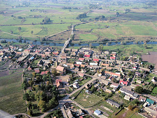
Gmina Santok is a rural gmina in Gorzów County, Lubusz Voivodeship, in western Poland. Its seat is the village of Santok, which lies approximately 12 kilometres (7 mi) east of Gorzów Wielkopolski.
Gmina Skwierzyna is an urban-rural gmina in Międzyrzecz County, Lubusz Voivodeship, in western Poland. Its seat is the town of Skwierzyna, which lies approximately 19 kilometres (12 mi) north of Międzyrzecz and 26 km (16 mi) south-east of Gorzów Wielkopolski.
Gmina Strzelce Krajeńskie is an urban-rural gmina in Strzelce-Drezdenko County, Lubusz Voivodeship, in western Poland. Its seat is the town of Strzelce Krajeńskie, which lies approximately 25 kilometres (16 mi) north-east of Gorzów Wielkopolski.
Gmina Dobiegniew is an urban-rural gmina in Strzelce-Drezdenko County, Lubusz Voivodeship, in western Poland. Its seat is the town of Dobiegniew, which lies approximately 18 kilometres (11 mi) north-east of Strzelce Krajeńskie and 43 km (27 mi) north-east of Gorzów Wielkopolski.
Gmina Stare Kurowo is a rural gmina in Strzelce-Drezdenko County, Lubusz Voivodeship, in western Poland. Its seat is the village of Stare Kurowo, which lies approximately 9 kilometres (6 mi) east of Strzelce Krajeńskie and 30 km (19 mi) north-east of Gorzów Wielkopolski.
Gmina Zwierzyn is a rural gmina in Strzelce-Drezdenko County, Lubusz Voivodeship, in western Poland. Its seat is the village of Zwierzyn, which lies approximately 6 kilometres (4 mi) south-east of Strzelce Krajeńskie and 25 km (16 mi) north-east of Gorzów Wielkopolski.
Stare Osieczno is a village in the administrative district of Gmina Dobiegniew, within Strzelce-Drezdenko County, Lubusz Voivodeship, in western Poland.

Goszczanowo is a village in the administrative district of Gmina Drezdenko, within Strzelce-Drezdenko County, Lubusz Voivodeship, in western Poland. It lies approximately 20 kilometres (12 mi) south-west of Drezdenko, 19 km (12 mi) south of Strzelce Krajeńskie, and 25 km (16 mi) east of Gorzów Wielkopolski.

Stare Bielice is a village in the administrative district of Gmina Drezdenko, within Strzelce-Drezdenko County, Lubusz Voivodeship, in western Poland. It lies approximately 6 kilometres (4 mi) east of Drezdenko, 27 km (17 mi) east of Strzelce Krajeńskie, and 47 km (29 mi) east of Gorzów Wielkopolski.
Trzebicz is a village in the administrative district of Gmina Drezdenko, within Strzelce-Drezdenko County, Lubusz Voivodeship, in western Poland. It lies approximately 6 kilometres (4 mi) west of Drezdenko, 17 km (11 mi) south-east of Strzelce Krajeńskie and 35 km (22 mi) east of Gorzów Wielkopolski.
Kawki is a village in the administrative district of Gmina Stare Kurowo, within Strzelce-Drezdenko County, Lubusz Voivodeship, in western Poland. It lies approximately 3 kilometres (2 mi) north-east of Stare Kurowo, 11 km (7 mi) east of Strzelce Krajeńskie, and 33 km (21 mi) north-east of Gorzów Wielkopolski.
Łęgowo is a village in the administrative district of Gmina Stare Kurowo, within Strzelce-Drezdenko County, Lubusz Voivodeship, in western Poland.
Nowe Kurowo is a village in the administrative district of Gmina Stare Kurowo, within Strzelce-Drezdenko County, Lubusz Voivodeship, in western Poland. It lies approximately 4 kilometres (2 mi) east of Stare Kurowo, 12 km (7 mi) east of Strzelce Krajeńskie, and 33 km (21 mi) north-east of Gorzów Wielkopolski.
Przynotecko is a village in the administrative district of Gmina Stare Kurowo, within Strzelce-Drezdenko County, Lubusz Voivodeship, in western Poland. It lies approximately 6 kilometres (4 mi) south-east of Stare Kurowo, 15 km (9 mi) south-east of Strzelce Krajeńskie, and 33 km (21 mi) east of Gorzów Wielkopolski.
Smolarz is a village in the administrative district of Gmina Stare Kurowo, within Strzelce-Drezdenko County, Lubusz Voivodeship, in western Poland. It lies approximately 5 kilometres (3 mi) north-east of Stare Kurowo, 12 km (7 mi) east of Strzelce Krajeńskie, and 34 km (21 mi) north-east of Gorzów Wielkopolski.