Gmina Goniądz

Last updated
Gmina Goniądz
Goniądz Commune
Gmina
POL Goniadz COA.svg
Coat of arms
POL powiat moniecki gmina Goniadz.svg
Gmina Goniądz within the Mońki County
Coordinates(Goniądz): 53°29′21″N22°44′16″E / 53.48917°N 22.73778°E / 53.48917; 22.73778 Coordinates: 53°29′21″N22°44′16″E / 53.48917°N 22.73778°E / 53.48917; 22.73778
CountryFlag of Poland.svg  Poland
Voivodeship Podlaskie
County Mońki
Seat Goniądz
Area
  Total 376.68 km2 (145.44 sq mi)
Population (2006)
  Total 5,209
  Density 14/km2 (36/sq mi)
   Urban 1,910
  Rural 3,299
Website http://goniadz.pl/

Gmina Goniądz is an urban-rural gmina (administrative district) in Mońki County, Podlaskie Voivodeship, in north-eastern Poland. Its seat is the town of Goniądz, which lies approximately 11 kilometres (7 mi) north-west of Mońki and 51 km (32 mi) north-west of the regional capital Białystok.

Gmina administrative division of Poland

The gmina is the principal unit of the administrative division of Poland, similar to a municipality. As of 2010 there were 2,478 gminy throughout the country. The word gmina derives from the German word Gemeinde, meaning "community".

Mońki County County in Podlaskie, Poland

Mońki County is a unit of territorial administration and local government (powiat) in Podlaskie Voivodeship, north-eastern Poland. It came into being on January 1, 1999, as a result of the Polish local government reforms passed in 1998. Its administrative seat and largest town is Mońki, which lies 40 kilometres (25 mi) north-west of the regional capital Białystok. The county also contains the towns of Knyszyn, lying 13 km (8 mi) south-east of Mońki, and Goniądz, 11 km (7 mi) north-west of Mońki.

Podlaskie Voivodeship Voivodeship in Poland

Podlaskie Voivodeship or Podlasie Province is a voivodeship (province) in northeastern Poland. It borders on Masovian Voivodeship to the west, Warmian-Masurian Voivodeship to the northwest, Lublin Voivodeship to the south, the Belarusian Voblasts of Grodno and Brest to the east, the Lithuanian Counties of Alytus and Marijampolė to the northeast, and the Kaliningrad Oblast of Russia to the north.

Contents

The gmina covers an area of 376.68 square kilometres (145.4 sq mi), and as of 2006 its total population is 5,209 (out of which the population of Goniądz amounts to 1,910, and the population of the rural part of the gmina is 3,299).

Villages

Apart from the town of Goniądz, Gmina Goniądz contains the villages and settlements of Białosuknia, Budne, Budne-Żarnowo, Dawidowizna, Doły, Downary, Klewianka, Kramkówka Duża, Kramkówka Mała, Krzecze, Łazy, Mierkienniki, Olszowa Droga, Osowiec, Owieczki, Piwowary, Płochowo, Smogorówka Dolistowska, Smogorówka Goniądzka, Szafranki, Uścianek, Wojtówstwo, Wólka Piaseczna and Wroceń.

Białosuknia Village in Podlaskie, Poland

Białosuknia is a village in the administrative district of Gmina Goniądz, within Mońki County, Podlaskie Voivodeship, in north-eastern Poland. It lies approximately 8 kilometres (5 mi) east of Goniądz, 10 km (6 mi) north of Mońki, and 46 km (29 mi) north-west of the regional capital Białystok.

Budne, Podlaskie Voivodeship Village in Podlaskie, Poland

Budne is a village in the administrative district of Gmina Goniądz, within Mońki County, Podlaskie Voivodeship, in north-eastern Poland. It lies approximately 2 kilometres (1 mi) north-west of Goniądz, 13 km (8 mi) north-west of Mońki, and 53 km (33 mi) north-west of the regional capital Białystok.

Budne-Żarnowo Village in Podlaskie, Poland

Budne-Żarnowo is a village in the administrative district of Gmina Goniądz, within Mońki County, Podlaskie Voivodeship, in north-eastern Poland. It lies approximately 3 kilometres (2 mi) north-west of Goniądz, 14 km (9 mi) north-west of Mońki, and 53 km (33 mi) north-west of the regional capital Białystok.

Neighbouring gminas

Gmina Goniądz is bordered by the gminas of Bargłów Kościelny, Grajewo, Jaświły, Mońki, Radziłów, Rajgród, Sztabin and Trzcianne.

Gmina Bargłów Kościelny Gmina in Podlaskie, Poland

Gmina Bargłów Kościelny is a rural gmina in Augustów County, Podlaskie Voivodeship, in north-eastern Poland. Its seat is the village of Bargłów Kościelny, which lies approximately 14 kilometres (9 mi) south-west of Augustów and 76 km (47 mi) north of the regional capital Białystok.

Gmina Grajewo Gmina in Podlaskie, Poland

Gmina Grajewo is a rural gmina in Grajewo County, Podlaskie Voivodeship, in north-eastern Poland. Its seat is the town of Grajewo, although the town is not part of the territory of the gmina.

Gmina Jaświły Gmina in Podlaskie, Poland

Gmina Jaświły is a rural gmina in Mońki County, Podlaskie Voivodeship, in north-eastern Poland. Its seat is the village of Jaświły, which lies approximately 12 kilometres (7 mi) north-east of Mońki and 42 km (26 mi) north of the regional capital Białystok.

Related Research Articles

Sokółka County County in Podlaskie, Poland

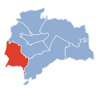
Sokółka County is a unit of territorial administration and local government (powiat) in Podlaskie Voivodeship, north-eastern Poland, on the border with Belarus. It was created on 1 January 1999 as a result of the Polish local government reforms passed in 1998. Its administrative seat and largest town is Sokółka, which lies 39 kilometres (24 mi) north-east of the regional capital Białystok. The county also contains the towns of Dąbrowa Białostocka, lying 30 km (19 mi) north of Sokółka, Krynki, lying 24 km (15 mi) south-east of Sokółka, and Suchowola, 33 km (21 mi) north-west of Sokółka.

Grajewo County County in Podlaskie, Poland

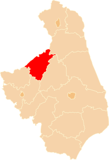
Grajewo County is a unit of territorial administration and local government (powiat) in Podlaskie Voivodeship, north-eastern Poland. It came into being on January 1, 1999, as a result of the Polish local government reforms passed in 1998. Its administrative seat and largest town is Grajewo, which lies 76 kilometres (47 mi) north-west of the regional capital Białystok. The county also contains the towns of Szczuczyn, lying 15 km (9 mi) south-west of Grajewo, and Rajgród, 19 km (12 mi) north-east of Grajewo.

Gmina Rajgród Gmina in Podlaskie, Poland

Gmina Rajgród is an urban-rural gmina in Grajewo County, Podlaskie Voivodeship, in north-eastern Poland. Its seat is the town of Rajgród, which lies approximately 19 kilometres (12 mi) north-east of Grajewo and 75 km (47 mi) north-west of the regional capital Białystok.

Gmina Mońki Gmina in Podlaskie, Poland

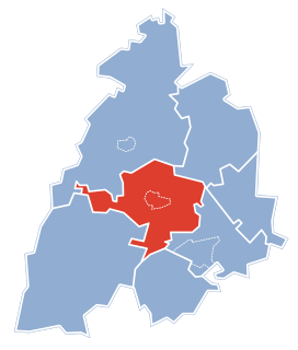
Gmina Mońki is an urban-rural gmina in Mońki County, Podlaskie Voivodeship, in north-eastern Poland. Its seat is the town of Mońki, which lies approximately 40 kilometres (25 mi) north-west of the regional capital Białystok.

Gmina Knyszyn Gmina in Podlaskie, Poland

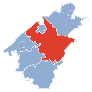
Gmina Knyszyn is an urban-rural gmina in Mońki County, Podlaskie Voivodeship, in north-eastern Poland. Its seat is the town of Knyszyn, which lies approximately 13 kilometres (8 mi) south-east of Mońki and 28 km (17 mi) north-west of the regional capital Białystok.

Gmina Krypno Gmina in Podlaskie, Poland

Gmina Krypno is a rural gmina in Mońki County, Podlaskie Voivodeship, in north-eastern Poland. Its seat is the village of Krypno, which lies approximately 15 kilometres (9 mi) south of Mońki and 27 km (17 mi) north-west of the regional capital Białystok.

Gmina Trzcianne Gmina in Podlaskie, Poland

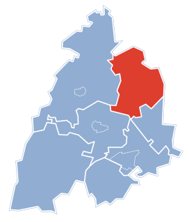
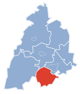
Gmina Trzcianne is a rural gmina in Mońki County, Podlaskie Voivodeship, in north-eastern Poland. Its seat is the village of Trzcianne, which lies approximately 11 kilometres (7 mi) south-west of Mońki and 41 km (25 mi) north-west of the regional capital Białystok.

Kramkówka Duża Village in Podlaskie, Poland

Kramkówka Duża is a village in the administrative district of Gmina Goniądz, within Mońki County, Podlaskie Voivodeship, in north-eastern Poland. It lies approximately 7 kilometres (4 mi) south of Goniądz, 8 km (5 mi) north-west of Mońki, and 47 km (29 mi) northwest of the regional capital Białystok.

Krzecze Village in Podlaskie, Poland

Krzecze is a village in the administrative district of Gmina Goniądz, within Mońki County, Podlaskie Voivodeship, in north-eastern Poland. It lies approximately 9 kilometres (6 mi) east of Goniądz, 14 km (9 mi) north of Mońki, and 50 km (31 mi) north-west of the regional capital Białystok.

Płochowo Village in Podlaskie, Poland

Płochowo is a village in the administrative district of Gmina Goniądz, within Mońki County, Podlaskie Voivodeship, in north-eastern Poland. It lies approximately 7 kilometres (4 mi) north-west of Goniądz, 17 km (11 mi) north-west of Mońki, and 57 km (35 mi) north-west of the regional capital Białystok.

Smogorówka Dolistowska Village in Podlaskie, Poland

Smogorówka Dolistowska is a village in the administrative district of Gmina Goniądz, within Mońki County, Podlaskie Voivodeship, in north-eastern Poland. It lies approximately 11 kilometres (7 mi) east of Goniądz, 15 km (9 mi) north-east of Mońki, and 49 km (30 mi) north-west of the regional capital Białystok.

Smogorówka Goniądzka Village in Podlaskie, Poland

Smogorówka Goniądzka is a village in the administrative district of Gmina Goniądz, within Mońki County, Podlaskie Voivodeship, in north-eastern Poland. It lies approximately 10 kilometres (6 mi) east of Goniądz, 14 km (9 mi) north-east of Mońki, and 48 km (30 mi) north-west of the regional capital Białystok.

Szafranki, Mońki County Village in Podlaskie, Poland

Szafranki is a village in the administrative district of Gmina Goniądz, within Mońki County, Podlaskie Voivodeship, in north-eastern Poland. It lies approximately 2 kilometres (1 mi) south-west of Goniądz, 11 km (7 mi) north-west of Mońki, and 51 km (32 mi) north-west of the regional capital Białystok.

Uścianek, Podlaskie Voivodeship Village in Podlaskie, Poland

Uścianek is a village in the administrative district of Gmina Goniądz, within Mońki County, Podlaskie Voivodeship, in north-eastern Poland. It lies approximately 11 kilometres (7 mi) south-west of Goniądz, 13 km (8 mi) west of Mońki, and 51 km (32 mi) north-west of the regional capital Białystok.

Wólka Piaseczna, Podlaskie Voivodeship Village in Podlaskie, Poland

Wólka Piaseczna is a village in the administrative district of Gmina Goniądz, within Mońki County, Podlaskie Voivodeship, in north-eastern Poland. It lies approximately 5 kilometres (3 mi) north of Goniądz, 16 km (10 mi) north of Mońki, and 55 km (34 mi) north-west of the regional capital Białystok.

Downary-Plac Village in Podlaskie, Poland

Downary-Plac is a village in the administrative district of Gmina Goniądz, within Mońki County, Podlaskie Voivodeship, in north-eastern Poland. It lies approximately 5 kilometres (3 mi) south-west of Goniądz, 7 km (4 mi) north-west of Mońki, and 48 km (30 mi) north-west of the regional capital Białystok.

References