
Jarosław County is a unit of territorial administration and local government (powiat) in Subcarpathian Voivodeship, south-eastern Poland, on the border with Ukraine. It came into being on January 1, 1999, as a result of the Polish local government reforms passed in 1998. Its administrative seat and largest town is Jarosław, which lies 49 kilometres (30 mi) east of the regional capital Rzeszów. The only other towns in the county are Radymno, lying 13 km (8 mi) south-east of Jarosław, and Pruchnik.

Chotyniec is a village in the administrative district of Gmina Radymno, within Jarosław County, in the Subcarpathian Voivodeship of south-eastern Poland, close to the border with Ukraine. It lies approximately 15 kilometres (9 mi) east of Radymno, 26 km (16 mi) east of Jarosław, and 74 km (46 mi) east of the regional capital Rzeszów. It lies on the Route of Wooden Architecture.
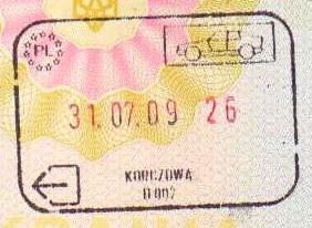
Korczowa is a village in the administrative district of Gmina Radymno, within Jarosław County, Subcarpathian Voivodeship, in south-eastern Poland, close to the border with Ukraine.

Michałówka is a village in the administrative district of Gmina Radymno, within Jarosław County, Subcarpathian Voivodeship, in south-eastern Poland, close to the border with Ukraine. It lies approximately 5 kilometres (3 mi) east of Radymno, 17 km (11 mi) south-east of Jarosław, and 64 km (40 mi) east of the regional capital Rzeszów.
Gmina Chłopice is a rural gmina in Jarosław County, Subcarpathian Voivodeship, in south-eastern Poland. Its seat is the village of Chłopice, which lies approximately 6 kilometres (4 mi) south of Jarosław and 50 km (31 mi) east of the regional capital Rzeszów.
Gmina Jarosław is a rural gmina in Jarosław County, Subcarpathian Voivodeship, in south-eastern Poland. Its seat is the town of Jarosław, although the town is not part of the territory of the gmina.
Gmina Laszki is a rural gmina in Jarosław County, Subcarpathian Voivodeship, in south-eastern Poland. Its seat is the village of Laszki, which lies approximately 16 kilometres (10 mi) east of Jarosław and 65 km (40 mi) east of the regional capital Rzeszów.
Budzyń is a village in the administrative district of Gmina Radymno, within Jarosław County, Subcarpathian Voivodeship, in south-eastern Poland, close to the border with Ukraine. It lies approximately 23 kilometres (14 mi) east of Radymno, 33 km (21 mi) east of Jarosław, and 81 km (50 mi) east of the regional capital Rzeszów.
Chałupki Chotynieckie is a village in the administrative district of Gmina Radymno, within Jarosław County, Subcarpathian Voivodeship, in south-eastern Poland, close to the border with Ukraine. It lies approximately 15 kilometres (9 mi) east of Radymno, 25 km (16 mi) east of Jarosław, and 73 km (45 mi) east of the regional capital Rzeszów.
Duńkowice is a village in the administrative district of Gmina Radymno, within Jarosław County, Subcarpathian Voivodeship, in south-eastern Poland, close to the border with Ukraine. It lies approximately 7 kilometres (4 mi) east of Radymno, 17 km (11 mi) east of Jarosław, and 65 km (40 mi) east of the regional capital Rzeszów.
Grabowiec is a village in the administrative district of Gmina Radymno, within Jarosław County, Subcarpathian Voivodeship, in south-eastern Poland, close to the border with Ukraine. It lies approximately 5 kilometres (3 mi) east of Radymno, 17 km (11 mi) south-east of Jarosław, and 64 km (40 mi) east of the regional capital Rzeszów.
Łazy is a village in the administrative district of Gmina Radymno, within Jarosław County, Subcarpathian Voivodeship, in south-eastern Poland, close to the border with Ukraine. It lies approximately 6 kilometres (4 mi) north-east of Radymno, 14 km (9 mi) east of Jarosław, and 62 km (39 mi) east of the regional capital Rzeszów.

Młyny is a village in the administrative district of Gmina Radymno, within Jarosław County, Subcarpathian Voivodeship, in south-eastern Poland, close to the border with Ukraine. It lies approximately 19 kilometres (12 mi) east of Radymno, 29 km (18 mi) east of Jarosław, and 77 km (48 mi) east of the regional capital Rzeszów.
Nienowice is a village in the administrative district of Gmina Radymno, within Jarosław County, Subcarpathian Voivodeship, in south-eastern Poland, close to the border with Ukraine. It lies approximately 9 kilometres (6 mi) east of Radymno, 21 km (13 mi) south-east of Jarosław, and 68 km (42 mi) east of the regional capital Rzeszów.

Skołoszów is a village in the administrative district of Gmina Radymno, within Jarosław County, Subcarpathian Voivodeship, in south-eastern Poland, close to the border with Ukraine. It lies approximately 4 kilometres (2 mi) south of Radymno, 15 km (9 mi) south-east of Jarosław, and 59 km (37 mi) east of the regional capital Rzeszów.
Sośnica is a village in the administrative district of Gmina Radymno, within Jarosław County, Podkarpackie Voivodeship, in south-eastern Poland, close to the border with.
Sośnica-Brzeg is a village in the administrative district of Gmina Radymno, within Jarosław County, Subcarpathian Voivodeship, in south-eastern Poland, close to the border with Ukraine. It lies approximately 7 kilometres (4 mi) south-east of Radymno, 20 km (12 mi) south-east of Jarosław, and 65 km (40 mi) east of the regional capital Rzeszów.
Święte is a village in the administrative district of Gmina Radymno, within Jarosław County, Subcarpathian Voivodeship, in south-eastern Poland, close to the border with Ukraine. It lies approximately 5 kilometres (3 mi) south-east of Radymno, 17 km (11 mi) south-east of Jarosław, and 62 km (39 mi) east of the regional capital Rzeszów.
Zaleska Wola is a village in the administrative district of Gmina Radymno, within Jarosław County, Subcarpathian Voivodeship, in south-eastern Poland, close to the border with Ukraine. It lies approximately 13 kilometres (8 mi) east of Radymno, 23 km (14 mi) east of Jarosław, and 71 km (44 mi) east of the regional capital Rzeszów.
Zamojsce is a village in the administrative district of Gmina Radymno, within Jarosław County, Subcarpathian Voivodeship, in south-eastern Poland, close to the border with Ukraine. It lies approximately 4 kilometres (2 mi) south of Radymno, 14 km (9 mi) south-east of Jarosław, and 59 km (37 mi) east of the regional capital Rzeszów.


