
Jarosław County is a unit of territorial administration and local government (powiat) in Subcarpathian Voivodeship, south-eastern Poland, on the border with Ukraine. It came into being on January 1, 1999, as a result of the Polish local government reforms passed in 1998. Its administrative seat and largest town is Jarosław, which lies 49 kilometres (30 mi) east of the regional capital Rzeszów. The only other towns in the county are Radymno, lying 13 km (8 mi) south-east of Jarosław, and Pruchnik.

Lubaczów County is a unit of territorial administration and local government (powiat) in Subcarpathian Voivodeship, south-eastern Poland, on the border with Ukraine. It came into being on January 1, 1999, as a result of the Polish local government reforms passed in 1998. Its administrative seat and largest town is Lubaczów, which lies 81 kilometres (50 mi) east of the regional capital Rzeszów. The county contains three other towns: Oleszyce, 7 km (4 mi) west of Lubaczów, Narol, 26 km (16 mi) north-east of Lubaczów, and Cieszanów, 12 km (7 mi) north of Lubaczów.

Przeworsk County is a unit of territorial administration and local government (powiat) in Subcarpathian Voivodeship, south-eastern Poland. It came into being on January 1, 1999, as a result of the Polish local government reforms passed in 1998. Its administrative seat and largest town is Przeworsk, which lies 36 kilometres (22 mi) east of the regional capital Rzeszów. The county also contains the towns of Kańczuga, lying 11 km (7 mi) south-west of Przeworsk, and Sieniawa, 15 km (9 mi) north-east of Przeworsk.
Gmina Jarosław is a rural gmina in Jarosław County, Subcarpathian Voivodeship, in south-eastern Poland. Its seat is the town of Jarosław, although the town is not part of the territory of the gmina.
Gmina Pawłosiów is a rural gmina in Jarosław County, Subcarpathian Voivodeship, in south-eastern Poland. Its seat is the village of Pawłosiów, which lies approximately 5 kilometres (3 mi) south-west of Jarosław and 47 km (29 mi) east of the regional capital Rzeszów.
Gmina Radymno is a rural gmina in Jarosław County, Subcarpathian Voivodeship, in south-eastern Poland, on the border with Ukraine. Its seat is the town of Radymno, although the town is not part of the territory of the gmina.
Gmina Roźwienica is a rural gmina in Jarosław County, Subcarpathian Voivodeship, in south-eastern Poland. Its seat is the village of Roźwienica, which lies approximately 10 kilometres (6 mi) south-west of Jarosław and 43 km (27 mi) east of the regional capital Rzeszów.
Gmina Wiązownica is a rural gmina in Jarosław County, Subcarpathian Voivodeship, in south-eastern Poland. Its seat is the village of Wiązownica, which lies approximately 6 kilometres (4 mi) north of Jarosław and 50 km (31 mi) east of the regional capital Rzeszów.
Gmina Dubiecko is a rural gmina in Przemyśl County, Subcarpathian Voivodeship, in south-eastern Poland. Its seat is the village of Dubiecko, which lies approximately 28 kilometres (17 mi) west of Przemyśl and 36 km (22 mi) south-east of the regional capital Rzeszów.
Gmina Krzywcza is a rural gmina in Przemyśl County, Subcarpathian Voivodeship, in south-eastern Poland. Its seat is the village of Krzywcza, which lies approximately 17 kilometres (11 mi) west of Przemyśl and 47 km (29 mi) south-east of the regional capital Rzeszów.
Gmina Kańczuga is an urban-rural gmina in Przeworsk County, Subcarpathian Voivodeship, in south-eastern Poland. Its seat is the town of Kańczuga, which lies approximately 11 kilometres (7 mi) south-west of Przeworsk and 29 km (18 mi) east of the regional capital Rzeszów.
Gmina Przeworsk is a rural gmina in Przeworsk County, Subcarpathian Voivodeship, in south-eastern Poland. Its seat is the town of Przeworsk, although the town is not part of the territory of the gmina.
Gmina Sieniawa is an urban-rural gmina in Przeworsk County, Subcarpathian Voivodeship, in south-eastern Poland. Its seat is the town of Sieniawa, which lies approximately 15 kilometres (9 mi) north-east of Przeworsk and 47 km (29 mi) east of the regional capital Rzeszów.
Gmina Zarzecze is a rural gmina in Przeworsk County, Subcarpathian Voivodeship, in south-eastern Poland. Its seat is the village of Zarzecze, which lies approximately 10 kilometres (6 mi) south of Przeworsk and 39 km (24 mi) east of the regional capital Rzeszów.
Gmina Złocieniec is an urban-rural gmina in Drawsko County, West Pomeranian Voivodeship, in north-western Poland. Its seat is the town of Złocieniec, which lies approximately 15 kilometres (9 mi) east of Drawsko Pomorskie and 96 km (60 mi) east of the regional capital Szczecin.
Hawłowice is a village in the administrative district of Gmina Pruchnik, within Jarosław County, Subcarpathian Voivodeship, in south-eastern Poland. It lies approximately 3 kilometres (2 mi) north-east of Pruchnik, 15 km (9 mi) south-west of Jarosław, and 40 km (25 mi) east of the regional capital Rzeszów.
Kramarzówka is a village in the administrative district of Gmina Pruchnik, within Jarosław County, Subcarpathian Voivodeship, in south-eastern Poland. It lies approximately 8 kilometres (5 mi) south of Pruchnik, 23 km (14 mi) south-west of Jarosław, and 41 km (25 mi) south-east of the regional capital Rzeszów.

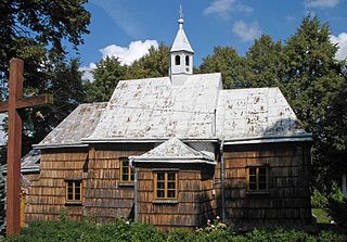
Pruchnik is a rural town in Jarosław County, Subcarpathian Voivodeship, in south-eastern Poland. It is the seat of the administrative district called Gmina Pruchnik. It lies approximately 17 kilometres (11 mi) south-west of Jarosław and 39 km (24 mi) east of the regional capital Rzeszów.
Rozbórz Okrągły is a village in the administrative district of Gmina Pruchnik, within Jarosław County, Subcarpathian Voivodeship, in south-eastern Poland. It lies approximately 3 kilometres (2 mi) north-west of Pruchnik, 16 km (10 mi) south-west of Jarosław, and 38 km (24 mi) east of the regional capital Rzeszów.
Świebodna is a village in the administrative district of Gmina Pruchnik, within Jarosław County, Subcarpathian Voivodeship, in south-eastern Poland. It lies approximately 5 kilometres (3 mi) west of Pruchnik, 20 km (12 mi) south-west of Jarosław, and 35 km (22 mi) east of the regional capital Rzeszów.


