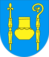
Gmina Warlubie Warlubie Commune | |||
---|---|---|---|
Gmina | |||
| |||
Coordinates(Warlubie): 53°35′17″N18°37′33″E / 53.58806°N 18.62583°E Coordinates: 53°35′17″N18°37′33″E / 53.58806°N 18.62583°E | |||
Country | |||
Voivodeship | Kuyavian-Pomeranian | ||
County | Świecie | ||
Seat | Warlubie | ||
Area | |||
• Total | 200.97 km2 (77.59 sq mi) | ||
Population (2006) | |||
• Total | 6,473 | ||
• Density | 32/km2 (83/sq mi) | ||
Website | http://www.warlubie.pl |
Gmina Warlubie is a rural gmina (administrative district) in Świecie County, Kuyavian-Pomeranian Voivodeship, in north-central Poland. Its seat is the village of Warlubie, which lies approximately 23 kilometres (14 mi) north-east of Świecie, 62 km (39 mi) north of Toruń, and 67 km (42 mi) north-east of Bydgoszcz.
The gmina is the principal unit of the administrative division of Poland, similar to a municipality. As of 2010 there were 2,478 gminy throughout the country. The word gmina derives from the German word Gemeinde, meaning "community".
Świecie County is a unit of territorial administration and local government (powiat) in Kuyavian-Pomeranian Voivodeship, north-central Poland. It came into being on January 1, 1999, as a result of the Polish local government reforms passed in 1998. Its administrative seat and largest town is Świecie, which lies 45 km (28 mi) north of Toruń and 45 km (28 mi) north-east of Bydgoszcz. The only other town in the county is Nowe, lying 33 km (21 mi) north-east of Świecie.
Kuyavian-Pomeranian Voivodeship, also known as Cuiavian-Pomeranian Voivodeship or simply Kujawsko-Pomorskie, or Kujawy-Pomerania Province, is one of the 16 voivodeships (provinces) into which Poland is divided. It is situated in mid-northern Poland, on the boundary between the two historic regions from which it takes its name: Kuyavia and Pomerania. Its two chief cities, serving as the province's joint capitals, are Bydgoszcz and Toruń.
The gmina covers an area of 200.97 square kilometres (77.6 sq mi), and as of 2006 its total population is 6,473.
The gmina contains part of the protected area called Wda Landscape Park.
Protected areas or conservation areas are locations which receive protection because of their recognized natural, ecological or cultural values. There are several kinds of protected areas, which vary by level of protection depending on the enabling laws of each country or the regulations of the international organizations involved.
Wda Landscape Park is a protected area in north-central Poland, established in 1993, covering an area of 237.86 square kilometres (91.84 sq mi). It takes its name from the Wda river.
Gmina Warlubie contains the villages and settlements of Bąkowo, Bąkowski Młyn, Błądziewno, Blizawy, Borowy Młyn, Borsukowo, Bursztynowo, Buśnia, Bzowo, Ciemny Las, Dębowo, Górna Buśnia, Grabowa Góra, Jeżewnica, Komorsk, Krusze, Krzewiny, Kurzejewo, Kuźnica, Lipinki, Mątasek, Nowa Huta, Płochocin, Płochocinek, Przewodnik, Rulewo, Rybno, Rynków, Średnia Huta, Stara Huta, Warlubie, Wielki Komorsk and Zamczyska.
Bąkowo is a village in the administrative district of Gmina Warlubie, within Świecie County, Kuyavian-Pomeranian Voivodeship, in north-central Poland. It lies approximately 3 kilometres (2 mi) south of Warlubie, 21 km (13 mi) north-east of Świecie, 60 km (37 mi) north of Toruń, and 65 km (40 mi) north-east of Bydgoszcz.
Bąkowski Młyn is a village in the administrative district of Gmina Warlubie, within Świecie County, Kuyavian-Pomeranian Voivodeship, in north-central Poland. It lies approximately 5 kilometres (3 mi) west of Warlubie, 21 km (13 mi) north-east of Świecie, 61 km (38 mi) north of Toruń, and 64 km (40 mi) north-east of Bydgoszcz.
Błądziewno is a village in the administrative district of Gmina Warlubie, within Świecie County, Kuyavian-Pomeranian Voivodeship, in north-central Poland. It lies approximately 8 kilometres (5 mi) south-west of Warlubie, 16 km (10 mi) north-east of Świecie, 56 km (35 mi) north of Toruń, and 60 km (37 mi) north-east of Bydgoszcz.
Gmina Warlubie is bordered by the gminas of Dragacz, Jeżewo, Nowe, Osie and Osiek.
Gmina Dragacz is a rural gmina in Świecie County, Kuyavian-Pomeranian Voivodeship, in north-central Poland. Its seat is the village of Dragacz, which lies approximately 23 kilometres (14 mi) north-east of Świecie and 53 km (33 mi) north of Toruń.
Gmina Jeżewo is a rural gmina in Świecie County, Kuyavian-Pomeranian Voivodeship, in north-central Poland. Its seat is the village of Jeżewo, which lies approximately 12 kilometres (7 mi) north of Świecie, 54 km (34 mi) north of Toruń, and 55 km (34 mi) north-east of Bydgoszcz.
Gmina Nowe is an urban-rural gmina in Świecie County, Kuyavian-Pomeranian Voivodeship, in north-central Poland. Its seat is the town of Nowe, which lies approximately 33 kilometres (21 mi) north-east of Świecie and 69 km (43 mi) north of Toruń.
Gmina Świecie nad Osą is a rural gmina in Grudziądz County, Kuyavian-Pomeranian Voivodeship, in north-central Poland. Its seat is the village of Świecie nad Osą, which lies approximately 23 kilometres (14 mi) east of Grudziądz and 56 km (35 mi) north-east of Toruń.
Gmina Osie is a rural gmina in Świecie County, Kuyavian-Pomeranian Voivodeship, in north-central Poland. Its seat is the village of Osie, which lies approximately 22 kilometres (14 mi) north of Świecie, 59 km (37 mi) north-east of Bydgoszcz, and 66 km (41 mi) north of Toruń.
Gmina Cekcyn is a rural gmina in Tuchola County, Kuyavian-Pomeranian Voivodeship, in north-central Poland. Its seat is the village of Cekcyn, which lies approximately 11 kilometres (7 mi) east of Tuchola and 51 km (32 mi) north of Bydgoszcz.
Gmina Stężyca is a rural gmina in Kartuzy County, Pomeranian Voivodeship, in northern Poland. Its seat is the village of Stężyca, which lies approximately 22 kilometres (14 mi) south-west of Kartuzy and 48 km (30 mi) west of the regional capital Gdańsk.
Gmina Luzino is a rural gmina in Wejherowo County, Pomeranian Voivodeship, in northern Poland. Its seat is the village of Luzino, which lies approximately 11 kilometres (7 mi) south-west of Wejherowo and 41 km (25 mi) north-west of the regional capital Gdańsk.
Gmina Szemud is a rural gmina in Wejherowo County, Pomeranian Voivodeship, in northern Poland. Its seat is the village of Szemud, which lies approximately 13 kilometres (8 mi) south of Wejherowo and 30 km (19 mi) north-west of the regional capital Gdańsk.
Gmina Chmielno is a rural gmina in Kartuzy County, Pomeranian Voivodeship, in northern Poland. Its seat is the village of Chmielno, which lies approximately 7 kilometres (4 mi) west of Kartuzy and 35 km (22 mi) west of the regional capital Gdańsk.
Borowy Młyn is a village in the administrative district of Gmina Warlubie, within Świecie County, Kuyavian-Pomeranian Voivodeship, in north-central Poland. It lies approximately 7 kilometres (4 mi) north-west of Warlubie, 23 km (14 mi) north of Świecie, 65 km (40 mi) north of Toruń, and 66 km (41 mi) north-east of Bydgoszcz.
Buśnia is a village in the administrative district of Gmina Warlubie, within Świecie County, Kuyavian-Pomeranian Voivodeship, in north-central Poland. It lies approximately 7 kilometres (4 mi) south-west of Warlubie, 17 km (11 mi) north-east of Świecie, 56 km (35 mi) north of Toruń, and 61 km (38 mi) north-east of Bydgoszcz.
Komorsk is a village in the administrative district of Gmina Warlubie, within Świecie County, Kuyavian-Pomeranian Voivodeship, in north-central Poland. It lies approximately 4 kilometres (2 mi) south-east of Warlubie, 24 km (15 mi) north-east of Świecie, 61 km (38 mi) north of Toruń, and 68 km (42 mi) north-east of Bydgoszcz.
Mątasek is a village in the administrative district of Gmina Warlubie, within Świecie County, Kuyavian-Pomeranian Voivodeship, in north-central Poland. It lies approximately 10 kilometres (6 mi) north-west of Warlubie, 28 km (17 mi) north of Świecie, 70 km (43 mi) north of Toruń, and 70 km (43 mi) north-east of Bydgoszcz.
Nowa Huta is a village in the administrative district of Gmina Warlubie, within Świecie County, Kuyavian-Pomeranian Voivodeship, in north-central Poland. It lies approximately 17 kilometres (11 mi) north-west of Warlubie, 28 km (17 mi) north of Świecie, 67 km (42 mi) north-east of Bydgoszcz, and 72 km (45 mi) north of Toruń.
Średnia Huta is a village in the administrative district of Gmina Warlubie, within Świecie County, Kuyavian-Pomeranian Voivodeship, in north-central Poland. It lies approximately 10 kilometres (6 mi) north-west of Warlubie, 25 km (16 mi) north of Świecie, 67 km (42 mi) north-east of Bydgoszcz, and 68 km (42 mi) north of Toruń.
Stara Huta is a village in the administrative district of Gmina Warlubie, within Świecie County, Kuyavian-Pomeranian Voivodeship, in north-central Poland. It lies approximately 14 kilometres (9 mi) north-west of Warlubie, 26 km (16 mi) north of Świecie, 67 km (42 mi) north-east of Bydgoszcz, and 70 km (43 mi) north of Toruń.
Wielki Komorsk is a village in the administrative district of Gmina Warlubie, within Świecie County, Kuyavian-Pomeranian Voivodeship, in north-central Poland. It lies approximately 3 kilometres (2 mi) east of Warlubie, 25 km (16 mi) north-east of Świecie, 62 km (39 mi) north of Toruń, and 69 km (43 mi) north-east of Bydgoszcz.