
Koziniec is a village in the administrative district of Gmina Jasionówka, within Mońki County, Podlaskie Voivodeship, in north-eastern Poland. It lies approximately 5 kilometres (3 mi) north-west of Jasionówka, 13 km (8 mi) east of Mońki, and 38 km (24 mi) north of the regional capital Białystok.
Rudki is a village in the administrative district of Gmina Nowe Miasto nad Pilicą, within Grójec County, Masovian Voivodeship, in east-central Poland.
Aleksandrów is a village in the administrative district of Gmina Góra Kalwaria, within Piaseczno County, Masovian Voivodeship, in east-central Poland. It lies approximately 19 kilometres (12 mi) west of Góra Kalwaria, 11 km (7 mi) south-west of Piaseczno, and 27 km (17 mi) south of Warsaw
Posada is a village in the administrative district of Gmina Przytyk, within Radom County, Masovian Voivodeship, in east-central Poland. It lies approximately 7 kilometres (4 mi) south-west of Przytyk, 25 km (16 mi) west of Radom, and 88 km (55 mi) south of Warsaw.
Cerekiew is a village in the administrative district of Gmina Zakrzew, within Radom County, Masovian Voivodeship, in east-central Poland. It lies approximately 6 kilometres (4 mi) south-east of Zakrzew, 8 km (5 mi) west of Radom, and 89 km (55 mi) south of Warsaw.
Gózdek is a village in the administrative district of Gmina Zakrzew, within Radom County, Masovian Voivodeship, in east-central Poland. It lies approximately 7 kilometres (4 mi) north-east of Zakrzew, 14 km (9 mi) north-west of Radom, and 80 km (50 mi) south of Warsaw.
Gulin is a village in the administrative district of Gmina Zakrzew, within Radom County, Masovian Voivodeship, in east-central Poland. It lies approximately 4 kilometres (2 mi) north of Zakrzew, 14 km (9 mi) north-west of Radom, and 82 km (51 mi) south of Warsaw.
Kozia Wola is a village in the administrative district of Gmina Zakrzew, within Radom County, Masovian Voivodeship, in east-central Poland. It lies approximately 5 kilometres (3 mi) north-west of Zakrzew, 16 km (10 mi) north-west of Radom, and 82 km (51 mi) south of Warsaw.
Kozinki is a village in the administrative district of Gmina Zakrzew, within Radom County, Masovian Voivodeship, in east-central Poland. It lies approximately 4 kilometres (2 mi) east of Zakrzew, 9 km (6 mi) north-west of Radom, and 86 km (53 mi) south of Warsaw.
Milejowice is a village in the administrative district of Gmina Zakrzew, within Radom County, Masovian Voivodeship, in east-central Poland. It lies approximately 5 kilometres (3 mi) east of Zakrzew, 7 km (4 mi) north-west of Radom, and 88 km (55 mi) south of Warsaw.
Mleczków is a village in the administrative district of Gmina Zakrzew, within Radom County, Masovian Voivodeship, in east-central Poland. It lies approximately 3 kilometres (2 mi) south-east of Zakrzew, 9 km (6 mi) north-west of Radom, and 87 km (54 mi) south of Warsaw.
Zakrzewska Wola is a village in the administrative district of Gmina Zakrzew, within Radom County, Masovian Voivodeship, in east-central Poland. It lies approximately 3 kilometres (2 mi) west of Zakrzew, 14 km (9 mi) north-west of Radom, and 86 km (53 mi) south of Warsaw.
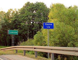
Ludwinów is a village in the administrative district of Gmina Liw, within Węgrów County, Masovian Voivodeship, in east-central Poland. It lies approximately 5 kilometres (3 mi) north-west of Węgrów and 72 km (45 mi) east of Warsaw.
Grabce Józefpolskie is a village in the administrative district of Gmina Mszczonów, within Żyrardów County, Masovian Voivodeship, in east-central Poland. It lies approximately 3 kilometres (2 mi) north-west of Mszczonów, 9 km (6 mi) south-east of Żyrardów, and 43 km (27 mi) south-west of Warsaw.
Kaczków is a village in the administrative district of Gmina Mszczonów, within Żyrardów County, Masovian Voivodeship, in east-central Poland. It lies approximately 7 kilometres (4 mi) east of Mszczonów, 15 km (9 mi) south-east of Żyrardów, and 37 km (23 mi) south-west of Warsaw.
Lublinów is a village in the administrative district of Gmina Mszczonów, within Żyrardów County, Masovian Voivodeship, in east-central Poland. It lies approximately 4 kilometres (2 mi) west of Mszczonów, 9 km (6 mi) south-east of Żyrardów, and 44 km (27 mi) south-west of Warsaw.
Świnice is a village in the administrative district of Gmina Mszczonów, within Żyrardów County, Masovian Voivodeship, in east-central Poland. It lies approximately 4 kilometres (2 mi) west of Mszczonów, 9 km (6 mi) south-east of Żyrardów, and 44 km (27 mi) south-west of Warsaw.
Górki is a village in the administrative district of Gmina Puszcza Mariańska, within Żyrardów County, Masovian Voivodeship, in east-central Poland. It lies approximately 6 kilometres (4 mi) east of Puszcza Mariańska, 8 km (5 mi) south of Żyrardów, and 47 km (29 mi) south-west of Warsaw.
Okrągłe is a village in the administrative district of Gmina Dąbrówno, within Ostróda County, Warmian-Masurian Voivodeship, in northern Poland. It lies approximately 4 kilometres (2 mi) west of Dąbrówno, 30 km (19 mi) south of Ostróda, and 52 km (32 mi) south-west of the regional capital Olsztyn.
Warchlinko is a village in the administrative district of Gmina Stargard, within Stargard County, West Pomeranian Voivodeship, in north-western Poland. It lies approximately 12 kilometres (7 mi) north of Stargard and 27 km (17 mi) east of the regional capital Szczecin.


