Golling an der Erlauf | |
|---|---|
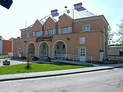 Golling an der Erlauf town hall | |
 Coat of arms | |
 Golling an der Erlauf Location within Austria | |
| Coordinates: 48°12′N15°11′E / 48.200°N 15.183°E | |
| Country | Austria |
| State | Lower Austria |
| District | Melk |
| Government | |
| • Mayor | Theodor Fischer |
| Area | |
• Total | 2.71 km2 (1.05 sq mi) |
| Elevation | 215 m (705 ft) |
| Population (2018-01-01) [2] | |
• Total | 1,514 |
| • Density | 560/km2 (1,400/sq mi) |
| Time zone | UTC+1 (CET) |
| • Summer (DST) | UTC+2 (CEST) |
| Postal code | 3381 |
| Area code | 02757 |
| Website | www.golling-erlauf.gv.at |
Golling an der Erlauf is a town in the district of Melk in the Austrian state of Lower Austria.