Northwest of Goodbee is the start of P-Kaw-Shun Creek, the major contributory to Sims Creek. The stream flows in a generally southwestward direction to join the Tangipahoa River south of Robert in Tangipahoa Parish.[2]
Seven miles west of Goodbee, near Robert, is a major distribution center for Walmart Stores.[3]
Closer to Goodbee, at the boundary between Saint Tammany and Tangipahoa Parishes, is the Florida Parishes Juvenile Detention Center, a correctional institution for youths.[4]
Interstate 12 (I-12) is an Interstate Highway located entirely within the US state of Louisiana. It spans a total of 85.59 miles (137.74 km) in an east–west direction from I-10 in Baton Rouge to an interchange with both I-10 and I-59 in Slidell. Along the way, it passes through the city of Hammond, where it intersects I-55 and US Route 51 (US 51). It also serves the cities of Ponchatoula and Denham Springs, as well as the St. Tammany Parish cities of Covington and Mandeville. Skirting the northern shore of Lake Pontchartrain, I-12 serves as both a northern bypass of the New Orleans metropolitan area and an alternate route for I-10, which serves the city of New Orleans itself.
Washington Parish is a parish located in the interior southeast corner of the U.S. state of Louisiana, one of the Florida Parishes. As of the 2020 census, the population was 45,463. Its parish seat is Franklinton. Its largest city is Bogalusa. The parish was founded in 1819.
Tangipahoa Parish is a parish located on the southeastern border of the U.S. state of Louisiana. As of the 2020 census, the population was 133,157. The parish seat is Amite City, while the largest city is Hammond. Southeastern Louisiana University is located in Hammond. Lake Pontchartrain borders the southeastern side of the parish.
St. Tammany Parish is a parish located in the U.S. state of Louisiana named after Tamanend, the legendary Lenape Chief of Chiefs and the "Patron Saint of America." At the 2020 census, the population was 264,570, making it the fourth-most populous parish in Louisiana. The parish seat is Covington. The parish was founded in 1810.
Hammond is the largest city in Tangipahoa Parish, Louisiana, United States, located 45 miles (72 km) east of Baton Rouge and 45 miles (72 km) northwest of New Orleans. Its population was 20,019 in the 2010 U.S. census, and 21,359 at the 2020 population estimates program.
Southeastern Louisiana University (Southeastern) is a public university in Hammond, Louisiana. It was founded in 1925 by Linus A. Sims as Hammond Junior College. Sims succeeded in getting the campus moved to north Hammond in 1928, when it became known as Southeastern Louisiana College. It achieved university status in 1970.
The Florida Parishes, on the east side of the Mississippi River—an area also known as the Northshore or Northlake region—are eight parishes in the southeastern portion of the U.S. state of Louisiana.
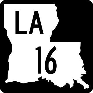
Louisiana Highway 16 (LA 16) is a state highway located in southeastern Louisiana. It runs 110.27 miles (177.46 km) in a general east–west direction from LA 22 south of French Settlement to LA 21 in Sun.
Louisiana Highway 22 (LA 22) is a state highway located in southeastern Louisiana. It runs 71.15 miles (114.50 km) in a general east–west direction from the junction of LA 75 and LA 942 in Darrow to U.S. Highway 190 (US 190) in Mandeville.
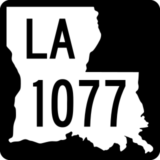
Louisiana Highway 1077 (LA 1077) is a state highway located in southeastern Louisiana. It runs 20.61 miles (33.17 km) in a general north–south direction from a dead end at Lake Pontchartrain in Madisonville to a junction with LA 25 south of Folsom.
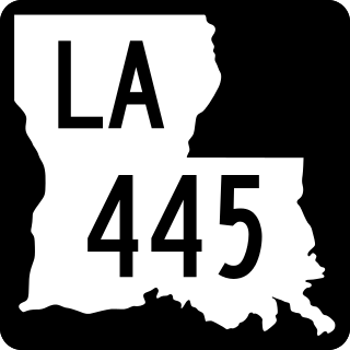
Louisiana Highway 445 is a state highway in Louisiana that serves Tangipahoa Parish. It spans 24.6 miles (39.6 km) in a south to north direction. Near its north end, it is known as Husser Road.
The Tangipahoa River originates northwest of McComb in southwest Mississippi, and runs south 122 miles (196 km) through Lake Tangipahoa in Percy Quin State Park before passing into southeast Louisiana. There it flows entirely in the eponymous Tangipahoa Parish until its mouth opens into the northwest region of Lake Pontchartrain.
Istrouma Area Council serves Scouts in both Louisiana and Mississippi, primarily in the Greater Baton Rouge Area and Florida Parishes. Specifically, the council includes Scouts from the following parishes: Ascension, East Baton Rouge, West Baton Rouge, East Feliciana, West Feliciana, Iberville, Pointe Coupee, St. Helena, St. James, St. Tammany, Washington, and Tangipahoa. Wilkinson County is the sole Mississippi county in the council.
Robert is an unincorporated community in Tangipahoa Parish, Louisiana, United States. It lies east of Hammond, at the intersection of US 190 and LA 445, from which it has a signed exit on Interstate 12. Robert is the largest settlement in Tangipahoa Parish's rural 8th ward.
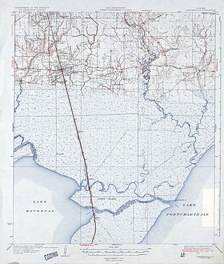
Sims Creek is a 4.7-mile-long (7.6 km) tributary of the Tangipahoa River in the 8th Ward of Tangipahoa Parish, Louisiana. It flows generally southeast from near Robert, and is joined about halfway down its course by its longest tributary, P-Kaw-Shun Creek, which begins north of Lorraine and flows southwest, passing under US 190 and Interstate 12, to its confluence with Sims Creek. The main creek then continues southwest, passing under LA 445, and meets the Tangipahoa River 4 miles (6 km) south of Robert. The creek is part of the Lake Pontchartrain Basin and thus sensitive to its ecology. In 2007, the attorney general of Louisiana issued a legal opinion that a private fence could not lawfully be constructed across Sims Creek, because of its importance to public drainage.
Louisiana Highway 40 (LA 40) is a state highway located in southeastern Louisiana. It runs 53.11 miles (85.47 km) in an east–west direction from LA 43 south of Montpelier to LA 41 in Bush.
The National Weather Service Weather Forecast Office New Orleans/Baton Rouge, Louisiana is a National Weather Service office located in Slidell, Louisiana.
This page is based on this Wikipedia article Text is available under the CC BY-SA 4.0 license; additional terms may apply. Images, videos and audio are available under their respective licenses.