Gordon Moss

Last updated

Gordon Moss is a nature reserve near Gordon, in the Scottish Borders area of Scotland, in the former Berwickshire.

Contents

The moss is situated one mile west of Gordon village, south of the Gordon – Earlston road (A6105). Parking places.

The fauna includes 16 species of butterfly and over 200 species of moth.

History and archaeology

clearing in the reserve Small Clearing in the Gordon Moss - geograph.org.uk - 923321.jpg
clearing in the reserve

On 21 January 1882, a workman walking across Gordon Moss discovered a flint axehead, described as being fashioned of a dark grey mottled flint, measuring 150mm by 50mm.

Gordon Moss is a remaining fragment of a much larger area of moss-land which historically extended across much of the low-lying ground from Earlston, past Gordon and Eastwards towards Greenlaw. Agricultural drainage schemes were implemented and allowed much of this land to be farmed. It appears that historically the drainage of the current Gordon Moss area was largely unsuccessful and in wet weather conditions much of the larger low-lying area becomes boggy and flooded to this day.

Gordon Moss formed part of the lands of the Greenknowe Estate. Circa the 1700s, some nearby land from the estate was sold as plots which now form Gordon's Main Street. Many of the title deeds of these plots came with a variety of rights from the lands of Greenknowe such as catching rabbits, gathering firewood and cutting divots (turf to fireproof thatching). This caused various conflicts with farming practices on the Greenknowe estate so in the 1800s part of the land of the Gordon Moss was given in exchange for these rights. The new owners of this land were known as the feuars and it is understood locally that certain properties still retain rights to part of the Gordon Moss. It appears that the feuars continued to attempt draining the land for some time afterwards and used it for grazing, firewood and shooting.

Local folklore says that in the mists of time the nearby village of Gordon was attacked by enemy soldiers. Local lads acted foolishly to entice the invaders to follow them into the Gordon Moss. By leaping out from behind bushes they lured the enemy into rushing forwards at them into very dangerous boggy areas and saved their village. They were proudly known as the Gordon Gowks and are remembered yet.

Twenty-first century

The Gordon Moss is a Site of Special Scientific Interest (SSSI) – these are controlled and monitored by Scottish Natural Heritage. There are very few remaining areas of semi-natural moss land remaining in the Scottish Borders.

Whilst there is little maintenance or human interference in the Gordon Moss, the Scottish Wildlife Trust have an involvement with part of the Moss.

The water levels in the moss are lower than they were historically and it is a pleasant and very quiet place to explore with strong footwear, but beware of adders. There are various safe tracks throughout, but some deep boggy areas and pools remain.

See also

Related Research Articles

<span class="mw-page-title-main">Scottish Borders</span> Council area of Scotland

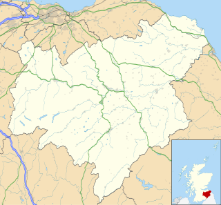
The Scottish Borders is one of 32 council areas of Scotland. It is bordered by West Lothian, Edinburgh, Midlothian, and East Lothian to the north, the North Sea to the east, Dumfries and Galloway to the south-west, South Lanarkshire to the west, and the English ceremonial counties of Cumbria and Northumberland to the south. The largest settlement is Galashiels, and the administrative centre is Newtown St Boswells.

<span class="mw-page-title-main">Berwickshire</span> Historic county in Scotland

Berwickshire is a historic county, registration county and lieutenancy area in south-eastern Scotland, on the English border. The county takes its name from Berwick-upon-Tweed, its original county town, which was part of Scotland at the time of the county's formation in the twelfth century, but became part of England in 1482 after several centuries of swapping back and forth between the two kingdoms. After the loss of Berwick, Duns and Greenlaw both served as county town at different periods.

<span class="mw-page-title-main">Duns, Scottish Borders</span> Town in Scottish Borders, Scotland

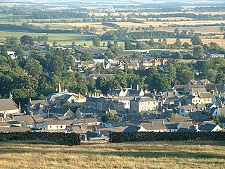
Duns is a town in the Scottish Borders, Scotland. It was the county town of the historic county of Berwickshire.

<span class="mw-page-title-main">Earlston</span> Town in Scottish Borders, Scotland

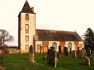
Earlston is a civil parish and market town in the county of Berwickshire, within the Scottish Borders. It is on the River Leader in Lauderdale, Scotland.

<span class="mw-page-title-main">Scotstown Moor</span>

Scotstown Moor is in the north of Aberdeen, Scotland.

Earlston RFC is a rugby union club, based at Earlston in the Scottish Borders.

<span class="mw-page-title-main">Polwarth, Scottish Borders</span> Village in Scottish Borders, Scotland, UK

Polwarth is a village and parish in the Scottish Borders area of Scotland. It is located at grid reference NT745502, between Greenlaw and Duns, in the former county of Berwickshire.

<span class="mw-page-title-main">Gordon, Scottish Borders</span> Village in Scottish Borders, Scotland

Gordon is a village in the Scottish Borders area of Scotland, within the historic county of Berwickshire. The village sits on the crossroads of the A6105 Earlston to Berwick on Tweed road and the A6089 Edinburgh to Kelso road. It is 6 miles (10 km) east of Earlston and 4 miles (6 km) west of Greenlaw.

<span class="mw-page-title-main">Gavinton</span> Village in Scottish Borders, Scotland, UK

Gavinton is a small settlement in the Scottish Borders area of Scotland, 2 kilometres (1.2 mi) south-west of Duns, the former county town of Berwickshire. The hamlet sits on a minor road off the A6105 Duns to Greenlaw road at grid reference NT767521.

<span class="mw-page-title-main">Pease Dean</span> Nature reserve in the Scottish Borders area of Scotland

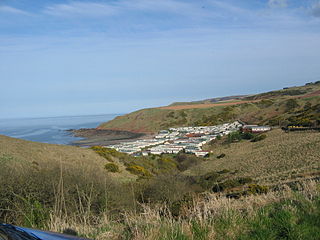
Pease Dean is a nature reserve at Pease Bay, in the Scottish Borders area of Scotland, near the Anglo-Scottish border and Cockburnspath, Cove, and Dunglass. OS 67 NT794707.

<span class="mw-page-title-main">Legerwood</span> Historic village in Scotland

Legerwood is a village by the Eden Water, in the Scottish Borders area of Scotland, near Lauder, near the Southern Upland Way.

<span class="mw-page-title-main">Edrom</span> Village in Scottish Borders, Scotland

Edrom is a parish and small village in the pre-1975 ancient county of Berwickshire, now an administrative area of the Scottish Borders region of Scotland.

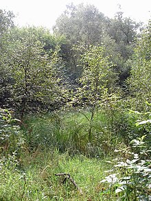
Bemersyde Moss is a Scottish Wildlife Trust nature reserve and a Site of Special Scientific Interest at Bemersyde in the Scottish Borders area of Scotland. Located near the River Tweed, this reserve features a mix of marshlands, willow scrub, and open water, creating a vital habitat for diverse wildlife. It particularly hostsbirds in the warmer months and wintering wildfowl, such as teal, shoveler, goldeneye, and wigeon, during colder months. The site also supports mammals like otters, which can be observed throughout the year.

<span class="mw-page-title-main">Cessford, Scottish Borders</span> Village in Scottish Borders, Scotland, UK

Cessford is a hamlet and former barony about a mile south of the B6401 road, in the Scottish Borders area of Scotland. The placename is from Gaelic 'ceis' and means 'the wattled causeway over the ford'; spellings vary between Cesfuird, Cesford, Cessfoord, Cessfuird, and Cessfurde.

Allanbank is a village near Allanton, in the Scottish Borders area of Scotland, in the historic county of Berwickshire.

<span class="mw-page-title-main">Crosshall cross</span>

The Crosshall Cross is a wheel-headed cross at Crosshall Farm, Eccles, in the Scottish Borders area of Scotland, in historic Berwickshire.

<span class="mw-page-title-main">Dirrington Great Law</span>

Dirrington Great Law is a hill in the Scottish Borders area of Scotland, in the former county of Berwickshire. The summit is around 2.5 kilometres (1.6 mi) south of Longformacus and 9 kilometres (5.6 mi) west of Duns. It is an isolated hill to the south of the Lammermuir Plateau. Dirrington Little Law is located 2 kilometres (1.2 mi) to the south-west.

Hare and Dunhog Mosses is a nature reserve near Selkirk, in the Scottish Borders area of Scotland, in the former Selkirkshire.

<span class="mw-page-title-main">Hoselaw Loch and Din Moss</span> Nature reserve in the Scottish Borders area of Scotland

Hoselaw Loch and Din Moss is a nature reserve near Kelso in the Scottish Borders area of Scotland, in the former Roxburghshire. A lack of footpaths and the surrounding land being used by farms makes access tricky.

References

55°40′29″N2°34′56″W / 55.6746°N 2.5823°W / 55.6746; -2.5823