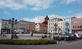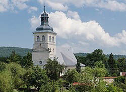
Kłodzko is a historic town in south-western Poland, in the region of Lower Silesia. It is situated in the centre of the Kłodzko Valley, on the Eastern Neisse river.

Bystrzyca Kłodzka is a historic town in Kłodzko County, in Lower Silesian Voivodeship in southwestern Poland. It is the administrative seat of Gmina Bystrzyca Kłodzka. As of December 2021, the town has a population of 9,773. The old town of Bystrzyca is famous for its many historical buildings and is a popular tourist destination.
Witalis Karol Teodor Wieder was a German-Polish traitor, a Nazi sympathizer, a recruited Agent of the Abwehr, and a self-proclaimed leader of the Goralenvolk during World War II. Goralenvolk were pro-Nazi traitors who claimed to originate from an aryan race, and who wanted to establish their own nation in the Polish mountains in Zakopane. Wieder acted as a Reichsdeutscher, and was known as a collaborator for the Nazi occupiers even though he was formerly an officer in the Polish army. At the end of the war, he escaped to Nazi Germany.

Dzierzgoń is a town in the Pomeranian Voivodeship in northern Poland. It is located in Sztum County east of Malbork and south of Elbląg on the river Dzierzgoń. Dzierzgoń has a population of 5,242, while the town and its environs have a combined population of about 10,000.

Radków is a town in Kłodzko County, Lower Silesian Voivodeship, in south-western Poland. It is the seat of the administrative district (gmina) called Gmina Radków, close to the Czech border. As at 2019, the town has a population of 2,406.

Nowe is a town in Świecie County, Kuyavian-Pomeranian Voivodeship, Poland, with 6,270 inhabitants (2004). It is located within the ethnocultural region of Kociewie.
Opoki is a village in the administrative district of Gmina Aleksandrów Kujawski, within Aleksandrów County, Kuyavian-Pomeranian Voivodeship, in north-central Poland. It lies approximately 9 kilometres (6 mi) south-west of Aleksandrów Kujawski and 23 km (14 mi) south of Toruń. It is located in the region of Kuyavia.

Turka is a village in the administrative district of Gmina Wólka, within Lublin County, Lublin Voivodeship, in eastern Poland. It lies approximately 8 km (5 mi) north-east of the regional capital Lublin. It is situated on the on the Bystrzyca River.

Lubomierz is a village in the administrative district of Gmina Mszana Dolna, within Limanowa County, Lesser Poland Voivodeship, in southern Poland. It lies approximately 12 kilometres (7 mi) south-east of Mszana Dolna, 20 km (12 mi) south-west of Limanowa, and 54 km (34 mi) south of the regional capital Kraków.

Tylmanowa is a village in the administrative district of Gmina Ochotnica Dolna, within Nowy Targ County, Lesser Poland Voivodeship, in southern Poland. It lies approximately 8 kilometres (5 mi) east of Ochotnica Dolna village, 30 km (19 mi) east of Nowy Targ, and 70 km (43 mi) south-east of the regional capital Kraków. The population of Tylmanowa is 2,600.

Kłodzko Fortress is a unique fortification complex of the Lower Silesian Voivodeship in southwestern Poland. The fortress once was one of the biggest strongholds in Prussian Silesia, however, in the whole German Empire, it was regarded as a minor one. Now, together with an extensive network of tunnels, it is one of the biggest attractions of the town of Kłodzko, with its underground labyrinth and a repository of different objects, from old fire engines to local glassware.

Brzegi Dolne is a village in the administrative district of Gmina Ustrzyki Dolne, within Bieszczady County, Subcarpathian Voivodeship, in south-eastern Poland. It lies approximately 3 kilometres (2 mi) north-east of Ustrzyki Dolne and 79 km (49 mi) south-east of the regional capital Rzeszów.

Rajkowy is a large and historically significant village of the Kociewie Land, in the administrative district of Gmina Pelplin, within Tczew County, Pomeranian Voivodeship, in northern Poland. It lies approximately 4 kilometres (2 mi) north of Pelplin, 16 km (10 mi) south-east of Tczew, and 62 km (39 mi) south of the regional capital Gdańsk. It is located within the historic region of Pomerania.

Kłodzko Land is a historical region in southwestern Poland.

The Sanok Royal Castle was built in the late 14th century in Sanok, Poland. The castle is situated on the San River at hill 317 m above sea level on a steep slope. Today it is the seat of the Sanok Historical Museum.

The Grafenort concentration camp was a subcamp of the Gross-Rosen concentration camp located in a castle in the village of Grafenort in Lower Silesia, which was operational throughout World War II. For 68 days from 1 March 1945, the camp was run exclusively as a women's subcamp, with between 250 and 400 female prisoners of Jewish ethnicity transferred from the Mittelsteine concentration camp. The reason behind the liquidation of Mittelsteine and the transfer of prisoners has not been fully understood. The prisoners at Grafenort were subjected to slave labor, building fortifications against the advancing Eastern Front of the Allies, and were known for receiving the most brutal treatment of any Nazi female concentration camp. The camp was liberated on 8 May 1945 by Soviet forces, and while some sources give different dates for the liberation, all Gross-Rosen subcamps were liberated between 8 and 9 May.

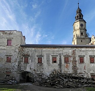
Gorzanów Castle is a former stately residence in the Kłodzko Land of the Lower Silesia. A 16th-century German foundation, it has been in the hands of the von Herberstein family of Grafs or Counts since the second half of the seventeenth century until 1930 — hence its name, and one of the former names of the village in which it is situated.

The Gorce Mountains are part of the Western Beskids mountain range spreading across southernmost Poland. They are situated in Małopolska Province, at the western tip of the long Carpathian range extending east beyond the Dunajec River for some 1,500 kilometres (930 mi). The Gorce are characterized by numerous ridges reaching in all directions for up to 40 kilometres (25 mi) east–west with a series of higher elevations cut by deep river valleys.

Siegenthal was a village in the vicinity of what is now Brzegi Dolne, in the administrative district of Gmina Ustrzyki Dolne, within Bieszczady County, Subcarpathian Voivodeship, in south-eastern Poland.

The district of Glatz was a Prussian district in Silesia, which existed from 1742 to 1945. Its capital was the town of Glatz (Kłodzko). Its territory is now part of the Polish Lower Silesian Voivodeship.


