
Signy Island is a small subantarctic island in the South Orkney Islands of Antarctica. It was named by the Norwegian whaler Petter Sørlle (1884–1933) after his wife, Signy Therese.
The Larsen Islands are a small group of islands north-west of Moreton Point, the western extremity of Coronation Island, in the South Orkney Islands of Antarctica. They were discovered by Captains George Powell and Nathaniel Palmer on the occasion of their joint cruise in December 1821. The islands were named on Petter Sørlle's chart, based upon his survey of the South Orkney Islands in 1912–1913, in honour of Carl Anton Larsen.
The Humboldt Mountains are a group of mountains immediately west of the Petermann Ranges, forming the westernmost portion of the Wohlthat Mountains in Queen Maud Land, Antarctica.
Laws Glacier is a confluent glacier system which flows into Marshall Bay on the south coast of Coronation Island, in the South Orkney Islands off Antarctica. It was surveyed in 1948–49 by the Falkland Islands Dependencies Survey (FIDS), and was named by the UK Antarctic Place-Names Committee for Richard M. Laws of the FIDS, leader and biologist at Signy Research Station in 1948 and 1949, and at South Georgia in 1951.

Christoffersen Island is a small island immediately west of the southern end of Powell Island in the South Orkney Islands of Antarctica. The name appears on a chart by Norwegian whaling captain Petter Sorlle, who made a running survey of these islands in 1912–13.

Noville Peninsula is a high ice-covered peninsula about 30 nautical miles (60 km) long, between Peale and Murphy Inlets on the north side of Thurston Island in Antarctica. It was delineated from aerial photographs made by U.S. Navy Operation HIGHJUMP in December 1946, and named for George O. Noville, executive officer of the Byrd Antarctic Expedition, 1933–35.
The John Peaks are prominent snow-covered peaks, 415 metres (1,360 ft) high, at the southern end of Coronation Island, north of Powell Island and east of Signy Island in the South Orkney Islands. They were probably first sighted by Captain George Powell and Captain Nathaniel Palmer, who discovered these islands in December 1821. The peaks were charted in 1933 by Discovery Investigations personnel on the Discovery II who named them for D.D. John, a member of the zoological staff of the Discovery Committee.
Jensen Ridge is a curving ridge running eastward from Foca Point toward Jane Col on Signy Island in the South Orkney Islands. It was named in 1991 by the UK Antarctic Place-Names Committee after Captain Gullik Jensen, of the whaling ship Strombus from Tønsberg, Norway, who made the last whaling expedition to Signy Island in 1935–36.
Sunshine Glacier is a glacier, 3 nautical miles (6 km) long and 2 nautical miles (3.7 km) wide, flowing south into Iceberg Bay on the south coast of Coronation Island, in the South Orkney Islands. It is the largest glacier on the south side of Coronation Island and terminates in ice cliffs up to 60 m high. Surveyed in 1948-49 by the Falkland Islands Dependencies Survey (FIDS) and so named by them because, when all else was in shadow, small gaps in the clouds above frequently allowed patches of sunshine to appear on the surface of this glacier. At the west side of Sunshine Glacier stands the conspicuous black ridge of Beaufoy Ridge, rising to 650 metres (2,130 ft) at its northwest end.

Grey Island is 1 km (0.62 mi) south of Michelsen Island and 2 km (1.2 mi) west of the southern part of Fredriksen Island, in the South Orkney Islands of Antarctica. It was first charted and named Holmen Graa on a map by the Norwegian whaler Captain Petter Sorlle, who made a running survey of the South Orkney Islands in 1912–13. The anglicised form appears on the chart by Discovery Investigations personnel on the Discovery II who surveyed the islands in 1933.
Findlay Point is a point 2 nautical miles (4 km) northwest of Palmer Bay on the north coast of Coronation Island, in the South Orkney Islands. It was first seen in December 1821 in the course of the joint cruise by Captain George Powell, British sealer, and Captain Nathaniel Palmer, American sealer, and roughly charted by Powell. It was surveyed by the Falkland Islands Dependencies Survey in 1956–58 and named by the UK Antarctic Place-Names Committee for Alexander George Findlay, an English geographer and hydrographer who compiled a long series of nautical directories and charts, including the South Orkney Islands.
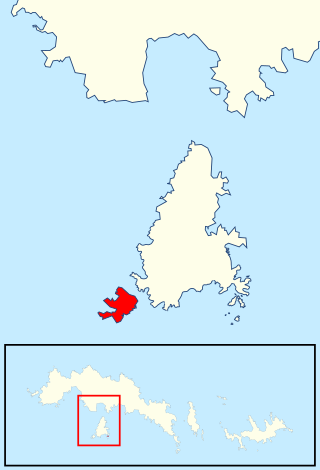
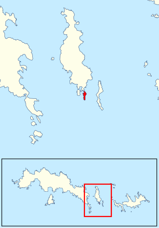
Moe Island is an island 2 km (1.2 mi) long in the South Orkney Islands off Antarctica, separated from the south-west end of Signy Island by Fyr Channel. It was charted by Captain Petter Sørlle in 1912–13, and named after M. Thoralf Moe of Sandefjord, Norway, a contemporary whaling captain who worked in this area. The northernmost point of the island is Spaull Point, named by United Kingdom Antarctic Place-Names Committee (UK-APC) after Vaughan W. Spaull, British Antarctic Survey (BAS) biologist on Signy Island, 1969.
The Monk Islands are a group of very small islands and rocks lying 1.5 nautical miles (3 km) south of Meier Point, off the south coast of Coronation Island in the South Orkney Islands off Antarctica. They were first charted and named "Munken" by Norwegian whaling captain Petter Sørlle in 1912–13. The name approved is an anglicized form of the earlier Norwegian name appearing on the chart by Discovery Investigations personnel on the Discovery II, who surveyed the islands in 1933.

Fredriksen Island is an island 5 km (3.1 mi) long and 1 km (0.62 mi) wide, lying 1 km south-east of Powell Island in the South Orkney Islands of Antarctica. It was discovered by Captains Nathaniel Palmer and George Powell in the course of their joint cruise in December 1821. It was named by Norwegian whaling captain Petter Sorlle, who made a running survey of the island in the 1912–13 summer.
Gerd Island is an island 1 nautical mile (2 km) west-southwest of Stene Point at the east side of the entrance to Norway Bight, off the south coast of Coronation Island in the South Orkney Islands. It was charted and named by Norwegian whaling captain Petter Sorlle, who made a running survey of the South Orkney Islands in 1912–13.
Michelsen Island is a small island in the South Orkney Islands off Antarctica. It is joined to the southern end of Powell Island by a narrow isthmus of occasionally submerged boulders. The island was first observed and roughly mapped in 1821 by Captains George Powell and Nathaniel Palmer. It was named on a map by Captain Petter Sørlle, a Norwegian whaler who made a running survey of the South Orkney Islands in 1912–13.
McLeod Glacier is a glacier 1 nautical mile (2 km) long, flowing in a southeasterly direction into Clowes Bay on the south side of Signy Island, in the South Orkney Islands off Antarctica. It was named by the UK Antarctic Place-Names Committee in 1954 for Michael McLeod, following a survey by the Falkland Islands Dependencies Survey in 1947. On December 12, 1821, the cutter Beaufoy under McLeod sailed to a position at least 60 nautical miles (110 km) west of the South Orkney Islands, where a chart annotation indicates that land was sighted, possibly Coronation Island.

Mackenzie Peninsula is a steep, rocky peninsula forming the western end of Laurie Island, in the South Orkney Islands, Antarctica. It was first seen and roughly charted by Captain George Powell and Captain Nathaniel Palmer in 1821. It was surveyed in 1903 by the Scottish National Antarctic Expedition under William S. Bruce, who gave this peninsula the maiden name of his wife, Jessie Mackenzie.
Reid Island is an island of the South Atlantic Ocean at the east side of the entrance to Iceberg Bay, along the south coast of Coronation Island in the South Orkney Islands. The name "Reidholmen" appears in this location for a small group of islands on a chart drawn by Captain Petter Sorlle in 1912–13. Survey by the Falkland Islands Dependencies Survey (FIDS) in 1948–49 determined that only a single island exists.

Lynch Island is an island lying in the eastern part of Marshall Bay, close off the south coast of Coronation Island in the South Orkney Islands, Antarctica.
