Prince Sultan bin Abdul Aziz Stadium is a multi-use stadium in Abha, Saudi Arabia. It is currently used mostly for football matches and is the home stadium of Abha. The stadium has a capacity of 20,000 people.
Ghoriwala is a town and union council in Bannu District of Khyber-Pakhtunkhwa. It is located at 32°54'20N 70°43'40E and has an altitude of 295 metres. It history and name is sometime linked with the famous Muslim King Sultan Muhammad Ghori.

Żelechlin is a village in the administrative district of Gmina Rojewo, within Inowrocław County, Kuyavian-Pomeranian Voivodeship, in north-central Poland. It lies approximately 2 kilometres (1 mi) west of Rojewo, 13 km (8 mi) north of Inowrocław, 29 km (18 mi) south-east of Bydgoszcz, and 29 km (18 mi) south-west of Toruń.

Osie, formerly German Osche, is a village in Świecie County, Kuyavian-Pomeranian Voivodeship, in north-central Poland. It is the seat of the gmina called Gmina Osie. It lies approximately 22 kilometres (14 mi) north of Świecie, 59 km (37 mi) north-east of Bydgoszcz, and 66 km (41 mi) north of Toruń.

Soyuqbulaq is a village in the Gadabay Rayon of Azerbaijan. The village forms part of the municipality of Ərtəpə.
Dąbrówka is a village in the administrative district of Gmina Wróblew, within Sieradz County, Łódź Voivodeship, in central Poland.

Lipa is a village in the administrative district of Gmina Stryków, within Zgierz County, Łódź Voivodeship, in central Poland. It lies approximately 3 kilometres (2 mi) north-west of Stryków, 15 km (9 mi) north-east of Zgierz, and 18 km (11 mi) north-east of the regional capital Łódź.
Rzymsko BG is a village in the administrative district of Gmina Dobra, within Turek County, Greater Poland Voivodeship, in west-central Poland.

Węgorzewo is a village in the administrative district of Gmina Okonek, within Złotów County, Greater Poland Voivodeship, in west-central Poland. It lies approximately 8 kilometres (5 mi) north-east of Okonek, 28 km (17 mi) north of Złotów, and 133 km (83 mi) north of the regional capital Poznań.

Hermanowo is a village in the administrative district of Gmina Gardeja, within Kwidzyn County, Pomeranian Voivodeship, in northern Poland. It lies approximately 3 kilometres (2 mi) south-west of Gardeja, 16 km (10 mi) south of Kwidzyn, and 88 km (55 mi) south of the regional capital Gdańsk.

Machowinko is a village in the administrative district of Gmina Ustka, within Słupsk County, Pomeranian Voivodeship, in northern Poland. It lies approximately 11 kilometres (7 mi) east of Ustka, 15 km (9 mi) north of Słupsk, and 109 km (68 mi) west of the regional capital Gdańsk.

Orzechowo is a settlement in the administrative district of Gmina Ustka, within Słupsk County, Pomeranian Voivodeship, in northern Poland. It lies approximately 5 kilometres (3 mi) east of Ustka, 17 km (11 mi) north-west of Słupsk, and 114 km (71 mi) west of the regional capital Gdańsk.
Marynowo is a settlement in the administrative district of Gmina Ostróda, within Ostróda County, Warmian-Masurian Voivodeship, in northern Poland.

Żółcin is a settlement in the administrative district of Gmina Drawsko Pomorskie, within Drawsko County, West Pomeranian Voivodeship, in north-western Poland. It lies approximately 8 kilometres (5 mi) north of Drawsko Pomorskie and 85 km (53 mi) east of the regional capital Szczecin.

Bromierz is a village in the administrative district of Gmina Nowogard, within Goleniów County, West Pomeranian Voivodeship, in north-western Poland. It lies approximately 9 kilometres (6 mi) south-east of Nowogard, 25 km (16 mi) east of Goleniów, and 45 km (28 mi) north-east of the regional capital Szczecin.

Świętoszewo is a settlement in the administrative district of Gmina Przybiernów, within Goleniów County, West Pomeranian Voivodeship, in north-western Poland. It lies approximately 10 kilometres (6 mi) east of Przybiernów, 23 km (14 mi) north of Goleniów, and 43 km (27 mi) north-east of the regional capital Szczecin.

Lusowo is a village in the administrative district of Gmina Płoty, within Gryfice County, West Pomeranian Voivodeship, in north-western Poland. It lies approximately 15 kilometres (9 mi) north-east of Płoty, 14 km (9 mi) east of Gryfice, and 77 km (48 mi) north-east of the regional capital Szczecin.
Kiddington with Asterleigh is a civil parish in West Oxfordshire. It contains the small village of Kiddington, the hamlet of Over Kiddington and Asterleigh, which is the site of an abandoned Mediaeval village at 51°53′54″N01°25′22″W.

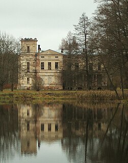
Baltoji Vokė Manor is a former Tyszkiewicz family residential manor in Baltoji Vokė village of the Vilnius district, in Lithuania.
Kohl City is an unincorporated community in Franklin County, in the U.S. state of Missouri.


