Gramsbergen

Last updated
Gramsbergen
Grambarge
Small city
Gramsbergen, kerk in straatzicht foto4 2011-04-02 12.57.jpg
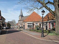
Gramsbergen, view of the Kerkstraat
Gramsbergen vlag.svg
Gramsbergen wapen.svg
2010-NL-P04-Overijssel-positiekaart-gemnamen.jpg
Red pog.svg
Gramsbergen
Location in province of Overijssel in the Netherlands
Netherlands location map.svg
Red pog.svg
Gramsbergen
Gramsbergen (Netherlands)
Coordinates: 52°36′37″N6°40′22″E / 52.61028°N 6.67278°E / 52.61028; 6.67278
Country Netherlands
Province Overijssel
Municipality Hardenberg
Area
[1]
  Total
3.33 km2 (1.29 sq mi)
Elevation
[2]
10 m (33 ft)
Population
 (2021) [1]
  Total
3,180
  Density955/km2 (2,470/sq mi)
Time zone UTC+1 (CET)
  Summer (DST) UTC+2 (CEST)
Postal code
7783 [1]
Dialing code 0524
Website gramsbergen.nl

Gramsbergen (Dutch Low Saxon: Grambarge) is a small Dutch city on the Vechte, located in the municipality of Hardenberg and the province of Overijssel. The town is located on corridors of different transportation modes: The N34 (Zwolle - Emmen), the Zwolle - Emmen railway and the Almelo - de Haandrik canal.

Contents

History

Gramsbergen and its hamlets have been inhabited since pre-historic times. In the 'Cultuur Historisch Informatie Centrum Vechtdal' [3] (The Historical and Cultural Center of Vechtdal), in the centre of Gramsbergen, several archaeological artefacts are exhibited. These artefacts come from settlements from around 8000 BC.

It was first mentioned in 1227 as Bergene, and means "the hill of Gram (person)". It received city rights in 1442. [4]

Gramsbergen developed on higher ground along the Vechte. In 1227, the Battle of Ane was fought to the west of Gramsbergen during which the bishop of Utrecht was defeated by the citizens of Drenthe. [5] In 1339, Huis Gramsbergen  [ nl ], a havezate , was built which developed into a castle. In 1673, it was taken by the Prince-Bishopric of Münster. The castle was destroyed in 1674 by the Dutch States Army to prevent Münster from threatening Coevorden. [6] The city did not develop in its later history and remained relatively small. [5] In 1840, it was home to 526 people. [7]

As an independent municipality, Gramsbergen comprised the centres of Gramsbergen and De Krim and the hamlets Ane, Anerveen, Anevelde, Den Velde  [ nl ], Holtheme  [ nl ] Holthone  [ nl ], and Loozen  [ nl ]. Since 1 January 2001, Gramsbergen has been part of Hardenberg. [7]

Transportation

Railway Station: Gramsbergen

Notable citizens

References

  1. 1 2 3 "Kerncijfers wijken en buurten 2021". Central Bureau of Statistics. Retrieved 14 March 2022.
  2. "Postcodetool for 7783AA". Actueel Hoogtebestand Nederland (in Dutch). Het Waterschapshuis. 24 July 2019. Archived from the original on 7 January 2019. Retrieved 14 March 2022.
  3. "Home". infocentrumvechtdal.nl.
  4. "Gramsbergen - (geografische naam)". Etymologiebank (in Dutch). Retrieved 14 March 2022.
  5. 1 2 Jan ten Hove (1998). Gramsbergen (in Dutch). Zwolle: Waanders. p. 154. ISBN   90-400-9200-1 . Retrieved 14 March 2022.
  6. "Gramsbergen". Kastelen in Overijssel (in Dutch). Retrieved 14 March 2022.
  7. 1 2 "Gramsbergen". Plaatsengids (in Dutch). Retrieved 14 March 2022.
  8. "Prof.dr. H.W. Bodewitz". University of Utrecht (in Dutch). Retrieved 14 March 2022.