
Gramsbergen is a small Dutch city on the Vechte, located in the municipality of Hardenberg and the province of Overijssel. The town is located on corridors of different transportation modes: The N34, the Zwolle - Emmen railway and the Almelo - de Haandrik canal.

Kruiningen is a village in the Dutch province of Zeeland. It is located in the municipality of Reimerswaal, about 5 km south of the village of Yerseke.

Wateren is a hamlet in the Dutch province of Drenthe. It is a part of the municipality of Westerveld, and lies about 22 km west of Assen.

Hijkersmilde is a hamlet in the Dutch province of Drenthe. It is a part of the municipality of Midden-Drenthe, and lies about 13 km southwest of Assen. Between 1913 and 1933, it had a train station.

Laaghalerveen is a hamlet in the Dutch province of Drenthe. It is a part of the municipality of Midden-Drenthe, and lies about 8 km south of Assen.
Witman is a hamlet in the Dutch province of Overijssel. It is located in the municipality of Hardenberg, about 2 km west of the town of Slagharen.

De Haar is a hamlet in the Dutch province of Drenthe. It is located in the municipality of Hoogeveen, about 7 km northeast of that town.
Eursinge is a hamlet in the Dutch province of Drenthe. It is located in the municipality of De Wolden, less than 1 km northwest of the village of Pesse.

Kalenberg is a hamlet in the northeastern Netherlands. It is located in the municipality Hoogeveen, Drenthe, about 4 km northwest of the town of Hogeveen.

Nolde is a hamlet in the Dutch province of Drenthe. It is located in the municipality of De Wolden, about 4 km south of Zuidwolde. The postal authorities have placed it under Linde.
Noordwijk is a hamlet in the Dutch province of Drenthe. It is located in the municipality of De Wolden, about 1 km north of De Wijk, from which it derives its name.
Noordwijk is a small village in the Dutch province of Groningen. It is located in the municipality of Marum, about 3 km north of the town of Marum. In 2019, it became part of Westerkwartier.

Vledderveen is a village in the Dutch province of Groningen. It is located in the municipality of Stadskanaal, about 3 km east of the centre of that town.
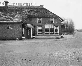
't Haantje is a hamlet in the Dutch province of Overijssel. It is located in the municipality of Hardenberg, about 5 km north of the town of Hardenberg.
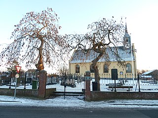
Ane is a village in the Dutch province of Overijssel. It is located in the municipality Hardenberg, about 5 km northeast of the centre of Hardenberg.
Anevelde is a hamlet in the Dutch province of Overijssel. It is located in the municipality Hardenberg, about 3 km northeast of the centre of Hardenberg.

Anholt is a hamlet in northeast Netherlands. It is located in the municipality De Wolden, Drenthe, about 2 km west of Pesse.

Hardenberg is a city and municipality in the province of Overijssel, Eastern Netherlands. The municipality of Hardenberg has a population of about 60,000, with about 19,000 living in the city. It received city rights in 1362 from Jan van Arkel, Bishop of Utrecht. The famous Pieterpad passes through Hardenberg, a municipality which is located on the German border.

Pesse is a village in the Dutch province of Drenthe. It is located in the municipality of Hoogeveen.

De Krim is a village in the municipality of Hardenberg part of the province of Overijssel, Netherlands. The village started as a peat excavation village.


