Cape Breton Island is an island on the Atlantic coast of North America and part of the province of Nova Scotia, Canada.

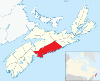
Halifax County is a county in the Canadian province of Nova Scotia. The Municipality of the County of Halifax was the municipal government of Halifax County, apart from the separately incorporated towns and cities therein. The Municipality was dissolved in 1996, together with those town and city governments, in their amalgamation into Halifax Regional Municipality.

Kings County is a county in the Canadian province of Nova Scotia. With a population of 60,600 in the 2016 Census, Kings County is the third most populous county in the province. It is located in central Nova Scotia on the shore of the Bay of Fundy, with its northeastern part forming the western shore of the Minas Basin.

Sackville—Preston—Chezzetcook is a federal electoral district in Halifax, Nova Scotia, Canada, that has been represented in the House of Commons of Canada since 1997.

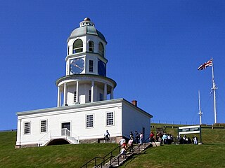
Halifax, formally known as the Halifax Regional Municipality (HRM), is the capital and largest municipality of the Canadian province of Nova Scotia. It had a population of 403,131 in 2016, with 316,701 in the urban area centred on Halifax Harbour. As of July 2020, Statistics Canada estimated the population of the CMA at 448,544 and 347,834 in the uban area. The regional municipality consists of four former municipalities that were amalgamated in 1996: Halifax, Dartmouth, Bedford, and Halifax County.

Bedford is a former town and current urban community of the Halifax Regional Municipality, in Nova Scotia, Canada. It was an independent town from 1980 to 1996. Bedford is on the northwestern end of Bedford Basin, an extension of the Halifax Harbour, which ends just before Nova Scotia Highway 102 and the Bedford Bypass, next to Lower Sackville. Bedford is at the junctions of Trunks 1, 2, and 7.

Fall River is a suburban community located in Nova Scotia, Canada within the Halifax Regional Municipality. It is located north-northeast of the Bedford Basin, northeast of Bedford and Lower Sackville and north of Waverley.
The Eastern Shore is a region of the Canadian province of Nova Scotia. It is the Atlantic coast running northeast from Halifax Harbour to the eastern end of the peninsula at the Strait of Canso.

Shelburne, officially named the Municipality of the District of Shelburne, is a district municipality comprising the eastern section of Shelburne County, Nova Scotia, Canada. Statistics Canada classifies the district municipality as a municipal district.
The Halifax Regional Municipality (HRM) in Nova Scotia, Canada has a widely varied geography.

Halifax, Nova Scotia, was originally inhabited by the Mi'kmaq. The first European settlers to arrive in the future Halifax region were French, in the early 1600s, establishing the colony of Acadia. The British settled Halifax in 1749, which sparked Father Le Loutre's War. To guard against Mi'kmaw, Acadian, and French attacks on the new Protestant settlements, British fortifications were erected in Halifax (1749), Bedford (1749), Dartmouth (1750), and Lawrencetown (1754). St. Margaret's Bay was first settled by French-speaking Foreign Protestants at French Village, Nova Scotia, who migrated from Lunenburg, Nova Scotia, during the American Revolution. All of these regions were amalgamated into the Halifax Regional Municipality (HRM) in 1996. While all of the regions of HRM developed separately over the last 250 years, their histories have also been intertwined.

Sheet Harbour is a rural community in Nova Scotia, Canada. It is located in the eastern reaches of the Halifax Regional Municipality, approximately 117 km (73 mi) northeast of the central urban area of the municipality, concentrated on Downtown Halifax and Dartmouth. The community is located along the Marine Drive scenic route on Trunk 7 at its junctions with Route 224 and Route 374. Surrounding the branched harbour which its name is derived from, the community has a population of about 800 and its respective census tract, containing sizable amounts of land around the community, has a population of 3,478 as of the 2011 Census. Two rivers, West River and East River, flow through the community and into the Northwest and Northeast Arms of the harbour respectively. The coastline of the community is heavily eroded and the region in which the community is located has an abundance of lakes. The region has a humid continental climate, congruent with the majority of Nova Scotia, and the ocean significantly influences the temperature.

Moser River is a rural community on the Eastern Shore of Nova Scotia, Canada, in the Halifax Regional Municipality. The community lies along the Marine Drive on Trunk 7, 32 km (20 mi) east of Sheet Harbour and 51 km (32 mi) southwest of Sherbrooke. The community is located along the shores of Necum Teuch Harbour, an inlet of the Atlantic Ocean, and is at the mouth of Moser River. The area was called Noogoomkeak in the mi'kmaq language, translating to "soft sand place". The community is named for Henry Moser, who was the son of Jacob Moser, who settled the area in the early 1800s. The first school in the community was built in 1905, and another school, Moser River Consolidated School, was built in 1957. The school closed in 2015, due to its very low student population. Marine Drive Academy in Sheet Harbour serves the community and its surroundings at all grade levels. There is a small seaside park in the community near the former school, as well as a post office and convenience store.

Halifax, Nova Scotia, is a major multi-modal transportation centre for freight and passengers in Atlantic Canada. Halifax, formally known as the Halifax Regional Municipality (HRM), is the capital and largest municipality of the Canadian province of Nova Scotia.

Nova Scotia is a province located in Eastern Canada fronting the Atlantic Ocean. One of the Maritime Provinces, Nova Scotia's geography is complex, despite its relatively small size in comparison to other Canadian provinces.

Sheet Harbour 36 is a Mi'kmaq reserve located in on the Eastern Shore of Nova Scotia, Canada, in the Halifax Regional Municipality. Part of the reserve is located just west of Sheet Harbour, Nova Scotia. The reserve's borders also includes a tract of land directly across the harbour, in the downtown area of Sheet Harbour. Grand Lake borders Sheet Harbour 36 on its western side. It is administratively part of the Millbrook First Nation.

The Sipekne'katik First Nation is composed of four Mi'kmaq First Nation reserves located in central Nova Scotia. As of 2012, the Mi'kmaq population is 1,195 on-Reserve, and approximately 1,190 off-Reserve. The First Nation includes Indian Brook 14, Nova Scotia, near Shubenacadie, Nova Scotia. The band was known as the Shubenacadie First Nation until 2014 when the traditional spelling and pronunciation of its name was officially adopted.

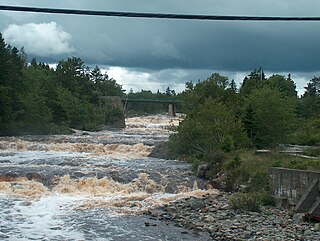
West River Sheet Harbour is a river on the Eastern Shore of Nova Scotia, Canada, in the Halifax Regional Municipality. Its headwaters are near the Musquodoboit Valley and the river flows southeast and empties in to the Northwest Arm of Sheet Harbour, Nova Scotia. The river has three main tributaries: West River Main, Killag River and Little River. The river was suffering from acidification, so a lime doser was installed and has been in use since September 2005. It stabilized the river's pH at 5.5, a healthy level for aquatic life.
East River Sheet Harbour is a river on the Eastern Shore of Nova Scotia, Canada, in the Halifax Regional Municipality. Its headwaters are at the Marshall Flowage near Malay Falls and the mouth of the river is at the head of the Northeast Arm in Sheet Harbour, Nova Scotia.

The Eastern Shore Granite Ridge, also known as the Musquodoboit Batholith, is a range of prominent hills averaging 100-125m (330-410ft) in height, located just inland from the Eastern Shore of Nova Scotia. Geologically, it is related to the much larger South Mountain Batholith, but the two are geologically distinct areas. Many of the hills have steep cliffs on one or more of their sides, some featuring vertical drops in excess of 50m (160ft); as a result, many of the taller hills offer extensive views despite their relatively low elevation.


