Related Research Articles

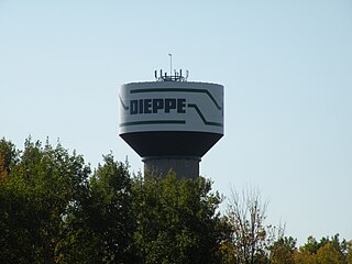
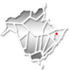
Dieppe is a city in the Canadian maritime province of New Brunswick. Statistics Canada counted the population at 28,114 in 2021, making it the fourth-largest city in the province. On 1 January 2023, Dieppe annexed parts of two neighbouring local service districts; revised census figures have not been released.

Shediac is a heavily Acadian town in Westmorland County, New Brunswick. The town is home to the famous Parlee Beach and is known as the "Lobster Capital of the World". It hosts an annual festival every July which promotes its ties to lobster fishing. At the western entrance to the town is a 90-ton sculpture called The World's Largest Lobster. It is believed that chiac, a well-known Acadian French patois, was named after Shediac.

Route 11 is a provincial highway in northeastern New Brunswick, Canada. The 440-kilometre (270 mi) road runs from Moncton to the Quebec border, near Campbellton, at the Matapédia Bridge, following the province's eastern and northern coastlines.
Route 15 is 79 kilometres (49 mi) long and is in the southeastern corner of the province of New Brunswick. Starting at the north end of the Petitcodiac River Causeway, it loops around the city of Moncton on Wheeler Boulevard, then turns northeast from Dieppe to Shediac. From there, it turns east and bypasses Cap-Pelé crossing the Scoudouc River, then southeast to meet the Trans-Canada Highway at Port Elgin. The highway is a divided freeway from Moncton to just east of Shediac, where it remains a controlled-access highway until east of Cap-Pele.

Moncton is a geographic parish in Westmorland County, New Brunswick, Canada.
The European and North American Railway (E&NA) is the name for three historic Canadian and American railways which were built in New Brunswick and Maine.
Haute-Aboujagane is a small Canadian community in Westmorland County, New Brunswick. Formerly a local service district, it was later part of the rural community of Beaubasin East.

The Gunningsville Bridge has been a name given to five different bridges that crossed the Petitcodiac River between Moncton at Route 106 and Riverview, New Brunswick at Route 114, New Brunswick, Canada. The latest Gunningsville Bridge opened on November 19, 2005. This is one of two links that cross the Petitcodiac River from Moncton to Riverview; the other is the Petitcodiac River Causeway. The Route links Vaughan Harvey Blvd In Moncton with Gunningsville Blvd In Riverview.

Route 132 is a New Brunswick provincial collector road that runs 27 kilometres (17 mi) between Dieppe and Shediac.

The history of Moncton extends back thousands of years, with its first inhabitants being the First Nations of the region, such as the Mi'kmaq. Located in New Brunswick, Moncton's motto is Resurgo, which is Latin for I rise again. This motto was originally chosen in celebration of the city's rebirth in 1875 after the recovery of the economy from the collapse of the shipbuilding industry. The city again lived up to its motto in more recent times, when the economy of the city was devastated once more during the 1980s as a result of the city's largest employers all departing the city in short order. The city has since rebounded due to growth in the light manufacturing, technology, distribution, tourism, and retail sectors of the economy and is now the fastest growing city in Canada east of Toronto.

Pointe-du-Chêne is a community and former local service district in Westmorland County, New Brunswick. Located on Shediac Bay, an inlet of the Northumberland Strait, Pointe-du-Chêne, also called La Pointe, is the home of Parlee Beach Provincial Park. It was once the terminus of the European and North American Railway and was a key stopover for Pan-Am's Trans Atlantic air service inaugurated in 1939. Pointe-du-Chêne became a cottage resort area in the early 20th century. Summer excursion trains from Moncton brought day trippers to the seashore. The railway terminus and proximity to Parlee Beach, made it an ideal location for cottages.
Ammon is a Canadian community in Moncton Parish, New Brunswick. Ammon includes the Intersection at Ammon Rd and New Brunswick Route 490. Ammon is in part of Greater Moncton.
Caissie Cape French: Cap-des-Caissie, is a small coastal community in Dundas Parish, Kent County, New Brunswick. Bordered on the north by Cocagne Cape, to the east by Cocagne Cove, and to the south by Bourgeois, Caissie Cape comprises New Brunswick Route 530, Chemin De La Cote and the roads that run between them. The community mostly consists of cottages owned by residents of New Brunswick, especially Moncton, though year-round homes do exist. Those who do live in Caissie Cape year round are primarily Acadians. Many of the streets are privately owned, as is common with other cottage communities in the area such as Grande-Digue and Shediac Bridge-Shediac River.
Lakeville is a Canadian community, located in Westmorland County, New Brunswick. The community is situated in southeastern New Brunswick, to the east of Moncton, at the intersection of New Brunswick Route 2 and New Brunswick Route 134. Lakeville is located mainly on Route 134.
Route 133 is a mostly east/west provincial highway in the Canadian province of New Brunswick.
Route 933 is a 32.2-kilometre (20.0 mi) long north to south secondary highway in the southeastern portion of New Brunswick, Canada.

Shediac is a geographic parish in Westmorland County, New Brunswick, Canada.

Dorchester is a geographic parish in Westmorland County, New Brunswick, Canada.

Shediac Bay is a tidal embayment, an extension of the Northumberland Strait in New Brunswick, Canada.
RCAF Station Moncton or RCAF Aerodrome Moncton or BCATP Station Moncton, was a Second World War training air station of the British Commonwealth Air Training Plan (BCATP). It was located east of Moncton, New Brunswick, Canada.
References
- ↑ Greater Shediac, Official Website.
46°13′N64°32′W / 46.217°N 64.533°W