Greenhill River

Last updated
Greenhill River
Canada Ontario relief location map.jpg
Red pog.svg
Location of the mouth of the Greenhill River in Ontario
Location
Country Canada
Province Ontario
Region Northeastern Ontario
District Algoma
Physical characteristics
SourceGreenhill Lake
  locationMakawa Township
  coordinates 48°35′11″N83°52′05″W / 48.58639°N 83.86806°W / 48.58639; -83.86806
  elevation396 m (1,299 ft)
Mouth Missinaibi River
  location
Hayward Township
  coordinates
48°43′17″N83°27′08″W / 48.72139°N 83.45222°W / 48.72139; -83.45222 Coordinates: 48°43′17″N83°27′08″W / 48.72139°N 83.45222°W / 48.72139; -83.45222
  elevation
286 m (938 ft)
Basin features
River system James Bay drainage basin
Tributaries 
  right South Greenhill River

The Greenhill River is a river in Algoma District in northeastern Ontario, Canada. [1] It is in the James Bay drainage basin, and is a left tributary of the Missinaibi River.

Algoma District District in Ontario, Canada

Algoma District is a district and census division in Northeastern Ontario in the Canadian province of Ontario.

Northeastern Ontario Secondary region in Ontario, Canada

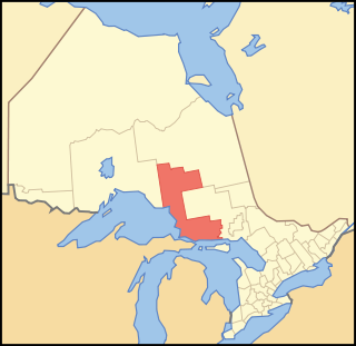
Northeastern Ontario is a secondary region of Northern Ontario which lies north of Lake Huron and east of Lake Superior.

Ontario Province of Canada

Ontario is one of the 13 provinces and territories of Canada. Located in Central Canada, it is Canada's most populous province accounting for 38.3 percent of the country's population, and is the second-largest province in total area. Ontario is fourth-largest jurisdiction in total area when the territories of the Northwest Territories and Nunavut are included. It is home to the nation's capital city, Ottawa, and the nation's most populous city, Toronto, which is also Ontario's provincial capital.

Contents

Course

The river begins at Greenhill Lake in geographic Makawa Township [2] and flows north, curving around the west side of the lake to eventually head southeast to Amik Lake. It continues south east then northeast through the north central part of geographic Amik Township, [3] then enters geographic Nebotik Township at the southwest corner. The river continues northeast, then turns east and takes in the right tributary South Greenhill River. It continues east, enters geographic Conking Township, [4] turns northeast, enters geographic Hayward Township, [5] flows under the Canadian National Railway transcontinental railway main line between the railway points of Fire River to the west and Argolis to the east, a section of track travelled on by Via Rail transcontinental Canadian passenger trains, and reaches its mouth at the Missinaibi River. The Missinaibi River flows via the Moose River to James Bay.

South Greenhill River watercourse in Canada

The South Greenhill River is a river in Algoma District and Sudbury District in northeastern Ontario, Canada. It is in the James Bay drainage basin, and is a right tributary of the Greenhill River.

Canadian National Railway railway company

Canadian National is a Canadian Class I freight railway headquartered in Montreal, Quebec that serves Canada and the Midwestern and Southern United States.

Transcontinental railroad Contiguous network of railroad trackage that crosses a continental land mass with terminals at different oceans or continental borders

A transcontinental railroad is a contiguous network of railroad trackage that crosses a continental land mass with terminals at different oceans or continental borders. Such networks can be via the tracks of either a single railroad, or over those owned or controlled by multiple railway companies along a continuous route. Although Europe is crisscrossed by railways, the railroads within Europe are usually not considered transcontinental, with the possible exception of the historic Orient Express. Transcontinental railroads helped open up unpopulated interior regions of continents to exploration and settlement that would not otherwise have been feasible. In many cases they also formed the backbones of cross-country passenger and freight transportation networks.

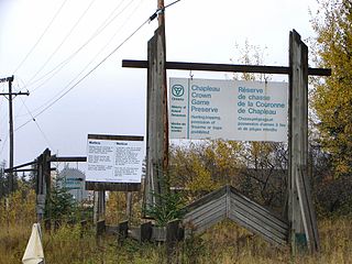
The entire course of the river, except for the short portion downstream (to the north) of the CN mainline, is within the Chapleau Crown Game Preserve. That remaining short portion is within Missinaibi Provincial Park.

Chapleau Crown Game Preserve

The Chapleau Crown Game Preserve is a fur bearing animal preserve area in Ontario, Canada, north-east of Lake Superior. It covers some 7,000 square kilometres (2,700 sq mi) in the Algoma and Sudbury Districts, and is officially classified as a Crown Game Preserve by the Government of Ontario Ministry of Natural Resources.

Tributaries

Related Research Articles

Mattagami River Canadian river

The Mattagami River is a river in Northern Ontario, Canada.

Groundhog River river in Canada

The Groundhog River is a river in Cochrane District and Sudbury District in Northeastern Ontario, Canada. The river is in the James Bay drainage basin and is a left tributary of the Mattagami River.

Fire River, Ontario Railway point in Ontario, Canada

Fire River is an unincorporated place and railway point in geographic Hayward Township, in the Unorganized North part of Algoma District in northeastern Ontario, Canada. It is on the Canadian National Railway transcontinental railway main line between the railway points of Dishnish to the west and Argolis to the east, has a passing track, and is passed but not served by Via Rail transcontinental Canadian passenger trains. The place is on the Fire River, a left tributary of the Missinaibi River.

Pivabiska River river in Canada

The Pivabiska River is a river in Cochrane District in Northeastern Ontario, Canada. It is in the James Bay drainage basin and is a left tributary of Missinaibi River.

Dunrankin River river in Northeastern Ontario, Canada

The Dunrankin River is a river in Algoma District and Sudbury District in northeastern Ontario, Canada. It is in the James Bay drainage basin, begins at Upper Dunrankin Lake and is a left tributary of the Kapuskasing River.

Swanson River (Ontario) watercourse in Canada

The Swanson River is a river in Sudbury District in northeastern Ontario, Canada. It is in the James Bay drainage basin, begins south of Mageau Lake and is a left tributary of the Chapleau River.

Makonie River watercourse in Canada

The Makonie River is a river in Sudbury District in northeastern Ontario, Canada. It is in the James Bay drainage basin, and is a left tributary of the Chapleau River.

East Dunrankin River watercourse in Canada

The East Dunrankin River is a river in Algoma District and Sudbury District in northeastern Ontario, Canada. It is in the James Bay drainage basin, and is a right tributary of the Dunrankin River.

Kirkwall River river in Northeastern Ontario, Canada

The Kirkwall River is a river in Algoma District and Sudbury District in northeastern Ontario, Canada. It is in the James Bay drainage basin, and is a right tributary of the Dunrankin River.

Nemegosenda River watercourse in Canada

The Nemegosenda River is a river in Algoma District and Sudbury District in northeastern Ontario, Canada. It is in the James Bay drainage basin, and is a right tributary of the Kapuskasing River.

Borden River (Ontario) watercourse in Ontario, Canada

The Borden River is a river in Sudbury District in northeastern Ontario, Canada. It is in the James Bay drainage basin, and is a left tributary of the Nemegosenda River.

Saganash River watercourse in Canada

The Saganash River is a river in Cochrane District in northeastern Ontario, Canada. It is in the James Bay drainage basin, and is a right tributary of the Kapuskasing River.

Shawmere River river in Sudbury District, Ontario, Canada

The Shawmere River is a river in Sudbury District in northeastern Ontario, Canada. It is in the James Bay drainage basin, and is a left tributary of the Ivanhoe River.

Argolis, Ontario Railway point in Ontario, Canada

Argolis is an unincorporated place and railway point in geographic Hayward Township, in the Unorganized North part of Algoma District in northeastern Ontario, Canada. It is on the Canadian National Railway transcontinental railway main line between the railway points of Fire River to the west and Peterbell to the east, has a passing track, and is passed but not served by Via Rail transcontinental Canadian trains. Argolis is on an unnamed right tributary of the Greenhill River, itself a tributary of the Missinaibi River, and is named for the Greek region of Argolis.

Valentine River river in Ontario, Canada

The Valentine River is a river in Cochrane District in northeastern Ontario, Canada. It is in the James Bay drainage basin, and is a tributary of Lac Pivabiska, the source of the Pivabiska River.

Little Valentine River watercourse in Canada

The Little Valentine River is a river in Cochrane District in northeastern Ontario, Canada. It is in the James Bay drainage basin, and is a right tributary of the Valentine River.

Fire River (Ontario) watercourse in Canada

The Fire River is a river in Algoma District in northeastern Ontario, Canada. It is in the James Bay drainage basin, and is a left tributary of the Missinaibi River.

Little Fire River watercourse in Canada

The Little Fire River is a river in geographic Moorehouse Township, Algoma District in northeastern Ontario, Canada. It is in the James Bay drainage basin, and is a tributary of the Fire River.

Gardiner River river in Ontario, Canada

The Gardiner River is a river in Cochrane District in northeastern Ontario, Canada. It is in the James Bay drainage basin, and is a left tributary of the Mattagami River. The river lies between the Mattagami and the Missinaibi River just upstream of the confluence of those two to form the Moose River, which flows to James Bay.
References

  1. "Greenhill River". Geographical Names Data Base. Natural Resources Canada . Retrieved 2016-11-18.
  2. "Makawa" (PDF). Geology Ontario - Historic Claim Maps. Ontario Ministry of Northern Development, Mines and Forestry. Archived from the original (PDF) on 2016-11-19. Retrieved 2016-11-18.
  3. "Amik" (PDF). Geology Ontario - Historic Claim Maps. Ontario Ministry of Northern Development, Mines and Forestry . Retrieved 2016-11-25.
  4. "Conking" (PDF). Geology Ontario - Historic Claim Maps. Ontario Ministry of Northern Development, Mines and Forestry . Retrieved 2016-11-25.
  5. "Hayward" (PDF). Geology Ontario - Historic Claim Maps. Ontario Ministry of Northern Development, Mines and Forestry. Archived from the original (PDF) on 2016-11-19. Retrieved 2016-11-18.

Sources

Ministry of Transportation of Ontario government ministry in Ontario

The Ministry of Transportation of Ontario (MTO) is the provincial ministry of the Government of Ontario that is responsible for transport infrastructure and related law in Ontario. The ministry traces its roots back over a century to the 1890s, when the province began training Provincial Road Building Instructors. In 1916, the Department of Public Highways of Ontario (DPHO) was formed and tasked with establishing a network of provincial highways. The first was designated in 1918, and by the summer of 1925, sixteen highways were numbered. In the mid-1920s, a new Department of Northern Development (DND) was created to manage infrastructure improvements in northern Ontario; it merged with the Department of Highways of Ontario (DHO) on April 1, 1937. In 1971, the Department of Highways took on responsibility for Communications and in 1972 was reorganized as the Ministry of Transportation and Communications (MTC), which then became the Ministry of Transportation in 1987.

The Ministry of Municipal Affairs and Housing is the department of the Government of Ontario that is responsible for municipal affairs and housing in the Canadian province of Ontario.