Griffith Wetlands Important Bird Area

Last updated

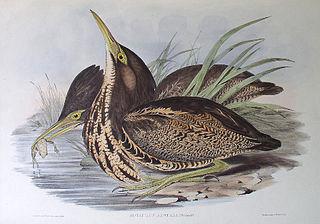
The IBA is an important site for Australasian bitterns Australasian Bittern (Botaurus poiciloptilus) in the grass.jpg
The IBA is an important site for Australasian bitterns

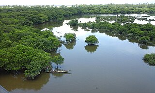
The Griffith Wetlands Important Bird Area is a group of wetlands lying close to the Riverina town of Griffith in southern New South Wales, Australia. It lies within the Murrumbidgee Irrigation Area.

Wetland A land area that is permanently or seasonally saturated with water

A wetland is a distinct ecosystem that is inundated by water, either permanently or seasonally, where oxygen-free processes prevail. The primary factor that distinguishes wetlands from other land forms or water bodies is the characteristic vegetation of aquatic plants, adapted to the unique hydric soil. Wetlands play a number of functions, including water purification, water storage, processing of carbon and other nutrients, stabilization of shorelines, and support of plants and animals. Wetlands are also considered the most biologically diverse of all ecosystems, serving as home to a wide range of plant and animal life. Whether any individual wetland performs these functions, and the degree to which it performs them, depends on characteristics of that wetland and the lands and waters near it. Methods for rapidly assessing these functions, wetland ecological health, and general wetland condition have been developed in many regions and have contributed to wetland conservation partly by raising public awareness of the functions and the ecosystem services some wetlands provide.

Riverina Region in New South Wales, Australia

The Riverina is an agricultural region of South-Western New South Wales (NSW), Australia. The Riverina is distinguished from other Australian regions by the combination of flat plains, warm to hot climate and an ample supply of water for irrigation. This combination has allowed the Riverina to develop into one of the most productive and agriculturally diverse areas of Australia. Bordered on the south by the state of Victoria and on the east by the Great Dividing Range, the Riverina covers those areas of New South Wales in the Murray and Murrumbidgee drainage zones to their confluence in the west.

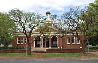
Griffith, New South Wales City in New South Wales, Australia

Griffith is a major regional city in the Murrumbidgee Irrigation Area that is located in the north-western part of the Riverina region of New South Wales, known commonly as the food bowl of Australia. It is also the seat of the City of Griffith local government area. Like the Australian capital, Canberra, and the nearby town of Leeton, Griffith was designed by Walter Burley Griffin and Marion Mahony Griffin. Griffith was named after Arthur Hill Griffith, the first New South Wales Minister of Public Works. Griffith was proclaimed a city in 1987, and had a population of 19,144 in 2016.

Contents

Description

North and South Lake Wyangan are used for water storage; they contain an area of cumbungi. Nericon Swamp is a shallow swamp usually dry enough to be grazed by cattle, though it sometimes fills from local rains when it supports large numbers of waders. Barren Box Swamp was originally an ephemeral swamp; it has been divided into three parts, with 60% of it remaining a natural wetland which holds water only in wet years; the other 40% is used for water storage and recycling, with reed beds and grazed margins. Campbell's Swamp is a black box-lignum swamp containing extensive open areas punctuated by stands of reeds and cumbungi; it fills occasionally from local rainfall or with water released from the irrigation system. [1]

Lake Wyangan is a recreational lake located immediately to the northwest of the town of Griffith in New South Wales, Australia. The lake was formed in 1950 and is surrounded by many orchards. It was formed with the remnants of a gypsum mine and also there was a natural swamp at the location as well. The lake is a popular attraction for tourists and locals alike. It is popular for many activities which include such things as boating, fishing, skiing, sailing, picnicking, walking, jogging, running, driving and other such activities. There are also some animals in the area. They are fenced off in secure enclosures and include such animals as deer. There is as well a playground where children can play and it includes such facilities as swings. It is one of the component wetlands of the Griffith Wetlands Important Bird Area.

<i>Typha</i> genus of plants

Typha is a genus of about 30 species of monocotyledonous flowering plants in the family Typhaceae. These plants have a variety of common names, in British English as bulrush or wild corndog, in American English as reed, cattail, swamp sausage, or punks, in Australia as cumbungi or bulrush, in Canada as bulrush or cattail, and in New Zealand as raupō. Other taxa of plants may be known as bulrush, including some sedges in Scirpus and related genera.

Wader

Waders are birds commonly found along shorelines and mudflats that wade in order to forage for food in the mud or sand. They are called shorebirds in North America, where the term "wader" is used to refer to long-legged wading birds such as storks and herons. Waders are members of the order Charadriiformes, which includes gulls, auks and their allies.

Birds

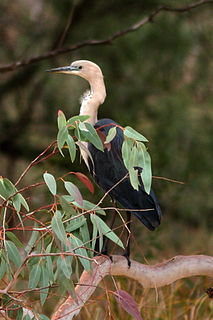
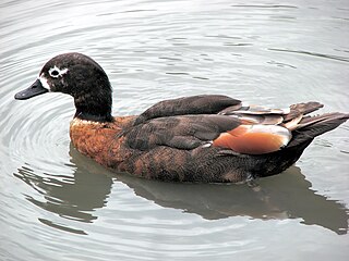
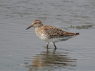
Together, the wetlands have been identified by BirdLife International as a fragmented 38 km2 (15 sq mi) Important Bird Area (IBA) because they regularly support small numbers of the endangered Australasian bittern as well as occasionally supporting over 1% of the world populations of sharp-tailed sandpipers, red-necked avocets and chestnut teals. [2]

BirdLife International global partnership of conservation organisations that strives to conserve birds

BirdLife International is a global partnership of conservation organisations that strives to conserve birds, their habitats, and global biodiversity, working with people towards sustainability in the use of natural resources. It is the world's largest partnership of conservation organisations, with over 120 partner organisations.

Important Bird Area area recognized as being globally important habitat for the conservation of birds populations

An Important Bird and Biodiversity Area (IBA) is an area identified using an internationally agreed set of criteria as being globally important for the conservation of bird populations.

Australasian bittern species of bird

The Australasian bittern, also known as the brown bittern or matuku hūrepo, is a large bird in the heron family Ardeidae. A secretive bird with a distinctive booming call, it is more often heard than seen. Australasian bitterns are endangered in both Australia and New Zealand.

Related Research Articles

Macquarie Marshes wetland in Australia

The Macquarie Marshes comprise the wetlands associated with the floodplains of the Macquarie River and its tributaries, in northern New South Wales, Australia. The Macquarie River and the marshes eventually drain into the Darling River. The marshes are important as a breeding site for waterbirds, especially in the aftermath of major floods.

Lake Argyle lake in Australia

Lake Argyle is Western Australia's largest and Australia's second largest freshwater man-made reservoir by volume. The reservoir is part of the Ord River Irrigation Scheme and is located near the East Kimberley town of Kununurra. The lake flooded large parts of the Shire of Wyndham-East Kimberley on the Kimberley Plateau about 80 kilometres (50 mi) inland from the Joseph Bonaparte Gulf, close to the border with the Northern Territory.

Edithvale-Seaford Wetlands nature reserve in Australia

The Edithvale-Seaford Wetlands are a group of two principally freshwater swamps, totalling 261 hectares, lying in the suburbs of Aspendale, Edithvale, Chelsea Heights, and Seaford in south-eastern Melbourne, Victoria, Australia. Together they form the Edithvale-Seaford Wetlands Ramsar Site. With the nearby Eastern Treatment Plant, they form the Carrum Wetlands Important Bird Area.

Mandora Marsh

Mandora Marsh, also known as Mandora Salt Marsh, is a complex and diverse wetland system in Western Australia close to Eighty Mile Beach, and included in the Eighty Mile Beach Ramsar Site. It lies at the western edge of the Great Sandy Desert bioregion and within the Mandora Station pastoral lease. The marsh is part of the 3337 km2 Mandora Marsh and Anna Plains Important Bird Area, identified as such by BirdLife International because of its importance for supporting large numbers of waders and waterbirds.

Coongie Lakes lake

The Coongie Lakes is a freshwater wetland system located in the Far North region of South Australia. The 21,790-square-kilometre (8,410 sq mi) lakes system is located approximately 1,046 kilometres north of the Adelaide city centre. The wetlands includes lakes, channels, billabongs, shallow floodplains, deltas, and interdune swamps. It lies on the floodplain of Cooper Creek, an ephemeral river flowing through a desert landscape in the Lake Eyre Basin which rarely, after occasional large floods, empties into Lake Eyre. The wetland system has been recognised both as being of international importance by designation under the Ramsar Convention with a listing on 15 June 1987 and being nationally important within Australia with a listing in A Directory of Important Wetlands in Australia (DIWA). Its extent includes the regional town of Innamincka, the Malkumba-Coongie Lakes National Park, the Innamincka Regional Reserve, the Strzelecki Regional Reserve and the Coongie Lakes Important Bird Area.
Cheetham and Altona Important Bird Area Important Bird Area in Victoria, Australia

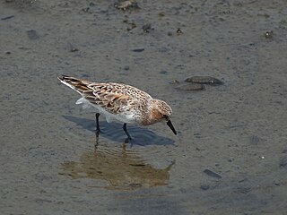
The Cheetham and Altona Important Bird Area comprises several wetland sites on, or close to, the north-western coast of Port Phillip in Victoria, south-eastern Australia. Collectively they total 1223 ha in area and lie within, or adjacent to, the western suburbs of the city of Melbourne. They were classified as an Important Bird Area (IBA) because they support more than 1% of the world populations of red-necked stint, chestnut teal and Pacific gull.

Fivebough and Tuckerbil Wetlands are two wetland sites within the Riverina and Murrumbidgee Irrigation Area (MIA), near Leeton in New South Wales, Australia. Both Fivebough and Tuckerbil sites form Crown reserve number 1030008 managed by NSW Department of Industry, for ecological conservation and public recreation. The reserve was recognised as being a Wetland of International Importance through designation under the Ramsar Convention on 21 October 2002 as Ramsar Site 1224

Hastings-Macleay Important Bird Area Important Bird Area in New South Wales, Australia

The Hastings-Macleay Important Bird Area is a 1148 km2 tract of land stretching for 100 km along the Mid North Coast of New South Wales, Australia, from Stuarts Point in the north to the Camden Haven River in the south. It is bounded on the west by the Pacific Highway. It combines ephemeral floodplain wetlands with coastal swamp forests. It is mostly cattle-grazed but contains large blocks of state forest, protected areas and tea-tree plantations.
Hunter Estuary Wetlands Australian wetlands

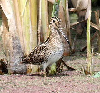
The Hunter Estuary Wetlands comprise a group of associated wetlands at and near the mouth of the Hunter River in the city of Newcastle, New South Wales, Australia. Some 30 km2 of the wetlands has been recognised as being of international importance by designation under the Ramsar Convention. It was listed on 21 February 1984 as Ramsar site 287. A larger area of the wetlands has been identified by BirdLife International as an Important Bird Area (IBA). The wetlands are recognised as the most important area in New South Wales for waders, or shorebirds.
Western District Lakes

The Western District Lakes of Victoria, in the Western District of Victoria, south-eastern Australia, were recognised on 15 December 1982 as wetlands of international importance by listing under the Ramsar Convention, as Ramsar site no.268.
Lake McLarty

Lake McLarty is a 219-hectare (540-acre) freshwater lake and associated nature reserve on the Swan Coastal Plain of Western Australia. The lake is named after a prominent pioneering family which settled in the district in the early 1860s. It lies about 90 kilometres (56 mi) south of Perth on the eastern side of the Harvey Estuary and forms part of the Peel-Yalgorup System Ramsar site. It is an important area for waders, or shorebirds, and is a well-known birdwatching site.

Menindee Lakes

The Menindee Lakes is a chain of shallow ephemeral freshwater lakes connected to the Darling River to form a storage system. The lakes lie in the far west region of New South Wales, Australia, near the town of Menindee.
Narran Wetlands Protected area in New South Wales, Australia

The Narran Wetlands, also known as the Narran Lakes, contained within the Narran Lakes Nature Reserve, comprise a series of protected ephemeral lakes and swamps fed by the Narran River in the north-west of New South Wales, Australia. The 26,480-hectare (65,400-acre) reserve is located approximately 50 kilometres (31 mi) east of Brewarrina.

Natimuk-Douglas Wetlands

The Natimuk-Douglas Wetlands comprise a chain of freshwater, brackish and saline wetlands in the semi-arid Wimmera region of western Victoria. Australia. They are important for waterbirds.
North Victorian Wetlands

The North Victorian Wetlands, also known as the Kerang Wetlands, comprise an extensive series of over 100 freshwater, brackish and saline lakes and swamps on the floodplain of the Loddon River where it enters the Murray valley, in the vicinity of the town of Kerang, in northern Victoria, south-eastern Australia. They are important for a variety, and sometimes large numbera, of waterbirds.

Ord Irrigation Area Important Bird Area Important Bird Area in Western Australia

The Ord Irrigation Area Important Bird Area is an area of land used for irrigated agriculture along the Ord River in the vicinity of the town of Kununurra in the Kimberley region of north-western Australia. It has been identified by BirdLife International as a 220 km2 Important Bird Area (IBA) for its significance for birds, especially estrildid finches.

Owingup Swamp and Boat Harbour Wetlands Important Bird Area Important Bird Area in Western Australia

The Owingup Swamp and Boat Harbour Wetlands Important Bird Area is a 442 ha site comprising Owingup Swamp, and ten other, smaller, wetlands nearby, in the Great Southern region of south-western Australia. It lies about 25 km south-south-west of Denmark, Western Australia, near the track to the coast at Boat Harbour cove. The site has been identified by BirdLife International as an Important Bird Area (IBA) because it is supports small numbers of the endangered Australasian bittern.

Tarrabool Lake – Eva Downs Swamp System lake in Australia

The Tarrabool Lake – Eva Downs Swamp System is an ephemeral wetland complex lying on the west of the Barkly Tableland region in the Northern Territory of Australia. It is listed on Australia's Register of the National Estate and on the DIWA wetland directory.

Warby–Chiltern Box–Ironbark Region

The Warby–Chiltern Box–Ironbark Region comprises a cluster of separate blocks of remnant box-ironbark forest habitat, with a collective area of 253 km2, in north eastern Victoria, south-eastern Australia.

Coastal Wet Tropics Important Bird Area Important Bird Area in Queensland, Australia

The Coastal Wet Tropics Important Bird Area comprises a disjunct 521 km2 stretch of coastal and subcoastal land in tropical Far North Queensland, Australia. It extends from just south of Cairns in the north for about 150 km to Cardwell in the south. It is important for the conservation of lowland rainforest birds, especially southern cassowaries.

References

  1. BirdLife International. (2011). Important Bird Areas factsheet: Griffith Wetlands. Downloaded from http://www.birdlife.org on 30/06/2011.
  2. "IBA: Griffith Wetlands". Birdata. Birds Australia. Archived from the original on 6 July 2011. Retrieved 30 June 2011.

Coordinates: 34°09′42″S145°51′21″E / 34.16167°S 145.85583°E / -34.16167; 145.85583

Geographic coordinate system Coordinate system

A geographic coordinate system is a coordinate system that enables every location on Earth to be specified by a set of numbers, letters or symbols. The coordinates are often chosen such that one of the numbers represents a vertical position and two or three of the numbers represent a horizontal position; alternatively, a geographic position may be expressed in a combined three-dimensional Cartesian vector. A common choice of coordinates is latitude, longitude and elevation. To specify a location on a plane requires a map projection.