
Bachorza is a village in the administrative district of Gmina Sokołów Podlaski, which is located within Sokołów County, Masovian Voivodeship, in east-central Poland.

Bartosz is a village in the administrative district of Gmina Sokołów Podlaski, within Sokołów County, Masovian Voivodeship, in east-central Poland. It lies approximately 3 kilometres (2 mi) south-west of Sokołów Podlaski and 86 km (53 mi) east of Warsaw.
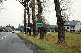
Brzozów is a village in the administrative district of Gmina Sokołów Podlaski, within Sokołów County, Masovian Voivodeship, in east-central Poland. It lies approximately 6 kilometres (4 mi) west of Sokołów Podlaski and 83 km (52 mi) east of Warsaw.

Brzozów-Kolonia is a village in the administrative district of Gmina Sokołów Podlaski, within Sokołów County, Masovian Voivodeship, in east-central Poland. It lies approximately 5 kilometres (3 mi) west of Sokołów Podlaski and 83 km (52 mi) east of Warsaw.
Chmielew is a village in the administrative district of Gmina Sokołów Podlaski, within Sokołów County, Masovian Voivodeship, in east-central Poland. It lies approximately 7 kilometres (4 mi) west of Sokołów Podlaski and 82 km (51 mi) east of Warsaw.
Dziegietnia is a village in the administrative district of Gmina Sokołów Podlaski, within Sokołów County, Masovian Voivodeship, in east-central Poland. It lies approximately 4 kilometres (2 mi) south-east of Sokołów Podlaski and 89 km (55 mi) east of Warsaw.
Justynów is a village in the administrative district of Gmina Sokołów Podlaski, within Sokołów County, Masovian Voivodeship, in east-central Poland. It lies approximately 9 kilometres (6 mi) south-west of Sokołów Podlaski and 79 km (49 mi) east of Warsaw.

Karlusin is a village in the administrative district of Gmina Sokołów Podlaski, within Sokołów County, Masovian Voivodeship, in east-central Poland. It lies approximately 3 kilometres (2 mi) south-east of Sokołów Podlaski and 90 km (56 mi) east of Warsaw.
Karolew is a village in the administrative district of Gmina Sokołów Podlaski, within Sokołów County, Masovian Voivodeship, in east-central Poland. It lies approximately 11 kilometres (7 mi) west of Sokołów Podlaski and 78 km (48 mi) east of Warsaw.
Kosierady Wielkie is a village in the administrative district of Gmina Sokołów Podlaski, within Sokołów County, Masovian Voivodeship, in east-central Poland. It lies approximately 7 kilometres (4 mi) south-west of Sokołów Podlaski and 83 km (52 mi) east of Warsaw.
Krasnodęby-Kasmy is a village in the administrative district of Gmina Sokołów Podlaski, within Sokołów County, Masovian Voivodeship, in east-central Poland. It lies approximately 6 kilometres (4 mi) south-east of Sokołów Podlaski and 92 km (57 mi) east of Warsaw.
Krasnodęby-Sypytki is a village in the administrative district of Gmina Sokołów Podlaski, within Sokołów County, Masovian Voivodeship, in east-central Poland. It lies approximately 5 kilometres (3 mi) south-east of Sokołów Podlaski and 91 km (57 mi) east of Warsaw.
Łubianki is a village in the administrative district of Gmina Sokołów Podlaski, within Sokołów County, Masovian Voivodeship, in east-central Poland. It lies approximately 3 kilometres (2 mi) north of Sokołów Podlaski and 88 km (55 mi) east of Warsaw.
Nowa Wieś is a village in the administrative district of Gmina Sokołów Podlaski, within Sokołów County, Masovian Voivodeship, in east-central Poland. It lies approximately 5 kilometres (3 mi) north-west of Sokołów Podlaski and 86 km (53 mi) east of Warsaw.
Pogorzel is a village in the administrative district of Gmina Sokołów Podlaski, within Sokołów County, Masovian Voivodeship, in east-central Poland. It lies approximately 12 kilometres (7 mi) north-west of Sokołów Podlaski and 84 km (52 mi) east of Warsaw.
Przywózki is a village in the administrative district of Gmina Sokołów Podlaski, within Sokołów County, Masovian Voivodeship, in east-central Poland. It lies approximately 6 kilometres (4 mi) south-west of Sokołów Podlaski and 84 km (52 mi) east of Warsaw.
Walerów is a village in the administrative district of Gmina Sokołów Podlaski, within Sokołów County, Masovian Voivodeship, in east-central Poland. It lies approximately 7 kilometres (4 mi) south-west of Sokołów Podlaski and 82 km (51 mi) east of Warsaw.
Wólka Miedzyńska is a village in the administrative district of Gmina Sokołów Podlaski, within Sokołów County, Masovian Voivodeship, in east-central Poland. It lies approximately 7 kilometres (4 mi) north-west of Sokołów Podlaski and 85 km (53 mi) east of Warsaw.
Ząbków is a village in the administrative district of Gmina Sokołów Podlaski, within Sokołów County, Masovian Voivodeship, in east-central Poland. It lies approximately 7 kilometres (4 mi) north-west of Sokołów Podlaski and 83 km (52 mi) east of Warsaw.
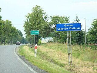
Żanecin is a village in the administrative district of Gmina Sokołów Podlaski, within Sokołów County, Masovian Voivodeship, in east-central Poland. It lies approximately 3 kilometres (2 mi) south of Sokołów Podlaski and 88 km (55 mi) east of Warsaw.
