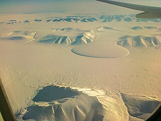
Gronau Nunataks

Last updated
Gronau Nunataks
Gronau Nunatakker
Groonimaa maastik.JPG
Southward bend in the Christian IV Glacier with the Gronau Nunataks in the background and the NW part of the Watkins Range in the forefront.
Highest point
PeakHighest point
Elevation 2,810 m (9,220 ft)
Dimensions
Length80 km (50 mi)E/W
Width33 km (21 mi)N/S
Geography
Greenland edcp relief location map.jpg
Red triangle with thick white border.svg
Location in Greenland
Country Greenland
Region Sermersooq
Range coordinates 69°27′N30°15′W / 69.450°N 30.250°W / 69.450; -30.250

The Gronau Nunataks (Danish : Gronau Nunatakker) [1] is a mountain range in King Christian IX Land, eastern Greenland. Administratively this range is part of the Sermersooq Municipality.

Contents

History

This group of nunataks at the edge of the vast Greenland Ice Sheet was first reported by German aviation pioneer Wolfgang von Gronau during his 1930 transatlantic flight on a Dornier Wal. [2]

The existence of the range was later confirmed by Lauge Koch during flights in 1933 that were part of the 1931–34 Three-year Expedition to East Greenland (Treårsekspeditionen). Following the subsequent survey and mapping of the mountains they were named after Wolfgang von Gronau. [3]

Geography

The Gronau Nunataks is a long cluster of nunataks. It is located north of the Watkins Range, beyond the large Christian IV Glacier and to the northeast of the Lindbergh Range. The Greenland Ice Sheet lies to the north and the Wager Nunataks further to the east. The Gronau Glacier is located in the western part of the mountains. The area of the range is remote and uninhabited. [4]

The Dødemandstoppene (Danish for "Mountains of the Dead", lit. "Peaks of the Dead Men") is a geographic division or part of the Gronau Nunataks located on the eastern side of the Grønlands Styrelse Glacier. The name originated in 1934 at the time of the British Trans-Greenland Expedition by Sir Martin Lindsay in which the dark pyramid or tomb-like mountains were deemed sinister when first seen. [3]

Defense Mapping Agency map of Greenland sheet Operational Navigation Chart C-13, 3rd edition.jpg
Defense Mapping Agency map of Greenland sheet

Peaks

The highest point of the Gronau Nunataks is a 2,810 m mountain. The area has been explored in recent decades by alpinists and some of the peaks have been named, but data are lacking regarding the exact location of certain peaks. [5] [6] [7] [8] Some of the summits named recently are the following:

Climate

Being so close to the Greenland Ice Sheet, Polar climate prevails in the Gronau Nunataks. The average annual temperature in the area of the range is -18 °C. The warmest month is July when the average temperature reaches -4 °C and the coldest is February when the temperature sinks to -25 °C. [9]

See also

Related Research Articles

<span class="mw-page-title-main">Extreme points of North America</span> Most prominent locations of the continents physical boundaries

This is a list of the extreme points of North America: the points that are highest and lowest, and farther north, south, east or west than any other location on the continent. Some of these points are debatable, given the varying definitions of North America.

The Wisconsin Range is a major mountain range of the Horlick Mountains in Antarctica, comprising the Wisconsin Plateau and numerous glaciers, ridges and peaks bounded by the Reedy Glacier, Shimizu Ice Stream, Horlick Ice Stream and the interior ice plateau.

The Reedy Glacier is a major glacier in Antarctica, over 100 nautical miles long and 6 to 12 nautical miles wide, descending from the polar plateau to the Ross Ice Shelf between the Michigan Plateau and Wisconsin Range in the Transantarctic Mountains. It marks the limits of the Queen Maud Mountains on the west and the Horlick Mountains on the east.

Frænkel Land is a peninsula in King Christian X Land, East Greenland. Administratively it is part of the Northeast Greenland National Park.

<span class="mw-page-title-main">Watkins Range</span> Mountain range in Greenland

The Watkins Range is Greenland's highest mountain range. It is located in King Christian IX Land, Sermersooq municipality.

<span class="mw-page-title-main">Princess Caroline-Mathilde Alps</span> Mountain range in Greenland

The Princess Caroline-Mathilde Alps are a mountain range system in the Holm Land Peninsula, King Frederick VIII Land, northeastern Greenland. Administratively this range is part of the Northeast Greenland National Park zone.

<span class="mw-page-title-main">Queen Louise Land</span> Mountainous region in northeastern Greenland

Queen Louise Land is a vast mountainous region located west of Dove Bay, King Frederik VIII Land, northeastern Greenland. Administratively it is part of the Northeast Greenland National Park zone.

<span class="mw-page-title-main">Odinland</span> Peninsula in southeastern Greenland

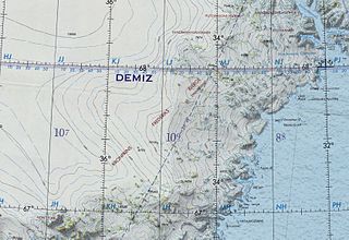
Odinland, also Odinsland in the Defense Mapping Agency Greenland Navigation charts, is a peninsula in the King Frederick VI Coast, southeastern Greenland. It is a part of the Sermersooq municipality.

<span class="mw-page-title-main">Lemon Range</span> Mountain range in Greenland

The Lemon Range or Lemon Mountains is a mountain range in King Christian IX Land, eastern Greenland. Administratively this range is part of the Sermersooq Municipality.

<span class="mw-page-title-main">Crown Prince Frederik Range</span> Mountain range in King Christian IX Land, Greenland

The Crown Prince Frederik Range is a large mountain range in King Christian IX Land, eastern Greenland. Administratively this range is part of the Sermersooq Municipality.

<span class="mw-page-title-main">Borgtinderne</span>

Borgtinderne, meaning 'Castle Pinnacles' in the Danish language, is a mountain range in King Christian IX Land, eastern Greenland. Administratively this range is part of the Sermersooq Municipality.

<span class="mw-page-title-main">Wolfgang von Gronau</span> German diplomat and aviator

Hans Wolfgang von Gronau was a German aviation pioneer and Luftwaffe general. During World War II he was the German air attaché and the chief of the Luftwaffe liaison staff in Japan.

<span class="mw-page-title-main">Ejnar Mikkelsen Range</span> Mountain range in Greenland

Ejnar Mikkelsen Range is a mountain range in King Christian IX Land, eastern Greenland. Administratively it is part of the Sermersooq Municipality.

<span class="mw-page-title-main">Princess Elizabeth Alps</span>

The Princess Elizabeth Alps is a mountain range in King Frederick VIII Land, northeastern Greenland. Administratively this range is part of the Northeast Greenland National Park zone.

<span class="mw-page-title-main">Lindbergh Range</span> Mountain range in Greenland

The Lindbergh Range or Lindbergh Nunataks is a mountain range in King Christian IX Land, eastern Greenland. Administratively the range is part of the Sermersooq Municipality.

<span class="mw-page-title-main">Lilloise Range</span> Mountain range in eastern Greenland

The Lilloise Range or Lilloise Mountains is a mountain range in King Christian IX Land, eastern Greenland. Administratively this range is part of the Sermersooq Municipality.

The Kangerluluk Range is a mountain range in the King Frederick VI Coast, southeastern Greenland. Administratively this range is part of the Kujalleq municipality.

References

  1. "Gronau Nunatakker". Mapcarta. Retrieved 29 July 2016.
  2. Gronau, W. von 1933: Im Grönland-Wal. Dreimal über den Atlantik und einmal um die Welt, 176 pp. Berlin: Reimar Hobbing
  3. 1 2 "Catalogue of place names in northern East Greenland". Geological Survey of Denmark. Retrieved 31 July 2016.[ permanent dead link ]
  4. 1 2 3 Google Earth
  5. 1 2 3 4 5 6 7 8 9 10 11 12 13 Engel, H. 2007: Gronau Nunatakker, first ascents. American Alpine Journal 2007, 201–202
  6. Burch, S. 2003: Gronau Nunatakker range, first ascents. American Alpine Journal 2003, 282–283.
  7. Arctic Summits - Summit Climbs
  8. Arctic Summits - Pilotsbjerg, 2805m, First Ascent
  9. "NASA Earth Observations Data Set Index". NASA. Archived from the original on 26 April 2020. Retrieved 30 January 2016.