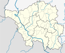
Großrosseln | |
|---|---|
 Town hall | |
Location of Großrosseln within Saarbrücken district  | |
| Coordinates: 49°12′N6°50′E / 49.200°N 6.833°E | |
| Country | Germany |
| State | Saarland |
| District | Saarbrücken |
| Subdivisions | 6 |
| Government | |
| • Mayor (2019–29) | Dominik Jochum [1] (CDU) |
| Area | |
• Total | 25.26 km2 (9.75 sq mi) |
| Elevation | 229 m (751 ft) |
| Population (2022-12-31) [2] | |
• Total | 7,939 |
| • Density | 310/km2 (810/sq mi) |
| Time zone | UTC+01:00 (CET) |
| • Summer (DST) | UTC+02:00 (CEST) |
| Postal codes | 66347–66352 |
| Dialling codes | 06898; 06809 |
| Vehicle registration | SB |
| Website | www.grossrosseln.de |
Großrosseln (German pronunciation: [ˈɡʁoːsˌʁɔsln̩] ; French : Grande-Rosselle, pronounced [ɡʁɑ̃dʁɔsɛl] , lit. 'Big Rosselle', in contrast to "Little Rosselle") is a village and a municipality in the district of Saarbrücken, in Saarland, Germany. It is situated on the border with France, approximately 12 km west of Saarbrücken. The neighbouring municipality in France is Petite-Rosselle.


