
Stadio Nicola Ceravolo is a multi-purpose stadium in Catanzaro, Italy. The stadium was built in 1919 and holds 14,650. It is currently the home of F.C. Catanzaro.

Rath is a borough in northern Düsseldorf District 6, near the airport, with 16,975 inhabitants (2000). It is about 5 km northeast of the city center.

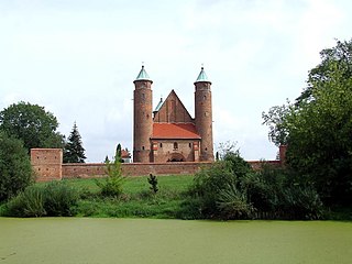
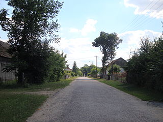
Węgrów is a village in the administrative district of Gmina Długołęka, within Wrocław County, Lower Silesian Voivodeship, in south-western Poland. Prior to 1945 it was in Germany.

The Museum of Aviation is the second-largest aerospace museum of the United States Air Force. The museum is located just outside Warner Robins, Georgia, and near Robins Air Force Base. It has a total of five different buildings containing fewer than its previous 93 different aircraft on 51 acres (21 ha). The museum is also the home of the Georgia Aviation Hall of Fame.
Dąbrowice is a village in the administrative district of Gmina Mrocza, within Nakło County, Kuyavian-Pomeranian Voivodeship, in north-central Poland.
Łukówiec is a village in the administrative district of Gmina Firlej, within Lubartów County, Lublin Voivodeship, in eastern Poland.

Ağanus is a village in the Lachin Rayon of Azerbaijan.

Agzibir is a village in the Kalbajar Rayon of Azerbaijan.
Przyborów is a village in the administrative district of Gmina Kobiele Wielkie, within Radomsko County, Łódź Voivodeship, in central Poland. It lies approximately 4 kilometres (2 mi) south-west of Kobiele Wielkie, 12 km (7 mi) south-east of Radomsko, and 86 km (53 mi) south of the regional capital Łódź.
Zadąbrów-Wiatraki is a village in the administrative district of Gmina Warta, within Sieradz County, Łódź Voivodeship, in central Poland.
Leopoldów is a village in the administrative district of Gmina Łęczna, within Łęczna County, Lublin Voivodeship, in eastern Poland. It lies approximately 4 kilometres (2 mi) south of Łęczna and 22 km (14 mi) east of the regional capital Lublin.
Kępa Radwankowska is a village in the administrative district of Gmina Góra Kalwaria, within Piaseczno County, Masovian Voivodeship, in east-central Poland. It lies approximately 5 kilometres (3 mi) south-east of Góra Kalwaria, 22 km (14 mi) south-east of Piaseczno, and 35 km (22 mi) south-east of Warsaw.
Brochów is a village in Sochaczew County, Masovian Voivodeship, east-central Poland. It is the seat of Gmina Brochów and lies some 11 kilometres (7 mi) north of Sochaczew and 52 km (32 mi) west of Warsaw.
Ruda is a village in the administrative district of Gmina Zduny, within Krotoszyn County, Greater Poland Voivodeship, in west-central Poland. It lies approximately 8 kilometres (5 mi) west of Zduny, 12 km (7 mi) west of Krotoszyn, and 87 km (54 mi) south of the regional capital Poznań.

Nowęcin is a village in the administrative district of Gmina Wicko, within Lębork County, Pomeranian Voivodeship, in northern Poland. It lies approximately 10 kilometres (6 mi) north of Wicko, 25 km (16 mi) north-west of Lębork, and 80 km (50 mi) north-west of the regional capital Gdańsk.
Będziechowo is a village in the administrative district of Gmina Główczyce, within Słupsk County, Pomeranian Voivodeship, in northern Poland. It lies approximately 7 kilometres (4 mi) south-west of Główczyce, 22 km (14 mi) north-east of Słupsk, and 91 km (57 mi) west of the regional capital Gdańsk.
Brzeziniak is a settlement in the administrative district of Gmina Zalewo, within Iława County, Warmian-Masurian Voivodeship, in northern Poland. It lies approximately 3 kilometres (2 mi) north-west of Zalewo, 30 km (19 mi) north of Iława, and 61 km (38 mi) west of the regional capital Olsztyn.

The Vale and Downland Museum is a local museum in the market town of Wantage, Oxfordshire, England. Its galleries present the cultural heritage of the Vale of White Horse region around Wantage. There is a Victorian kitchen, Iron Age skeleton and a bust of Sir John Betjeman amongst its attractions, along with a cafe serving homemade food. During school holidays there are several themed days, most of which are 'entry by donation'. The museum also acts as a community hub holding a weekly Women's Institute market, several book groups and various drawing, knitting and needlework classes. The museum is located in the Old Surgery, Church Street, in the centre of the town. The museum has around 1,500 books, pamphlets and periodicals in its library.

Triigi is a village in Saaremaa Parish, Saare County in western Estonia.

Bala Quila also known Alwar fort is a fort in Alwar in Indian state of Rajasthan. It is situated on a hill in the Aravalli Range, above the town of Alwar. The fort is 5 kilometres (3.1 mi) long and is about 1.5 kilometres (0.93 mi) wide. It was built in 15th century by the Hasan Khan Mewati. In the following centuries it went to the Marathas,and to the Kachwaha Rajputs.


