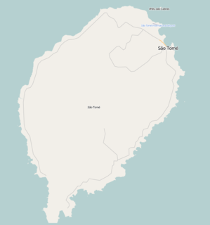
Trindade is a town located on São Tomé Island, which is part of the island nation of São Tomé and Príncipe. Its population is 16,140. It is the seat of Mé-Zóchi District. It lies 7 km southwest of the capital São Tomé. Nearby places include Diogo Simão to the northeast, Lemos to the east, Cruzeiro to the south and Piedade to the west. There is a secondary school in Trindade, opened in 2011, with a capacity of 720 students.

Ilhéu das Rolas is an islet in the African island nation of São Tomé and Príncipe. The island lies on the equator, off the southern tip of São Tomé Island, separated by Canal das Rolas. Its maximum elevation is 96 m. Its population is 76. It is part of the Caué District. Access is only by ferry departing from Ponta Baleia on São Tomé Island. There is a lighthouse on the islet, built in 1929. Its focal height is 106 meters and its range is 12 nmi. The island is home to a small resort, the Pestana Equador.

Santana is a town on the eastern coast of São Tomé Island, which is part of the island nation of São Tomé and Príncipe. It is the seat of Cantagalo District. The population of Santana with the adjacent settlements Cidade Alta, Cova Água, Gomes, Nova Olinda, Picão Flor, Praia Messias Alves, Riboque Santana and Zandrigo is 10,290 (2012).2012 detailed census São Tomé e Príncipe, Instituto Nacional de Estatística</ref> Santana lies 9 km south of the capital São Tomé and 17 km northeast of São João dos Angolares. The islet Ilhéu de Santana lies about 1 km off-shore, 2.5 km southeast of Santana.

Porto Alegre is a village in Caué District on São Tomé Island in São Tomé and Príncipe. Its population is 795. Porto Alegre lies 2.5 km northeast of the southernmost point of São Tomé Island, Ponta Homem da Capa. It is 1.5 km west of Ponta Baleia, 17 km southwest of São João dos Angolares and 40 km southwest of the capital São Tomé. Across the Canal das Rolas lies the Ilhéu das Rolas. On the east side of Ponta Homem da Capa is the beach Praia Inhame. The plantation complex Roça de Porto Alegre was established around 1890 by Jacinto Carneiro de Sousa e Almeida. The oldest preserved building dates from 1918.

Santa Cruz is a village on São Tomé Island in the nation of São Tomé and Príncipe. Its population is 191. It lies 1 km north of Santa Margarida and 1 km west of Madalena.

Blublu is a small village on São Tomé Island in São Tomé and Príncipe. Its population is 19. It lies 0.7 km southeast of Bobo Forro and 3 km southwest of the city centre of the capital São Tomé.

Bombom is a town in the north-eastern part of São Tomé Island in São Tomé and Príncipe. Its population is 498. It lies 2 km west of Pantufo and 3 km south of the city centre of the capital São Tomé.

Lemos is a village on São Tomé Island in the nation of São Tomé and Príncipe. Its population is 1,136. It is 2 km east of Trindade.

Plateau is a village on São Tomé Island in the nation of São Tomé and Príncipe. Its population is 99. It lies 1 km northeast of Java and 4 km southwest of Trindade.

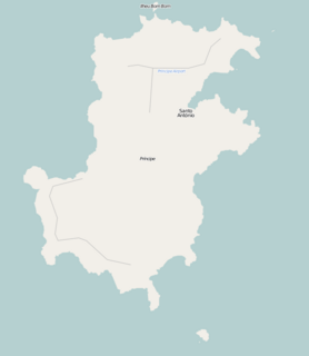
Portinho is a village on Príncipe Island in the nation of São Tomé and Príncipe located 2 km east of the island capital Santo António. Its population is 3.

Caixão Grande is a town on São Tomé Island in the nation of São Tomé and Príncipe. Its population is 1,021. It lies about 5 km southwest of the national capital São Tomé.

Batepá is a village on São Tomé Island in São Tomé and Príncipe. Its population is 775. It lies 2 km west of Trindade and 2 km east of Monte Café. It was the starting point of the Batepá massacre, a brutally crushed rebellion in February 1953, in which hundreds of local inhabitants were killed. It marked the rise of the independence movement in Portuguese São Tomé and Príncipe, and is commemorated annually as a national holiday on February 3.

Sundy is a settlement in the northwestern part of Príncipe Island in São Tomé and Príncipe. Its population is 416. Sundy lies 5 km northwest of the island capital of Santo António. In 1822 the first cocoa plantation of the whole archipelago was established in Sundy. Several buildings of this plantation have been preserved.

Praia Melão is a seaside village in the north-eastern part of São Tomé Island in São Tomé and Príncipe, part of Mé-Zóchi District. Its population is 2,668. It lies 1 km northeast of Almas, 1 km southeast of Pantufo and 4.5 km southeast of the capital São Tomé.

Bobo Forro is a village in the north-eastern part of São Tomé Island in São Tomé and Príncipe, part of Mé-Zóchi District. Its population is 715. It lies 3 km southwest of the city centre of the capital São Tomé, and 4 km northeast of Trindade. The adjacent village in the Água Grande District is also called Bobo Forro.

Almas is a town in Mé-Zóchi District, São Tomé Island, São Tomé and Príncipe. Its population is 1,255. It lies 1 km southwest of Praia Melão and 5 km south of the capital São Tomé.

Correia is a settlement in the Água Grande District on São Tomé Island in São Tomé and Príncipe. Its population is 575. Located 3 km west of the city centre of São Tomé, it forms a part of the São Tomé Urban area. Before ca. 2010, it was part of the Lobata District.

Santa Margarida is a village in the mid-north of São Tomé Island in São Tomé and Príncipe, part of the Mé-Zóchi District. Its population is 384. It lies 1 km southwest of Madalena and 4 km northwest of Trindade.

Ototó is a village in the central part of São Tomé Island in São Tomé and Príncipe. Its population is 585. It lies 1 km southeast of Santa Margarida and 1.2 km south of Madalena.

São Joaquim is a village in the western part of Príncipe Island in São Tomé and Príncipe. Its population is 93. São Joaquim is located 5 km southwest of the island capital of Santo António.


