Ilhéu das Rolas is an islet in the African island nation of São Tomé and Príncipe. The island lies on the equator, off the southern tip of São Tomé Island, separated by Canal das Rolas. Its maximum elevation is 96 m. Its population is 76. It is part of the Caué District. Access is only by ferry departing from Ponta Baleia on São Tomé Island. There is a lighthouse on the islet, built in 1929. Its focal height is 106 meters and its range is 12 nmi. The island is home to a small resort, the Pestana Equador.
Guadalupe is a town located in the northern part of São Tomé Island, which is part of the island nation of São Tomé and Príncipe. It is the seat of Lobata District. Its population is 7,604. Guadalupe lies 1.5 km northwest of Agostinho Neto, 10 km east of Neves and 11 km northwest of the capital São Tomé.
Porto Alegre is a village in Caué District on São Tomé Island in São Tomé and Príncipe. Its population is 795. Porto Alegre lies 2.5 km northeast of the southernmost point of São Tomé Island, Ponta Homem da Capa. It is 1.5 km west of Ponta Baleia, 17 km southwest of São João dos Angolares and 40 km southwest of the capital São Tomé. Across the Canal das Rolas lies the Ilhéu das Rolas. On the east side of Ponta Homem da Capa is the beach Praia Inhame. The plantation complex Roça de Porto Alegre was established around 1890 by Jacinto Carneiro de Sousa e Almeida. The oldest preserved building dates from 1918.

Ilhéu das Cabras is an uninhabited island in the Gulf of Guinea. It is one of the smaller islands of São Tomé and Príncipe. The islet is located about 2 km off the northeast coast of the island of São Tomé, 8 km north of the city centre of São Tomé. The islet consists of two hills, about 90 metres high. There is a lighthouse on the northeastern summit, built in 1890; its focal height 97 metres and its range is 12 nmi. The islet was mentioned as "Mooro Caebres" in the 1665 map by Johannes Vingboons.
Blublu is a small village on São Tomé Island in São Tomé and Príncipe. Its population is 19. It lies 0.7 km southeast of Bobo Forro and 3 km southwest of the city centre of the capital São Tomé.
Bombom is a town in the north-eastern part of São Tomé Island in São Tomé and Príncipe. Its population is 498. It lies 2 km west of Pantufo and 3 km south of the city centre of the capital São Tomé.
Plateau is a village on São Tomé Island in the nation of São Tomé and Príncipe. Its population is 99. It lies 1 km northeast of Java and 4 km southwest of Trindade.
Ribeira Peixe is a seaside village on São Tomé Island in the nation of São Tomé and Príncipe. Its population is 503. It lies 1 km southwest of Praia Pesqueira and 6 km southwest of São João dos Angolares. There was a plantation complex (roça) at Ribeira Peixe, that produced cocoa, copra, coconut and palm oil.
Caixão Grande is a town on São Tomé Island in the nation of São Tomé and Príncipe. Its population is 1,021. It lies about 5 km southwest of the national capital São Tomé.

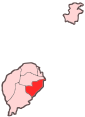
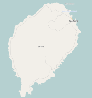
Ana Chaves Bay is a bay on the northeast coast of São Tomé Island in São Tomé and Príncipe. The capital city of São Tomé and its port are situated by the bay. It stretches from the Ponta Oque del Rei in the north to Ponta São Sebastião in the south. Forte de São Sebastião, now part of São Sebastião Museum, occupies Ponta São Sebastião. The port of São Tomé was built at the end of the 1950s on reclaimed land that extends 0.2 miles (0.32 km) north of Ponta São Sebastião; there is a 200 m quay at its north end, with a depth of 3 metres alongside. It is the main port of the country for solid goods; the port of Neves is the main point of entry for liquid fuels. The bay is generally shallow, offering anchorage for small vessels in depths of less than 5 metres (16 ft).

Bombaim is a small village on São Tomé Island in São Tomé and Príncipe. Its population is 18. It is 6 km south of Monte Café and 8 km southwest of Trindade. It was established as a plantation (roça).
Batepá is a village on São Tomé Island in São Tomé and Príncipe. Its population is 775. It lies 2 km west of Trindade and 2 km east of Monte Café. It was the starting point of the Batepá massacre, a brutally crushed rebellion in February 1953, in which hundreds of local inhabitants were killed. It marked the rise of the independence movement in Portuguese São Tomé and Príncipe, and is commemorated annually as a national holiday on February 3.

Praia Melão is a seaside village in the north-eastern part of São Tomé Island in São Tomé and Príncipe, part of Mé-Zóchi District. Its population is 2,668. It lies 1 km northeast of Almas, 1 km southeast of Pantufo and 4.5 km southeast of the capital São Tomé.
Bobo Forro is a village in the north-eastern part of São Tomé Island in São Tomé and Príncipe, part of Mé-Zóchi District. Its population is 715. It lies 3 km southwest of the city centre of the capital São Tomé, and 4 km northeast of Trindade. The adjacent village in the Água Grande District is also called Bobo Forro.
Almas is a town in Mé-Zóchi District, São Tomé Island, São Tomé and Príncipe. Its population is 1,255. It lies 1 km southwest of Praia Melão and 5 km south of the capital São Tomé.
São Marçal is a suburb of the city São Tomé in the nation of São Tomé and Príncipe. Its population is 2,866. It is 2.3 km southeast of the city centre of São Tomé and 1 km northwest of Pantufo.
São João da Vargem is a suburb of the city São Tomé in the nation of São Tomé and Príncipe. Its population is 1,793. It lies on the coast, 1 km northwest of the city centre of São Tomé.
Correia is a settlement in the Água Grande District on São Tomé Island in São Tomé and Príncipe. Its population is 575. Located 3 km west of the city centre of São Tomé, it forms a part of the São Tomé Urban area. Before ca. 2010, it was part of the Lobata District.