New Bussa is a town in Niger State, Nigeria. It is the new site of Bussa after the Kainji Lake dam set the previous location underwater. As of 2007 New Bussa had an estimated population of 24,449. New Bussa is the headquarters of the Borgu Emirate and the Borgu Local Government Area.
Svrbice is a small village in the Topoľčany District of the Nitra Region in Slovakia, situated approximately 24 km south of Topoľčany. In 2011 it had 209 inhabitants.

Freila is a municipality located in the province of Granada, Spain. According to the 2005 census (INE), the city has a population of 1039 inhabitants.
Castillonroy or Castellonroi is a municipality located in the province of Huesca, Aragon, Spain. According to the 2007 census (INE), the municipality has a population of 382 inhabitants.

Griebo is a former municipality in the district of Wittenberg, Saxony-Anhalt, Germany. Since January 2008, it is part of the town Wittenberg.

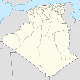
Mahelma is a suburb of the city of Algiers in northern Algeria.

Smogorówka Dolistowska is a village in the administrative district of Gmina Goniądz, within Mońki County, Podlaskie Voivodeship, in north-eastern Poland. It lies approximately 11 kilometres (7 mi) east of Goniądz, 15 km (9 mi) north-east of Mońki, and 49 km (30 mi) north-west of the regional capital Białystok.

Włosty-Olszanka is a village in the administrative district of Gmina Szepietowo, within Wysokie Mazowieckie County, Podlaskie Voivodeship, in north-eastern Poland. It lies approximately 3 kilometres (2 mi) north-west of Szepietowo, 4 km (2 mi) south of Wysokie Mazowieckie, and 51 km (32 mi) south-west of the regional capital Białystok.
Kotów is a village in the administrative district of Gmina Łabowa, within Nowy Sącz County, Lesser Poland Voivodeship, in southern Poland. It lies approximately 3 kilometres (2 mi) south-east of Łabowa, 18 km (11 mi) south-east of Nowy Sącz, and 91 km (57 mi) south-east of the regional capital Kraków.
Ewelin is a village in the administrative district of Gmina Garwolin, within Garwolin County, Masovian Voivodeship, in east-central Poland. It lies approximately 9 kilometres (6 mi) west of Garwolin and 52 km (32 mi) south-east of Warsaw.
Baharabad is a village and municipality in the Beylagan Rayon of Azerbaijan. It has a population of 741.
Borzęcice is a village in the administrative district of Gmina Koźmin Wielkopolski, within Krotoszyn County, Greater Poland Voivodeship, in west-central Poland. It lies approximately 8 kilometres (5 mi) north-east of Koźmin Wielkopolski, 23 km (14 mi) north of Krotoszyn, and 71 km (44 mi) south-east of the regional capital Poznań.

Broniec is a village in the administrative district of Gmina Olesno, within Olesno County, Opole Voivodeship, in south-western Poland. It lies approximately 8 kilometres (5 mi) east of Olesno and 48 km (30 mi) north-east of the regional capital Opole.
Gumara River is a river of northern-western Ethiopia. It empties into Lake Tana at 11°53′N37°31′E from the east. Hot springs on the Gumara's banks at Wanzagay, which were popular in medicinal hot baths in the late 18th and early 19th centuries, are mentioned by the missionary Henry Stern.
San Stefano is a village in Karnobat Municipality, in Burgas Province, in southeastern Bulgaria.
Reopalu is a village in Väätsa Parish, Järva County in central Estonia.
Sepaküla is a village in Ridala Parish, Lääne County, in western Estonia.
Ribnice is a village in the municipality of Vranje, Serbia. According to the 2002 census, the village has a population of 471 people.
Zarratón is a village in the province and autonomous community of La Rioja, Spain. The municipality covers an area of 18.69 square kilometres (7.22 sq mi) and as of 2011 had a population of 318 people.