The St. Francis River is a tributary of the Mississippi River, about 426 miles (686 km) long, in southeastern Missouri and northeastern Arkansas in the United States. The river drains a mostly rural area and forms part of the Missouri-Arkansas state line along the western side of the Missouri Bootheel.
Eagle Bend is a census-designated place and unincorporated community in Warren County, Mississippi. It is approximately 31 miles northwest of downtown Vicksburg, and is part of the Vicksburg Micropolitan Statistical Area.

Cleveland Township is a township in Davis County, Iowa, United States. As of the 2000 census, its population was 675.
Wayside is an unincorporated community in Washington County, Mississippi, United States.
Horse Creek is a stream and tributary of the Tombigbee River in southern Marengo County and northern Clarke County in Alabama.
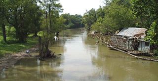
Concordia is a ghost town in Bolivar County, Mississippi, United States, located on the eastern edge of the Mississippi Levee, approximately 2.5 mi (4.0 km) west of Mississippi Highway 1.
Eutaw is a ghost town in Bolivar County, Mississippi, United States. The settlement had a port on the Mississippi River called "Eutaw Landing."
Duncansby is a ghost town in Issaquena County, Mississippi, United States.
Briers is a ghost town located in Adams County, Mississippi, United States. Briar Landing was its port, located directly on the Mississippi River.
Kienstra is a ghost town located in Adams County, Mississippi, United States. South of the town was Kienstra Landing, located on the Mississippi River.
Artonish is a ghost town located in Wilkinson County, Mississippi, United States. South of the town was Artonish Landing, located on a stretch of the Mississippi River known as the "Homochitto Cutoff".
Magna Vista is a ghost town in Issaquena County, Mississippi.
Hobbs Island is an unincorporated community in Madison County, Alabama, United States.
Liverpool is a ghost town in Yazoo County, Mississippi, United States. Liverpool Landing, the settlement's port on the Yazoo River, was located 0.9 mi (1.4 km) west of Liverpool.

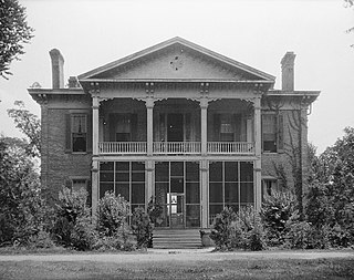
Binnsville is a ghost town in Kemper County, Mississippi, United States.
Refuge is an unincorporated community located in Washington County, Mississippi, United States.
Sunflower Landing is an unincorporated community in Coahoma County, Mississippi, United States.
Crosno is a ghost town in Mississippi County, in the U.S. state of Missouri. The GNIS classifies it as a populated place.
Rushs Ridge is an extinct town in Mississippi County, in the U.S. state of Missouri. The GNIS classifies it as a populated place.
Riverton is a ghost town in Bolivar County, Mississippi, United States.