GvSIG

Last updated
gvSIG
Developer(s) gvSIG Association
Initial releaseOctober 2004 (2004-10)
Stable release
2.6 [1]   OOjs UI icon edit-ltr-progressive.svg / 6 November 2019; 3 November 2020
Repository
Written in Java
Operating system Windows, Linux, Mac OS
Platform Java
Available inCA, DE, EN, ES, EU, FR, GL, IT, PT,...
Type GIS
License GNU GPL
Website www.gvsig.org

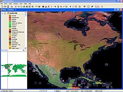
gvSIG, geographic information system (GIS), is a desktop application designed for capturing, storing, handling, analyzing and deploying any kind of referenced geographic information in order to solve complex management and planning problems. gvSIG is known for having a user-friendly interface, being able to access the most common formats, both vector and raster ones. It features a wide range of tools for working with geographic-like information (query tools, layout creation, geoprocessing, networks, etc.).

Contents

Nomenclature

gvSIG was initially developed for the Generalitat Valenciana (gv), an institution of the self-governed autonomous community of Valencia. This explains the abbreviation gvSIG for which the last three letters stands for Sistema d'informació geogràfica (SIG), or GIS in English.

Features gvSIG Desktop

Typical tools in a full-fledged desktop GIS client can also be found in gvSIG, among other things:

Sextante [7] GIS has been ported to a plugin for gvSIG adding analysis functions for raster datasets in addition to gvSIG's built-in vector analysis tools. Within Sextante, GRASS GIS can be used as extension to make its algorithms available to gvSIG users. [8]

gvSIG Mobile

gvSIG Mobile aims at broadening gvSIG execution platforms to a range of mobile devices, in order to give an answer to the needs of a growing number of mobile solutions users, who wish to use a GIS on different types of devices. So far, gvSIG Mobile is a Geographic Information System, as well as a Spatial Data Infrastructures client for mobile devices. Such a client is also the first one licensed under open source. gvSIG Mobile is known for:

Features gvSIG Mobile

Typical tools in a mobile GIS client can also be found in gvSIG Mobile:

Related Research Articles

<span class="mw-page-title-main">Esri</span> Geospatial software & SaaS company

Environmental Systems Research Institute, Inc., doing business as Esri, is an American multinational geographic information system (GIS) software company headquartered in Redlands, California. It is best known for its ArcGIS products. With a 40% market share, Esri is the world's leading supplier of GIS software, web GIS and geodatabase management applications.

<span class="mw-page-title-main">Geography Markup Language</span> XML grammar for geographical features

The Geography Markup Language (GML) is the XML grammar defined by the Open Geospatial Consortium (OGC) to express geographical features. GML serves as a modeling language for geographic systems as well as an open interchange format for geographic transactions on the Internet. Key to GML's utility is its ability to integrate all forms of geographic information, including not only conventional "vector" or discrete objects, but coverages and sensor data.

A coverage is the digital representation of some spatio-temporal phenomenon. ISO 19123 provides the definition:

In computing, the Open Geospatial Consortium Web Feature Service (WFS) Interface Standard provides an interface allowing requests for geographical features across the web using platform-independent calls. One can think of geographical features as the "source code" behind a map, whereas the WMS interface or online tiled mapping portals like Google Maps return only an image, which end-users cannot edit or spatially analyze. The XML-based GML furnishes the default payload-encoding for transporting geographic features, but other formats like shapefiles can also serve for transport. In early 2006 the OGC members approved the OpenGIS GML Simple Features Profile. This profile is designed both to increase interoperability between WFS servers and to improve the ease of implementation of the WFS standard.

<span class="mw-page-title-main">TerraLib</span> Geographic information system software library

TerraLib is an open-source geographic information system (GIS) software library. It extends object-relational database management systems (DBMS) to handle spatiotemporal data types.

A GIS software program is a computer program to support the use of a geographic information system, providing the ability to create, store, manage, query, analyze, and visualize geographic data, that is, data representing phenomena for which location is important. The GIS software industry encompasses a broad range of commercial and open-source products that provide some or all of these capabilities within various information technology architectures.

<span class="mw-page-title-main">Manifold System</span>

Manifold System is a geographic information system (GIS) software package developed by Manifold Software Limited that runs on Microsoft Windows. Manifold System handles both vector and raster data, includes spatial SQL, a built-in Internet Map Server (IMS), and other general GIS features.

A Web Map Service (WMS) is a standard protocol developed by the Open Geospatial Consortium in 1999 for serving georeferenced map images over the Internet. These images are typically produced by a map server from data provided by a GIS database.

<span class="mw-page-title-main">ArcGIS</span> Geographic information system maintained by Esri

ArcGIS is a family of client, server and online geographic information system (GIS) software developed and maintained by Esri.

<span class="mw-page-title-main">JUMP GIS</span>

Java Unified Mapping Program (JUMP) is a Java based vector and raster GIS and programming framework. Current development continues under the OpenJUMP name.

<span class="mw-page-title-main">QGIS</span> Open-source desktop GIS software

QGIS is a geographic information system (GIS) software that is free and open-source. QGIS supports Windows, macOS, and Linux. It supports viewing, editing, printing, and analysis of geospatial data., QGIS was previously also known as Quantum GIS.

Kosmo is a desktop geographic information system (GIS) with advanced functions. It is the first of a series of developments that are being made available to the community.

The Open Source Geospatial Foundation (OSGeo), is a non-profit non-governmental organization whose mission is to support and promote the collaborative development of open geospatial technologies and data. The foundation was formed in February 2006 to provide financial, organizational and legal support to the broader Free and open-source geospatial community. It also serves as an independent legal entity to which community members can contribute code, funding and other resources.

Mapbender is a graduated project of the Open Source Geospatial Foundation. It was awarded OGC web site of the month in 2008. It is used by PortalU and several federal states to implement the INSPIRE regulation. Many municipalities use Mapbender as City Map Services and it is used as the mapping framework for online cycle route planners.

MapServer is an open-source development environment for building spatially enabled internet applications, built in the C language, and is widely known as one of the fastest Web mapping engines available. It can run as a CGI program or via MapScript which supports several programming languages. MapServer can access hundreds of data formats, any raster or vector format supported by GDAL, and reprojections on-the-fly are handled by PROJ. MapServer was originally developed by Steve Lime, then working at the University of Minnesota — so, it was previously referred to as "UMN MapServer", to distinguish it from commercial "map servers"; today it is commonly referred to as just "MapServer", and is maintained by the MapServer Project Steering Committee (PSC). MapServer was originally developed with support from NASA, which needed a way to make its satellite imagery available to the public.

In cartography, a Styled Layer Descriptor (SLD) is an XML schema specified by the Open Geospatial Consortium (OGC) for describing the appearance of map layers. It is capable of describing the rendering of vector and raster data. A typical use of SLDs is to instruct a Web Map Service (WMS) how to render a specific layer.

ArcGIS Server is the core server geographic information system (GIS) software made by Esri. ArcGIS Server is used for creating and managing GIS Web services, applications, and data. ArcGIS Server is typically deployed on-premises within the organization’s service-oriented architecture (SOA) or off-premises in a cloud computing environment.

A Spatial Data Infrastructure (SDI), also called geospatial data infrastructure, is a data infrastructure implementing a framework of geographic data, metadata, users and tools that are interactively connected in order to use spatial data in an efficient and flexible way. Another definition is "the technology, policies, standards, human resources, and related activities necessary to acquire, process, distribute, use, maintain, and preserve spatial data".

The Open Geospatial Consortium Web Coverage Service Interface Standard (WCS) defines Web-based retrieval of coverages – that is, digital geospatial information representing space/time-varying phenomena.

<span class="mw-page-title-main">Open Geospatial Consortium</span> Standards organization

The Open Geospatial Consortium (OGC), an international voluntary consensus standards organization for geospatial content and location-based services, sensor web and Internet of Things, GIS data processing and data sharing. It originated in 1994 and involves more than 500 commercial, governmental, nonprofit and research organizations in a consensus process encouraging development and implementation of open standards.

References

  1. Error: Unable to display the reference properly. See the documentation for details.
  2. "gvSIG 2.0: Add-ons manager". gvSIG. 7 May 2013. Retrieved November 7, 2016.
  3. "Create your own gvSIG (new plugin)". gvSIG. 14 September 2015. Retrieved November 7, 2016.
  4. "gvSIG page on OSGEO". gvSIG. Retrieved November 7, 2016.
  5. "gvSIG headers on About.java file". gvSIG. Retrieved November 7, 2016.
  6. "gvSIG Desktop downloads". gvSIG. Retrieved November 7, 2016.
  7. Sextantegis.com
  8. "GRASS and Sextante - GRASS-Wiki". grasswiki.osgeo.org. Retrieved 2023-02-15.
  9. Rubio, Juan Lucas Domínguez. "free as mobile gis can be :: gvsig mobile on linux". free as mobile gis can be :: gvsig mobile on linux. Retrieved 2023-02-15.

OA Digital fork

gvSIG Community Edition