Baitadi District, historical name “Bairath” (बैराथ), a part of Sudurpashchim Province, is one of the 77 districts of Nepal. It is a Hill district. Baitadi, with Dasharathchand as its headquarters, covers an area of 1,519 km2 (586 sq mi) and has a population of 250,898 according to the census (2011). The Baitadi district entails 56 village development councils (VDCs) and two municipality in the past. Now, by federal policy there are 10 local units; 4 Municipalities and 6 Rural Municipalities. Baitadi falls into the farthest western regional district of Nepal touching Jhulaghat, India, Nepal's neighboring country, to its border.

Darchula District (Nepali: दार्चुला जिल्ला pronounced [ˈdaɾt͡sula], a part of Sudurpashchim Province, is one of the nine districts of province and one of seventy-seven districts of Nepal. The district, with Khalanga as its district headquarters, covers an area of 2,322 km2 and has a population of 133,274. Darchula Lies in the west-north corner of the country.
Deulek is a village development committee in Baitadi District in the Mahakali Zone of western Nepal. At the time of the 1991 Nepal census it had a population of 2,004 and had 354 houses in the village.
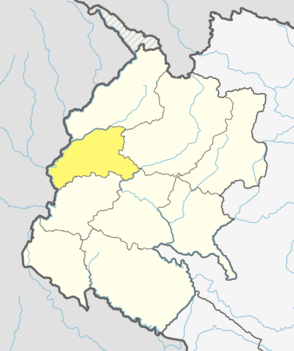
Kotila is a village development committee in Baitadi District in the Mahakali Zone of western Nepal. At the time of the 1991 Nepal census it had a population of 2,713 and had 472 houses in the town.
Deulekh is a village in Bajhang District in the Seti Zone of north-western Nepal. At the time of the 1991 Nepal census it had a population of 2,952 and had 456 houses in the village.

Boharigau is a village development committee in Darchula District in Sudurpashchim Pradesh of western Nepal. At the time of the 1991 Nepal census it had a population of 3262 people living in 572 individual households.
Dattu is a place belongs to Ward No 9 of Mahakali Municipality in Darchula District in Sudurpashchim Pradesh of western Nepal. At the time of the 1991 Nepal census it had a population of 1832 people living in 344 individual households. It consist of 9 sub regions: Sakar, Thapala, Mali Dattu, Bait, Ulaini, Tali Dattu, Udyai, Kholi, Chuchai. The south part is border with India which is separated by the Mahakali River, and the Indian markets Baluwakot and Ghatiwagad are connected by a hanging bridge, which helps access to Indian markets and trading business among residents and others nearby. The cultural relationship with India has also strengthened the ties among both countries' residents.
Ghusa is a village development committee in Darchula District in the Mahakali Zone of western Nepal. At the time of the 1991 Nepal census it had a population of 1026 people living in 165 individual households.
Gokuleshwar is a village development committee in Darchula District in the Mahakali Zone of western Nepal. At the time of the 1991 Nepal census it had a population of 2694 people living in 486 individual households.
Gulijar is a village development committee in Darchula District in the Mahakali Zone of western Nepal. At the time of the 1991 Nepal census it had a population of 2970 people living in 485 individual households.
Hunainath is a village development committee in Darchula District in the Mahakali Zone of western Nepal. At the time of the 1991 Nepal census it had a population of 1631.It is named after the Hunainath, a god in Nepal.
Huti is a village development committee (VDC) in Darchula District in the Mahakali Zone of western Nepal. At the time of the 1991 Nepal census it had a population of 2317 people living in 417 individual households. It is named after the village of Huti. The Brama Devta temple is located there at Huti-2 and is visited by many pilgrims.
Khalanga is a town and the district headquarters of the Darchula District in the Sudurpashchim Pradesh province of Nepal. It is part of the Mahakali Municipality in the Mahakali Zone. The town is located on the bank of Mahakali River and the border with Uttarakhand state, India. The town on the Indian side of the border also has similar name, spelt as Dharchula.
Khar is a village development committee (VDC) of Darchula District in the Mahakali Zone of Far-Western Development Region, Nepal. Geographically khar is located 29.79 N and 80.64 E, its nearest border to the district headquarters is Dallekh which is 10- 12 kilometer north east to the Darchula. The Khar VDC is surrounded by Sipti and Dhuligada VDC to the East and South, Katai to the West, and Eyarkot to the North. According to national census 2011 khar VDC has total population 4,272 residing 698 households.
Latinath is a village development committee in Darchula District in the Mahakali Zone of western Nepal. At the time of the 1991 Nepal census it had a population of 3392 people living in 587 individual households. In this development region one of the famous temple of this district is located which is called "latainath" or "latinath".
Pipalchauri is a village development committee in Darchula District in the Mahakali Zone of western Nepal. At the time of the 1991 Nepal census it had a population of 1854 people living in 293 individual households.
Sankarpur is a Village Development Committee in Darchula District in the Mahakali Zone of western Nepal. At the time of the 1991 Nepal census it had a population of 2645 people residing in 460 individual households.
Seri is a village development committee in Darchula District in the Mahakali Zone of western Nepal. At the time of the 1991 Nepal census it had a population of 1683 people living in 315 individual households.
Sipti is a village development committee in Darchula District in the Mahakali Zone of western Nepal. At the time of the 2011 Nepal census it had a population of 4,339 people living in 749 individual households.
Dallekh is a small village of Khar village Development committee of Darchula Nepal. According to national census report 2011 the population of Dallekh is nearly 800, resides in 85 households. Dallekh is a nearest border village of Khar VDC to the district headquarters, which is 10–12 km northeast from Darchula Khalanga.
