Güiria Airport

Last updated
Juan Manuel Valdez Airport
Güiria Airport
Summary
Airport type Public
Operator Government
Serves Güiria, Venezuela
Elevation  AMSL 42 ft / 13 m
Coordinates 10°34′25″N62°18′45″W / 10.57361°N 62.31250°W / 10.57361; -62.31250
Map
Venezuela location map (+claimed).svg
Airplane silhouette.svg
GUI
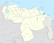
Location of the airport in Venezuela
Runways
Direction Length Surface
m ft
05/23 2,015 6,611 Asphalt
Source: WAD [1] GCM [2] Google Maps [3]

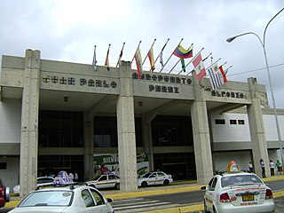
The Juan Manuel Valdez Airport or Güiria Airport (Spanish : Aeropuerto Juan Manuel Valdez), formerly known as Cristóbal Colón Airport, ( IATA : GUI, ICAO : SVGI) is an airport serving Güiria, in the state of Sucre in Venezuela.

Spanish language Romance language

Spanish or Castilian is a Romance language that originated in the Castile region of Spain and today has hundreds of millions of native speakers in the Americas and Spain. It is a global language and the world's second-most spoken native language, after Mandarin Chinese.

An IATA airport code, also known as an IATA location identifier, IATA station code or simply a location identifier, is a three-letter code designating many airports around the world, defined by the International Air Transport Association (IATA). The characters prominently displayed on baggage tags attached at airport check-in desks are an example of a way these codes are used.

ICAO airport code four-letter code designating many airports around the world

The ICAOairport code or location indicator is a four-letter code designating aerodromes around the world. These codes, as defined by the International Civil Aviation Organization and published in ICAO Document 7910: Location Indicators, are used by air traffic control and airline operations such as flight planning.

Contents

The Guiria non-directional beacon (Ident: GUI) is located on the field. [4]

Non-directional beacon radio transmitter which emits radio waves in all directions

A non-directional (radio) beacon (NDB) is a radio transmitter at a known location, used as an aviation or marine navigational aid. As the name implies, the signal transmitted does not include inherent directional information, in contrast to other navigational aids such as low frequency radio range, VHF omnidirectional range (VOR) and TACAN. NDB signals follow the curvature of the Earth, so they can be received at much greater distances at lower altitudes, a major advantage over VOR. However, NDB signals are also affected more by atmospheric conditions, mountainous terrain, coastal refraction and electrical storms, particularly at long range.
See also

Venezuela is connected to the world primarily via air and sea. In the south and east the Amazon rainforest region has limited cross-border transport; in the west, there is a mountainous border of over 1,375 miles (2,213 km) shared with Colombia. The Orinoco River is navigable by oceangoing vessels up to 400 km inland, and connects the major industrial city of Ciudad Guayana to the Atlantic Ocean.

Related Research Articles

Arturo Michelena International Airport airport in Venezuela

Arturo Michelena International Airport is an airport serving the city of Valencia in Venezuela, located two hours from Caracas by car. The airport was named after Venezuela's painter Arturo Michelena, who was born in Valencia.

Sucre (state) State of Venezuela

Sucre State is one of the 23 states of Venezuela. The state capital is Cumaná. Sucre State covers a total surface area of 11,800 km² and, as of the 2011 census, had a population of 896,921. The most important river in the state is the Manzanares River.

Juan Manuel Gálvez International Airport airport in Honduras

Juan Manuel Gálvez International Airport is an international airport located on the island of Roatán, in the Caribbean Sea 50 kilometres (31 mi) off the northern coast of Honduras. Roatán is in the Bay Islands Department of Honduras.

Gui or GUI may refer to:

Valdez TV is a Venezuelan community television channel. It was created in April 2005 and can be seen in the community of Güiria in the Valdez Municipality of the Sucre State of Venezuela on UHF channel 23. Marcos Vargas is the legal representative of the foundation that owns this channel.

Paria Peninsula Peninsula in Venezuela

The Paria Peninsula,, is a large peninsula on the Caribbean Sea, in the state of Sucre in northern Venezuela.

General José Francisco Bermúdez Airport airport

General José Francisco Bermúdez Airport is an airport serving the Caribbean coastal city of Carúpano, Venezuela. The airport is named in honor of José Francisco Bermúdez, a general in the Venezuelan War of Independence.

Antonio José de Sucre Airport airport in Venezuela

Antonio José de Sucre Airport is an airport serving Cumaná, the capital of Sucre state in Venezuela.

Juan Pablo Pérez Alfonzo Airport airport

Juan Pablo Pérez Alfonzo Airport, is an airport serving El Vigía, a city in Mérida state in Venezuela. It opened in 1991, and was named for the Venezuelan politician Juan Pablo Pérez Alfonzo (1903–1979).

La Fría Airport airport in Venezuela

La Fría Airport, also known as Francisco García de Hevia International Airport, is an airport serving La Fría, a town in the Táchira state of Venezuela. The runway is 2 kilometres (1.2 mi) northwest of the town.

Cacique Aramare Airport airport in Venezuela

Cacique Aramare Airport is an airport serving Puerto Ayacucho, the capital of the Amazonas state in Venezuela. The airport and city are on the Orinoco River, locally the border between Venezuela and Colombia.

Manuel Carlos Piar Guayana Airport airport

Manuel Carlos Piar Guayana International Airport, is an airport in the city of Ciudad Guayana, Venezuela. Ciudad Guayana is divided into two main population centres, San Félix and Puerto Ordaz, where the airport is located and hence its IATA code of PZO. The city sits at the confluence of the Orinoco and Caroni Rivers, and is the main access point for the natural attractions in south-east Venezuela, mainly Canaima National Park and Gran Sabana.

Juan Vicente Gómez International Airport airport

Juan Vicente Gómez International Airport, is an airport serving San Antonio del Táchira, in the Táchira state of Venezuela. In June 1993, it was renamed in honor of the early Venezuelan President Juan Vicente Gómez, who was from Táchira, in a ceremony presided over by interim President Ramón José Velásquez.

Mapire is a town situated in the Bideau Parish of the Valdez Municipality, Sucre, Venezuela. The town is situated 24 kilometers from Guiria, the capital of Valdez, on the Paria Peninsula.

Amor Del Bueno is a 2004 telenovela produced by Venevisión and Iguana Productions. Venezuelan actors Coraima Torres and Ricardo Álamo star as the main protagonists.

Güiria Place in Sucre, Venezuela

Güiria is the capital city of Valdez Municipality in the Venezuelan state of Sucre. Güiria was the place where the military campaign for South American independence set out to Upper Peru and also a starting point of the 1901 Venezuelan Civil War. Founded on 8 December 1767, Güiria is the state's third-largest urban centre, with a population of approximately 40,000. It is an important harbour, the only one in Venezuela located on the open Atlantic Ocean rather than on the Caribbean Sea, and the economic centre of Paria Peninsula, due to it being near the Gulf of Paria's natural gas fields, where several state and private companies have exploration projects.

Valdez Municipality Municipality in Sucre, Venezuela

Valdez is a municipality of Sucre State, Venezuela. The capital is Güiria.

Guarico Municipal Airport airport in Venezuela

Guarico Municipal Airport is an airport serving the city of San Juan de los Morros, the capital of Guárico state in Venezuela.

References