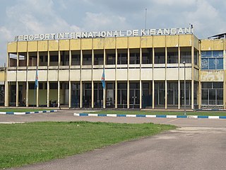
Kisangani Bangoka International Airport is an airport serving Kisangani, Democratic Republic of the Congo. The airport is 12 kilometres (7.5 mi) east of the city. The Bangoka VOR/DME is 1.7 nautical miles (3.1 km) west of the airport.

Kindu Airport is an airport serving the Lualaba River port of Kindu, Democratic Republic of the Congo.
Gbadolite Airport is an airport serving Gbadolite, the capital of the Nord-Ubangi Province in the Democratic Republic of the Congo. The airport is at the village of Moanda, 6 kilometres (3.7 mi) southwest of Gbadolite.

Bunia Airport is an airport serving Bunia the capital of Ituri province, Democratic Republic of the Congo.
Bria Airport is an airport serving Bria, a town on the Kotto River in the Haute-Kotto prefecture of the Central African Republic. The airport is in the southern section of the town.
Carnot Airport is an airstrip serving Carnot, a city in the Mambéré-Kadéï prefecture of the Central African Republic. The runway is on the western edge of the city.
N'Délé Airport is an airport serving N'Délé, a town in the Bamingui-Bangoran prefecture of the Central African Republic. The airport is on the northwest edge of the town.

Antonio José de Sucre Airport is a commercial airport serving Cumaná, the capital of Sucre state in Venezuela.
Faranah Airport is an airport serving the city of Faranah in Guinea. The airport is 2 kilometres (1.2 mi) west of the city, across the Niger River.
Saurimo Airport is a public use airport serving the city of Saurimo in Lunda Sul Province, Angola. It was formerly known as Henrique de Carvalho Airport.
Kang Airport is an airport serving the village of Kang, in the Kgalagadi District of Botswana.
Gitega Airport was an airport serving the city of Gitega, the current capital of Burundi. The airport was on a low ridge in the northwest section of the city.
Kirundo Airport is an airstrip serving the city of Kirundo, Burundi. The airstrip is 4 kilometres (2.5 mi) north of Kirundo, on the north shore of Lake Rwihinda.
Southdowns Airport is an airport serving Kitwe, a city in the Copperbelt Province in Zambia. The airport is located in Kalulushi District, in the countryside 9 kilometres (5.6 mi) southwest of Kitwe and 5 kilometres (3.1 mi) south-east of Kalulushi.
Gamboula Airport is an airstrip serving Gamboula, a town in the Mambéré-Kadéï prefecture of the Central African Republic. The airstrip is 3 kilometres (2 mi) northeast of the town, alongside the RN6 road.

Teniente Julio Gallardo Airport, is an airport serving Puerto Natales, a city in the Magallanes Region of Chile. The airport is 7 kilometres (4.3 mi) north-northwest of Puerto Natales, which is on the Admiral Montt Gulf (es), a long fjord that reaches inland close to the border with Argentina. The airport is 12 kilometres (7.5 mi) from the border.
Chelinda Airport is an airport serving Chelinda, a village in the Northern Region of Malawi.
Mafeteng Airport is an airport serving the city of Mafeteng, the capital of Mafeteng District, Lesotho.
Mantšonyane Airport is an airport serving the town of Mantšonyane in Thaba-Tseka District, Lesotho.
Kubuta Airfield is a rural airstrip serving Kubuta, an Inkhundla in the Shiselweni Region of Eswatini.
