Zevenkamp is a neighbourhood in the borough Prins Alexander, Rotterdam.

Therese-Giehse-Allee is a station on the U5 line of the Munich U-Bahn, named after the German actress Therese Giehse.

The Quadrilatero is the traditional name of a defensive system of the Austrian Empire in the Lombardy-Venetia region of Italy, which connected the fortresses of Peschiera, Mantua, Legnago and Verona between the Mincio, the Po and Adige Rivers. The name refers to the fact that on a map the fortresses appear to form the vertices of a quadrilateral. In the period between the end of the Napoleonic Wars and the Revolutions of 1848, they were the only fully modernized and armed fortresses within the Empire.

The Sacro Monte di Crea is a Roman Catholic sanctuary in the comune of Serralunga di Crea, Piedmont, northern Italy. It is reached via a steeply ascending route which winds through a wooded natural park, whose flora where catalogued by the Casalese photographer and polymath Francesco Negri.

WDBC is a radio station licensed to Escanaba, Michigan broadcasting a full-service format featuring news, talk and adult standards music.
Abba Khel is a town and Union Council of Lakki Marwat District in Khyber Pakhtunkhwa.
Baist Khel is a town and union council in Lakki Marwat District of Khyber-Pakhtunkhwa. It is located at 32°43'9N 70°45'29E and has an altitude of 269 metres.

Shorlu is a town in the Ararat Province of Armenia.

Brzózki is a village in the administrative district of Gmina Szubin, within Nakło County, Kuyavian-Pomeranian Voivodeship, in north-central Poland. It lies approximately 9 kilometres (6 mi) north of Szubin, 10 km (6 mi) south-east of Nakło nad Notecią, and 19 km (12 mi) west of Bydgoszcz.

Măgurele is a commune in Prahova County, Romania. It is composed of three villages: Coada Malului, Iazu and Măgurele.

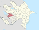
Horovlu is a village in the Jabrayil Rayon of Azerbaijan.
Grodzisk-Wieś is a village in the administrative district of Gmina Czerwin, within Ostrołęka County, Masovian Voivodeship, in east-central Poland.
Sierakowo is a village in the administrative district of Gmina Kościan, within Kościan County, Greater Poland Voivodeship, in west-central Poland. It lies approximately 3 kilometres (2 mi) north-west of Kościan and 40 km (25 mi) south-west of the regional capital Poznań.
Boża Wólka is a village in the administrative district of Gmina Mrągowo, within Mrągowo County, Warmian-Masurian Voivodeship, in northern Poland.
Gostyniec is a village in the administrative district of Gmina Świerzno, within Kamień County, West Pomeranian Voivodeship, in north-western Poland. It lies approximately 4 kilometres (2 mi) north of Świerzno, 13 km (8 mi) east of Kamień Pomorski, and 69 km (43 mi) north of the regional capital Szczecin.
Grabowo is a settlement in the administrative district of Gmina Siemyśl, within Kołobrzeg County, West Pomeranian Voivodeship, in north-western Poland.
Vallvidrera, el Tibidabo i les Planes is a neighborhood in the Sarrià-Sant Gervasi district of Barcelona, Catalonia (Spain). It is formed by three areas: Vallvidrera, Tibidabo and les Planes.
Hasanlar Dam is a dam in Düzce Province, Turkey, built between 1965 and 1972. The development was backed by the Turkish State Hydraulic Works.
Taga-Roostoja is a village in Alutaguse Parish, Ida-Viru County in northeastern Estonia.
Hasanlar is a village in the District of Gerede, Bolu Province, Turkey. As of 2010 it had a population of 32 people.