
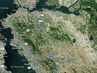
Hacienda Business Park is a 900-acre (364 hectare) mixed-use job center and housing development in Pleasanton, California. [1] [2]
Hacienda Business Park is a 900-acre (364 hectare) mixed-use job center and housing development in Pleasanton, California. [1] [2]
Approved in 1982 and ratified by Pleasanton voters in 1983, [3] the business park covers approximately 20 square blocks and features many multi-story office buildings and headquarters for mid-sized companies. It was envisioned by local and county planners as a location for office space that would be less expensive than that of Silicon Valley or San Francisco, close to housing in Pleasanton and nearby Dublin as well as the homes of existing employees in the San Francisco Bay Area. In 2010, the city settled a lawsuit to allow for more affordable housing development in the area. [2]
It is located adjacent to the Dublin/Pleasanton BART station. [1] San Joaquin Regional Transit District (SJRTD) provides commuter subscription service from the Central Valley on several lines in addition to local service provided by WHEELS and County Connection.

Alameda County is a county in the state of California in the United States. As of the 2010 census, the population was 1,510,271, making it the 7th-most populous county in the state. and 20th most populous nationally. The county seat is Oakland. Alameda County is included in the San Francisco Bay Area, occupying much of the East Bay region.

Dublin is a suburban city of the East Bay and Tri-Valley regions of Alameda County, California, United States. It is located along the north side of Interstate 580 at the intersection with Interstate 680, roughly 35 miles (56 km) east of downtown San Francisco, 23 miles (37 km) east of downtown Oakland, and 31 miles (50 km) north of downtown San Jose.

Pleasanton is a city in Alameda County, California, incorporated in 1894. It is a suburb in the San Francisco Bay Area located about 25 miles (40 km) east of Oakland, and 6 miles (9.7 km) west of Livermore. The population was 70,285 at the 2010 census. In 2005 and 2007, Pleasanton was ranked the wealthiest middle-sized city in the United States by the Census Bureau. Pleasanton is home to the headquarters of Safeway, Workday, Ellie Mae, Roche Molecular Diagnostics, Blackhawk Network Holdings, and Veeva Systems. Other major employers include Kaiser Permanente, Oracle, Nordstrom and Macy's. Although Oakland is the Alameda County seat, a few county offices are located in Pleasanton. The Alameda County Fairgrounds are located in Pleasanton, where the county fair is held during the last week of June and the first week of July. Pleasanton Ridge Regional Park is located on the west side of town.

South San Francisco is a city in San Mateo County, California, United States, located on the San Francisco Peninsula in the San Francisco Bay Area. The city is colloquially known as “South City”. The population was 63,632 at the 2010 census.

The Tri-Valley area is a triangle-shaped region of the eastern San Francisco Bay Area, 18 miles southeast of Oakland and 33 miles from San Francisco. It encompasses the cities of Dublin, Livermore, Pleasanton and San Ramon, the town of Danville and the CDPs of Alamo, Blackhawk and Diablo.

WHEELS is a bus service that provides public transportation in the Tri-Valley Region of the San Francisco Bay Area, in the United States. Started in 1986, Wheels offers service to various communities in three cities, and connects to Bay Area Rapid Transit (BART) and Altamont Corridor Express (ACE) trains for connections to and from the greater Bay Area and Central Valley.
The East Bay is the eastern region of the San Francisco Bay Area and includes cities along the eastern shores of the San Francisco Bay and San Pablo Bay. The region has grown to include inland communities in Alameda and Contra Costa counties. With a population of roughly 2.5 million in 2010, it is the most populous subregion in the Bay Area.
The Iron Horse Regional Trail is a rail trail for pedestrians, horse riders and bicycles in the East Bay Area in California.

The Dublin/Pleasanton–Daly City line is a Bay Area Rapid Transit (BART) line in the San Francisco Bay Area that runs between Dublin/Pleasanton station and Daly City station. It has 18 stations in Dublin, Pleasanton, Castro Valley, San Leandro, Oakland, San Francisco, and Daly City. The line is colored blue on maps, and BART has begun to call it the Blue Line. Some Sunday daytime service on the line terminates at Montgomery Street station.

Dublin/Pleasanton is a Bay Area Rapid Transit station on the border of Dublin and Pleasanton. The eastern end of the Dublin/Pleasanton–Daly City line, it is a major bus terminal served by six providers.

The Sunol Water Temple is located at 505 Paloma Way in Sunol, California. Designed by Willis Polk, the 59 foot high classical pavilion is made up of twelve concrete Corinthian columns and a concrete ring girder that supports the conical wood and tile roof. Inside the temple, water originally from the Pleasanton well fields and Arroyo de la Laguna flowed into a white tiled cistern before plunging into a deeper water channel carrying water from the filter galleries to the Niles Aqueduct in Niles Canyon and across San Francisco Bay near the Dumbarton Bridge. The roof covering the cistern has paintings depicting Native American maidens carrying water vessels. The temple is open to the public Monday to Friday, 9 a.m. to 3 p.m.

The Federal Correctional Institution, Dublin is a low-security United States federal prison for female inmates in Dublin, California. The facility also has an adjacent satellite prison camp housing minimum-security female offenders.
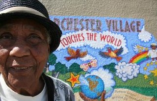
Parchester Village is a planned majority African-American village in northwestern Richmond, California that was the first in the state to sell to blacks.

West Dublin/Pleasanton is a Bay Area Rapid Transit (BART) station on the Dublin/Pleasanton–Daly City line, located in the median of I-580 on the border of Dublin and Pleasanton in the northwestern Amador Valley. It was an infill station and opened in 2011 - fourteen years after the rest of the line.
Greenbelt Alliance is a non-profit land conservation and urban planning organization that has worked in California's nine-county San Francisco Bay Area since 1958.

Throughout the history of Bay Area Rapid Transit, better known as BART, there have been plans to extend service to other areas.
Bay Area Rapid Transit, widely known by the acronym BART, is the main rail transportation system for the San Francisco Bay Area. It was envisioned as early as 1946 but the construction of the original system began in the 1960s.
Amador Valley is a valley in eastern Alameda County, California and is the location of the cities of Dublin and Pleasanton. The valley is bounded by the foothills of the Diablo Range on the north and south, Pleasanton Ridge to the west, and Livermore Valley to the east.
Rancho Santa Rita was a 8,894-acre (35.99 km2) Mexican land grant in the Amador Valley and western Livermore Valley, which is in present day Alameda County, California.
Naglee Park and Ride Lot was a transit center in Tracy, California. The lot served as a bus hub for transportation on local, commuter, and long-distance bus services. It was closed by the city in spring 2016 after being sold for development as a Chipotle Mexican Grill and Panera Bread restaurant.
Coordinates: 37°41′N121°54′W / 37.69°N 121.9°W
| This Alameda County, California building and structure-related article is a stub. You can help Wikipedia by expanding it. |