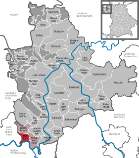
Aschaffenburg is a Landkreis (district) in Bavaria, Germany. It is bounded by the districts of Darmstadt-Dieburg, Offenbach, Main-Kinzig, the districts Main-Spessart and Miltenberg, and the town of Aschaffenburg.

Spessart is a Mittelgebirge, a range of low wooded mountains, in the States of Bavaria and Hesse in Germany. It is bordered by the Vogelsberg, Rhön and Odenwald. The highest elevation is the Geiersberg at 586 metres above sea level.

Schöllkrippen is a market community in the Aschaffenburg district in the Regierungsbezirk of Lower Franconia (Unterfranken) in Bavaria, Germany and seat of the Verwaltungsgemeinschaft of Schöllkrippen. It has a total population of around 4,300 (2020).

Mömbris is a community – since 31 January 1964 a market community – in the Aschaffenburg district in the Regierungsbezirk of Lower Franconia (Unterfranken) in Bavaria, Germany. With over 11,000 inhabitants, Mömbris is the district's fifth largest community.

The Kahlgrund is an area in the northern Spessart in Lower Franconia, Bavaria, Germany, following the valley of the river Kahl. It roughly corresponds to the former district of Alzenau, which was merged into the district of Aschaffenburg in 1972. A small part of the area is part of the Main-Kinzig-Kreis, Hesse.

Alzenau is a town in the north of the Aschaffenburg district in the Regierungsbezirk of Lower Franconia (Unterfranken) in Bavaria, Germany. Until 1 July 1972, Alzenau was the district seat of the now abolished district of the same name and has a population of around 19,000.

Kleinkahl is a community in the Aschaffenburg district in the Regierungsbezirk of Lower Franconia (Unterfranken) in Bavaria, Germany, and a member of the Verwaltungsgemeinschaft of Schöllkrippen. Kleinkahl has around 1,800 inhabitants.

Mespelbrunn is a community in the Aschaffenburg district in the Regierungsbezirk of Lower Franconia (Unterfranken) in Bavaria, Germany and a member of the Verwaltungsgemeinschaft of Mespelbrunn, whose seat is in Heimbuchenthal.

Sommerkahl is a community in the Aschaffenburg district in the Regierungsbezirk of Lower Franconia (Unterfranken) in Bavaria, Germany and a member of the Verwaltungsgemeinschaft of Schöllkrippen. It has a population of around 1,300 (2020).

Fellen is a community in the Main-Spessart district in the Regierungsbezirk of Lower Franconia (Unterfranken) in Bavaria, Germany and a member of the Verwaltungsgemeinschaft of Burgsinn.
Hasloch is a community in the Main-Spessart district in the Regierungsbezirk of Lower Franconia (Unterfranken) in Bavaria, Germany and a member of the Verwaltungsgemeinschaft of Kreuzwertheim. Hasloch has a population close to 1,400.

Neuhütten is a community in the Main-Spessart district in the Regierungsbezirk of Lower Franconia (Unterfranken) in Bavaria, Germany and a member of the Verwaltungsgemeinschaft of Partenstein. It has a population of around 1,100.

Sinntal is a municipality in the Main-Kinzig district, in Hesse, Germany. It has a population of around 8,900.

The Ludwig Western Railway is a German railway line that was originally funded by the Kingdom of Bavaria. It runs from Bamberg via Würzburg to Aschaffenburg and on into the former "Kurhessian" Hanau.

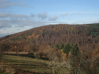
Hohe Mark (Spessart) is a wooded hill of Bavaria, Germany. It is part of the Mittelgebirge Spessart and lies in the district of Aschaffenburg, near Alzenau.
Schanzenkopf (Schwedenschanze) is a wooded hill in the Aschaffenburg district of Bavaria, Germany. It is part of the Mittelgebirge Spessart and lies right on the border with the state of Hesse.
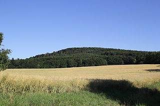
Schanzenkopf (Spessart) is a wooded hill of Bavaria, Germany. It lies in the Mittelgebirge Spessart in the district of Aschaffenburg.

The Kahl is a river in the northern Spessart in Bavaria and Hesse, Germany. It is a right tributary of the Main and is 35.6 km (22.1 mi) long. The name Kahl comes from the Old High German word kaldaha, which means cool and clear. The Kahl rises from two sources left and right of the road at the foot of the Spessart hills, near Kleinkahl. These springs produce 50–60 litres per second. The Kahl flows into the river Main in Kahl am Main. The mouth is near the old Kahl Nuclear Power Plant. The largest tributaries are Westerbach, Sommerkahl, Reichenbach and Geiselbach.

The Eselsweg is a long-distance hiking trail that follows an ancient trade route through the Mittelgebirge Spessart, in the states of Hesse and Bavaria, Germany. It is 111 km long and leads from Schlüchtern in the valley of the Kinzig river to Großheubach on the river Main. The trail follows an ancient trade route on which donkey caravans used to transport salt, thus giving rise to the name.
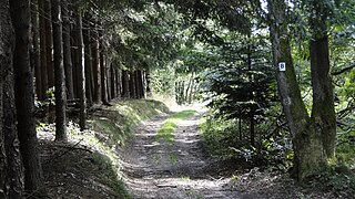
The Birkenhainer Straße is a long-distance hiking trail that follows an ancient trade route through the Mittelgebirge Spessart, in the states of Hesse and Bavaria, Germany. It is 71 km long and leads from Hanau to Gemünden am Main, cutting across the so-called Mainviereck, a large loop of the river Main. The trail follows an ancient trade route which in the Middle Ages was an important road for moving troops and for long-distance trade. The Birkenhainer Straße was a part of the link between Nuremberg and Antwerp. Its origins may lie back as far as the Neolithic period. The name likely derives from a prominent copse of birch trees that used to exist near the road at Geiselbach (Hesse).


