Hahnenmoos Pass

Last updated
Hahnenmoos Pass

Dammerung Hahnenmoospass.jpg

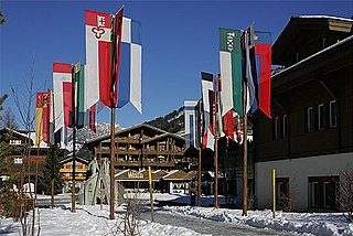
The Hahnenmoos Pass in winter
Elevation 1,950 m (6,398 ft)
Traversed by Trail (dead end road)
Location Bern, Switzerland
Range Bernese Alps
Coordinates 46°27′11″N7°29′42″E / 46.45306°N 7.49500°E / 46.45306; 7.49500 Coordinates: 46°27′11″N7°29′42″E / 46.45306°N 7.49500°E / 46.45306; 7.49500
Switzerland relief location map.jpg
Red pog.svg
Location in Switzerland

The Hahnenmoos Pass (German: Hahnenmoospass) is a mountain pass of the Bernese Alps. The pass crosses the col between the peaks of Regenboldshorn and Albristhorn, at an elevation of 1,950 m (6,400 ft). The Hahnenmoos Pass is the lowest pass between the Engstligental, to the east, and the upper Simmental, to the west. [1]

German language West Germanic language

German is a West Germanic language that is mainly spoken in Central Europe. It is the most widely spoken and official or co-official language in Germany, Austria, Switzerland, South Tyrol (Italy), the German-speaking Community of Belgium, and Liechtenstein. It is also one of the three official languages of Luxembourg and a co-official language in the Opole Voivodeship in Poland. The languages which are most similar to German are the other members of the West Germanic language branch: Afrikaans, Dutch, English, the Frisian languages, Low German/Low Saxon, Luxembourgish, and Yiddish. There are also strong similarities in vocabulary with Danish, Norwegian and Swedish, although those belong to the North Germanic group. German is the second most widely spoken Germanic language, after English.

Mountain pass Route through a mountain range or over a ridge

A mountain pass is a navigable route through a mountain range or over a ridge. Since many of the world's mountain ranges have presented formidable barriers to travel, passes have played a key role in trade, war, and both human and animal migration throughout Earth's history. At lower elevations it may be called a hill pass. The highest vehicle-accessible pass in the world appears to be Mana Pass, located in the Himalayas on the border between India and Tibet, China.

Bernese Alps part of the Alps mountain range in Switzerland

The Bernese Alps are a mountain range of the Alps, located in western Switzerland. Although the name suggests that they are located in the Berner Oberland region of the canton of Bern, portions of the Bernese Alps are in the adjacent cantons of Valais, Fribourg and Vaud, the latter being usually named Fribourg Alps and Vaud Alps respectively. The highest mountain in the range, the Finsteraarhorn, is also the highest point in the canton of Bern.

Contents

The pass is traversed by a hiking track, which connects Adelboden, at an elevation of 1,350 m (4,430 ft) in the Engstligental, with Lenk, at an elevation of 1,068 m (3,504 ft) in the Simmental. The track forms part of the Alpine Pass Route, a long-distance hiking trail across Switzerland between Sargans and Montreux. Although a road leads to the pass from Adelboden, the pass can not be traversed by car. [1] [2]

Adelboden Place in Bern, Switzerland

Adelboden is a mountain village and a municipality in Switzerland, located in the Frutigen-Niedersimmental administrative district in the Bernese Highlands.

Lenk im Simmental Place in Bern, Switzerland

Lenk im Simmental is a municipality in the Obersimmental-Saanen administrative district in the canton of Bern in Switzerland.

The Alpine Pass Route is a long-distance hiking trail through the Alps in Switzerland, part of the Via Alpina route. It starts in Sargans in eastern Switzerland, and crosses the heart of country westwards to finish in Montreux on the shore of Lake Geneva. The total route covers over 325 kilometres (202 mi) and crosses 16 mountain passes, and takes 15 or more walking days to complete.

In winter the pass is part of a ski area. The Berghotel Hahnenmoospass is a hotel and restaurant that is located at the summit of the pass and is open in both summer and winter. [3]

See also

Related Research Articles

Kleine Scheidegg mountain pass

The Kleine Scheidegg is a mountain pass at an elevation of 2,061 m (6,762 ft), situated below and between the Eiger and Lauberhorn peaks in the Bernese Oberland region of Switzerland. The name means "minor watershed", even though it is actually higher than the neighbouring Grosse Scheidegg. Possibly this is because Kleine Scheidegg is a watershed between the two arms of the Lütschine river, while Grosse Scheidegg divides the Lütschine from the Rychenbach stream.

Bernese Highlands higher part of the canton of Bern, Switzerland

The Berner Oberland, is the higher part of the canton of Bern, Switzerland, in the southern end of the canton, and one of the canton's five administrative regions.

Klausen Pass mountain pass in Switzerland, between Uri and Glarus cantons

Klausen Pass is a high mountain pass in the Swiss Alps connecting Altdorf in the canton of Uri with Linthal in the canton of Glarus. Somewhat unusually, the boundary between the two cantons does not lie at the summit of the pass, but some 8 kilometres (5.0 mi) down the slope towards Linthal, with the summit being in Uri.

Grosse Scheidegg mountain pass

The Grosse Scheidegg is a mountain pass in the Bernese Alps of Switzerland, The pass crosses the col between the Schwarzhorn and the Wetterhorn mountains at an elevation of 1,962 m (6,437 ft).

Col des Mosses mountain pass in Switzerland

Col des Mosses is a mountain pass in the western Bernese Alps of Switzerland. The pass is located in the municipality of Ormont-Dessous in the canton of Vaud. It links Aigle, to the south in the valley of the Rhone, with Château-d'Œx, to the north in the valley of the Sarine, and is flanked to the west by the Mont d'Or and to the east by the Pic Chaussy.

Engstligenalp valley

The Engstligenalp is a plateau of the western Swiss Alps. It lies south of Adelboden at 1900 – 2000 m above sea level. Since 1996 it has belonged to the Swiss culture landscapes of national importance.

Wildstrubel mountain of the Bernese Alps

The Wildstrubel is a mountain of the Alps, straddling the border between the Swiss cantons of Bern and Valais. It forms a large glaciated massif, about 15 km wide, extending between the Rawil Pass and the Gemmi Pass. Along with the Muverans, the Diablerets and the Wildhorn, the Wildstrubel is one the four distinct mountain massifs of the Bernese Alps that lie west of the Gemmi Pass. The massif of the Wildstrubel is at the centre between the valleys of Simmental (BE), Engstligental (BE) and the Rhone (VS), the exact location of the tripoint being the summit of the Schneehorn. It comprises several distinct summits, including the Wetzsteinhorn, the Rohrbachstein, the Weisshorn, the Pointe de la Plaine Morte, Mont Bonvin, the Trubelstock and the Schneehorn. The main crest with the almost equally high summits of the Mittelgipfel and the Grossstrubel forms an amphitheatre oriented eastward which ends at the Steghorn and the Daubenhorn. This area encloses the Wildstrubel Glacier. To the southwest, the Wildstrubel overlooks the high plateau of the Plaine Morte Glacier, which also includes an unnamed lake below the Schneehorn.

Hausstock mountain in the Glarus Alps

The Hausstock is a mountain in the Glarus Alps, at an elevation of 3,158 m (10,361 ft) on the border between the cantons of Glarus and Graubünden. It overlooks the valleys of Linth and Sernf rivers in Glarus, and the valley of the Vorderrhein river in Graubünden. The Hausstock was the site of the 1799 withdrawal of the Russian army under General Alexander Suvorov. A well-known destination already in the nineteenth century with British and American climbers, the mountain remains popular with mountain climbers and skiers.

Gross Lohner mountain

The Gross Lohner, is a limestone mountain of the Bernese Alps, located between Adelboden and Kandersteg in the Bernese Oberland. The main summit has an elevation of 3,048.7 metres (10,002 ft) above sea level and is distinguished by the name Vorder Lohner. The mountain features several other peaks, from east to west:

Surenen Pass mountain pass in Central Switzerland

The Surenen Pass is a high mountain pass across the Urner Alps in the canton of Uri in Central Switzerland. The pass crosses the col between the Blackenstock and the Eggenmanndli peaks, at an elevation of 2,292 m (7,520 ft).

Chlyne Lohner mountain

The Chlyne Lohner is a mountain of the Bernese Alps, located between the valleys of Adelboden and Kandersteg.

Joch Pass mountain pass in Switzerland, connecting Innertkirchen in the canton of Bern with Engelberg in the canton of Obwalden

The Joch Pass is a mountain pass of the Uri Alps, located between the Bernese Oberland and Central Switzerland, at the foot of the Titlis. The pass crosses the col between the peaks of Graustock and Jochstock, at an elevation of 2,207 m (7,241 ft) and at the border between the cantons of Bern and Nidwalden.

Foo Pass

The Foo Pass is a mountain pass of the Glarus Alps, located on the border between the Swiss cantons of St. Gallen and Glarus, at an elevation of 2,223 m (7,293 ft). It crosses the col between the peaks of Foostock and Piz Sardona.

Richetli Pass

The Richetli Pass is a high mountain pass in the Glarus Alps in the Swiss canton of Glarus. The pass crosses between the heads of the valleys of the Linth and the Sernf rivers, using the col between the Hausstock and Kärpf mountains, at an elevation of 2,261 m (7,418 ft).

Sefinenfurgge Pass mountain pass in the Swiss canton of Bern

The Sefinafurgga is a mountain pass of the Bernese Alps. The pass crosses the col between the peaks of Hundshore and Bütlasse, at an elevation of 2,612 m (8,570 ft).

Hohtürli mountain pass

The Hohtürli is a high Alpine hiking pass of the Bernese Alps. The pass crosses the col between the peaks of Wildi Frau and Dündenhorn, at an elevation of 2,778 m (9,114 ft).

Bunderchrinde Pass mountain pass

The Bunderchrinde Pass is a mountain pass of the Bernese Alps. The pass crosses the col between the peaks of Gross Lohner and Chlyne Lohner, at an elevation of 2,385 m (7,825 ft).

Riseten Pass

The Riseten Pass is a mountain pass of the Glarus Alps, located on the border between the Swiss cantons of St. Gallen and Glarus, at an elevation of 2,189 m (7,182 ft). It crosses the col between the peaks of the Wissgandstöckli and Foostock.

References

  1. 1 2 map.geo.admin.ch (Map). Swiss Confederation. Retrieved 2015-05-21.
  2. Reynolds, Kev (2011). "Trek 10 - Alpine Pass Route". Trekking in the Alps. Cicerone. pp. 124–135. ISBN   978 1 85284 600 8.
  3. "Berghotel Hahnenmoospass". Berghotel Hahnenmoospass. Archived from the original on 2016-03-04. Retrieved 2015-05-22.