List of highest paved roads in Switzerland

Last updated

The Grimsel Pass road Grimselsee, 2010 07.JPG
The Grimsel Pass road

This is a list of the highest paved roads in Switzerland. It includes paved roads in the Alps that are over 1 kilometre (0.62 miles) long and whose culminating point is over 1,850 metres (6,070 feet) above sea level. This height approximately corresponds to that of the highest major settlements in the country. [1] Some of the listed roads are closed to motorised vehicles, although they are normally all accessible to pedestrians and cyclists. These mountain roads are popular with drivers, bikers and cyclists for their spectacular scenery and are often the highlights of bicycle races such as Tour de Suisse and Tour de Romandie. Many of them are also served by public transport, the main transport company being PostBus Switzerland.

Contents

As the tree line lies at approximately 2,000 metres in the Alps, almost all the upper sections of the listed roads are in the alpine zone, where the main form of precipitation becomes snow. Most of these roads are closed in winter, although important road links such as the Simplon remain open through the year.

This list does not include any motorway as the three highest motorways (San Bernardino Tunnel, Gotthard Road Tunnel and Vue des Alpes Tunnel) are below 1,700 metres. For a list including only road passes, see list of highest road passes in Switzerland.

List

Road Highest elevation Canton(s) [2] Itinerary (highest point)Highest pointType [3] Notes
Umbrail2,501 m (8,205 ft) Graubünden Santa Maria Val Müstair Umbrail Pass Bormio (IT) 46°32′35″N10°26′02″E / 46.54306°N 10.43389°E / 46.54306; 10.43389 (Umbrail Pass) Pass
Nufenen2,478 m (8,130 ft) Ticino/Valais Bedretto Nufenen Pass Ulrichen 46°28′41″N08°23′35″E / 46.47806°N 8.39306°E / 46.47806; 8.39306 (Nufenen Pass) PassOnly road between the cantons of Ticino and Valais
Great St Bernard (pass road)2,469 m (8,100 ft) Valais Bourg-Saint-Pierre Great St Bernard Pass Saint Oyen (IT) 45°52′08″N7°10′14″E / 45.86889°N 7.17056°E / 45.86889; 7.17056 (Great St Bernard Pass) Pass
Furka2,429 m (7,969 ft) Uri/Valais Realp Furka Pass Oberwald 46°34′22″N08°25′00″E / 46.57278°N 8.41667°E / 46.57278; 8.41667 (Furka Pass) PassOnly road between the cantons of Valais and Uri
Grimsel Panoramastrasse2,390 m (7,841 ft) Bern Grimsel PassStierenbergOberaarsee 46°33′08″N08°16′48″E / 46.55222°N 8.28000°E / 46.55222; 8.28000 (Oberaarsee) Dead-end
Moiry2,389 m (7,838 ft) Valais GrimentzLac de MoiryLac de Châteaupré 46°06′24″N07°34′44″E / 46.10667°N 7.57889°E / 46.10667; 7.57889 (Moiry) Dead-end
Griessee2,387 m (7,831 ft) Valais Nufenen Pass road– Griessee 46°27′44″N08°22′22″E / 46.46222°N 8.37278°E / 46.46222; 8.37278 (Griessee) Dead-endStarting point on the Nufenen Pass road (p. 2,303 m)
Flüela2,383 m (7,818 ft) Graubünden Davos Flüela Pass Susch 46°45′01″N09°56′52″E / 46.75028°N 9.94778°E / 46.75028; 9.94778 (Flüela Pass) Pass
Alp Anarosa2,340 m (7,677 ft) Graubünden WergensteinTguma Parkplatz 46°37′26″N09°21′51″E / 46.62389°N 9.36417°E / 46.62389; 9.36417 (Tguma) Dead-end
Bernina2,329 m (7,641 ft) Graubünden Pontresina Bernina Pass Poschiavo 46°24.744′N10°1.71′E / 46.412400°N 10.02850°E / 46.412400; 10.02850 (Bernina Pass) PassAlso a railway pass (2,253 m); only road between the valley of Poschiavo and the rest of the country
Livigno2,315 m (7,595 ft) Graubünden Poschiavo Livigno Pass Livigno (IT) 46°26′33″N10°03′25″E / 46.44250°N 10.05694°E / 46.44250; 10.05694 (Livigno Pass) Pass
Albula2,315 m (7,595 ft) Graubünden Bergün Albula Pass La Punt 46°35′N09°53′E / 46.583°N 9.883°E / 46.583; 9.883 (Albula Pass) PassRailway tunnel below the pass
Val Sambuco2,311 m (7,582 ft) Ticino Fusio Lago del Narèt 46°28′47″N8°34′31″E / 46.47972°N 8.57528°E / 46.47972; 8.57528 (Lago del Narèt) Dead-end
Robièi2,310 m (7,579 ft) Ticino Robièi Lago dei Cavagnöö 46°27′19″N08°30′30″E / 46.45528°N 8.50833°E / 46.45528; 8.50833 (Lago dei Cavagnöö) Dead-endOnly accessible by aerial tramway (lowest point: 1,856 m)
Julier2,284 m (7,493 ft) Graubünden Bivio Julier Pass Silvaplana 46°28.32′N09°43.74′E / 46.47200°N 9.72900°E / 46.47200; 9.72900 (Julier Pass) Pass
Susten2,264 m (7,428 ft) Bern/Uri Gadmen Susten Pass Wassen 46°43.8′N08°26.94′E / 46.7300°N 8.44900°E / 46.7300; 8.44900 (Susten Pass) PassRoad tunnel at 2,224 m, dead-end road to the summit of the pass on the Bernese side; only road between the cantons of Bern and Uri
Lago della Sella dam2,257 m (7,405 ft) Ticino Gotthard Pass Hospice– Lago della Sella 46°33′33″N08°35′34″E / 46.55917°N 8.59278°E / 46.55917; 8.59278 (Lago della Sella) Dead-end
Sanetsch2,252 m (7,388 ft) Valais Conthey or Savièse Sanetsch Pass Lac de Sanetsch 46°19′51″N07°17′10″E / 46.33083°N 7.28611°E / 46.33083; 7.28611 (Sanetsch Pass) Dead-endRoad ends at Lac de Sanetsch
Passo Scimfuss2,242 m (7,356 ft) Ticino Gotthard Pass Hospice–Passo Scimfuss 46°32′35″N08°35′28″E / 46.54306°N 8.59111°E / 46.54306; 8.59111 (Passo Scimfuss) Dead-end
Alpe Galm2,231 m (7,320 ft) Valais GuttetGalm 46°21′23″N07°40′52″E / 46.35639°N 7.68111°E / 46.35639; 7.68111 (Galm) Dead-end
Männlichen2,224 m (7,297 ft) Bern Grindelwald Männlichen Station 46°36′41″N07°56′33″E / 46.61139°N 7.94250°E / 46.61139; 7.94250 (Männlichen Station) Dead-end
Emosson2,206 m (7,238 ft) Valais FinhautLac d'Emosson Lac du Vieux Emosson 46°03′47″N06°53′56″E / 46.06306°N 6.89889°E / 46.06306; 6.89889 (Vieux Emosson) Dead-endPublic road to Emosson dam (1,965 m), limited access to Vieux Emosson dam
Täschalp2,205 m (7,234 ft) Valais TäschTäschalp 46°03′30″N07°48′45″E / 46.05833°N 7.81250°E / 46.05833; 7.81250 (Täschalp) Dead-end
Mattmark2,203 m (7,228 ft) Valais Saas-Almagell Mattmarksee 46°03′01″N07°57′50″E / 46.05028°N 7.96389°E / 46.05028; 7.96389 (Mattmarksee) Dead-end
Croix de Coeur2,173 m (7,129 ft) Valais VerbierCroix de Coeur 46°07′18″N07°13′57″E / 46.12167°N 7.23250°E / 46.12167; 7.23250 (Croix de Coeur) Dead-endGravel road from La Tsoumaz side
Grimsel2,164 m (7,100 ft) Bern/Valais Guttannen Grimsel Pass Oberwald 46°33.72′N8°20.34′E / 46.56200°N 8.33900°E / 46.56200; 8.33900 (Grimsel Pass) PassOnly paved road between the cantons of Bern and Valais
Ofen2,149 m (7,051 ft) Graubünden Zernez Ofen Pass Tschierv 46°38.472′N10°17.598′E / 46.641200°N 10.293300°E / 46.641200; 10.293300 (Ofen Pass) PassOnly paved road between the Val Müstair and the rest of the country
Val des Dix2,141 m (7,024 ft) Valais Hérémence or Euseigne Grande Dixence 46°05′03″N07°24′13″E / 46.08417°N 7.40361°E / 46.08417; 7.40361 (Grande Dixence) Dead-endPaved road ends at Le Chargeur, at the foot of the dam
Nagens2,134 m (7,001 ft) Graubünden LaaxNagen 46°51′42″N09°13′50″E / 46.86167°N 9.23056°E / 46.86167; 9.23056 (Nagens) Dead-end
Avers2,124 m (6,969 ft) Graubünden Ausserferrera Juf 46°26′45″N09°34′45″E / 46.44583°N 9.57917°E / 46.44583; 9.57917 (Juf) Dead-endRoad to the highest settlement in Europe
Splügen2,117 m (6,946 ft) Graubünden Splügen Splügen Pass Campodolcino (IT) 46°30.36′N09°20.22′E / 46.50600°N 9.33700°E / 46.50600; 9.33700 (Splügen Pass) Pass
Val d'Arolla2,107 m (6,913 ft) Valais Les Haudères Arolla 46°01′33″N07°28′39″E / 46.02583°N 7.47750°E / 46.02583; 7.47750 (Arolla) Dead-endHighest point above Arolla
Gotthard (main pass road)2,106 m (6,909 ft) Ticino/Uri Airolo Gotthard Pass Hospenthal 46°33′33″N8°33′41″E / 46.559167°N 08.561389°E / 46.559167; 08.561389 (Gotthard Pass) PassHighest point on the Uri side: 1,903 m
Gotthard (Tremola road) 2,106 m (6,909 ft) Ticino/Uri Airolo (Motto Bartola)– Gotthard Pass Hospenthal (Brüggloch) 46°33′33″N8°33′41″E / 46.559167°N 08.561389°E / 46.559167; 08.561389 (Gotthard Pass) PassHistorical road mostly paved with granite stones, highest point on the Uri side: 1,903 m
Lauchernalp2,102 m (6,896 ft) Valais Wiler (Lötschen) Lauchernalp 46°24′54″N07°46′15″E / 46.41500°N 7.77083°E / 46.41500; 7.77083 (Lauchernalp) Dead-end
Weritzalp2,099 m (6,886 ft) Valais Wiler (Lötschen)Weritzalp 46°25′18″N07°47′33″E / 46.42167°N 7.79250°E / 46.42167; 7.79250 (Weritzalp) Dead-end
Thyon2,095 m (6,873 ft) Valais Hérémence Thyon 46°10′55″N07°22′21″E / 46.18194°N 7.37250°E / 46.18194; 7.37250 (Thyon) Dead-end
Stein Glacier2,090 m (6,857 ft) Bern Hotel Steingletscher–Parkplatz 46°42′48″N08°24′58″E / 46.71333°N 8.41611°E / 46.71333; 8.41611 (Steingletscher) Dead-endStarting point on the Susten Pass road (1,865 m), end at the foot of the western Stein Glacier tongue
Mandelon2,068 m (6,785 ft) Valais HérémenceMandelon 46°07′52″N07°24′41″E / 46.13111°N 7.41139°E / 46.13111; 7.41139 (Mandelon) Dead-end
San Bernardino2,065 m (6,775 ft) Graubünden Hinterrhein San Bernardino Pass San Bernardino 46°29′46″N9°10′15″E / 46.496111°N 9.170833°E / 46.496111; 9.170833 (San Bernardino Pass) Pass
Valle di Campo2,064 m (6,772 ft) Graubünden Poschiavo (Sfazù)–Alpe Campo 46°24′05″N10°07′07″E / 46.40139°N 10.11861°E / 46.40139; 10.11861 (Alpe Campo) Dead-end
Steinigboda2,049 m (6,722 ft) Graubünden NufenenSteinigboda 46°33′17″N09°14′31″E / 46.55472°N 9.24194°E / 46.55472; 9.24194 (Steinigboda) Dead-end
Moosalp2,048 m (6,719 ft) Valais Bürchen Moosalp Törbel 46°15′05″N07°49′47″E / 46.25139°N 7.82972°E / 46.25139; 7.82972 (Moosalp) Pass
Salastrains2,048 m (6,719 ft) Graubünden St. MoritzSalastrains 46°29′58″N09°49′43″E / 46.49944°N 9.82861°E / 46.49944; 9.82861 (Salastrains) Dead-end
Oberalp2,046 m (6,713 ft) Graubünden/Uri Sedrun Oberalp Pass Andermatt 46°39′32″N8°40′16″E / 46.659°N 8.671°E / 46.659; 8.671 (Oberalp Pass) PassAlso a railway pass
Marguns2,040 m (6,693 ft) Graubünden St. Moritz–Suvretta–Marguns 46°29′23″N09°48′59″E / 46.48972°N 9.81639°E / 46.48972; 9.81639 (Marguns) Dead-end
Curnera2,039 m (6,690 ft) Graubünden Tschamut (Surpalits)– Lai da Curnera 46°38′16″N08°42′25″E / 46.63778°N 8.70694°E / 46.63778; 8.70694 (Curnera) Dead-endHighest point west of Lai da Curnera dam
Bettmeralp2,037 m (6,683 ft) Valais Riederalp Bettmeralp 46°23′45″N08°03′56″E / 46.39583°N 8.06556°E / 46.39583; 8.06556 (Bettmeralp) Dead-endLimited access (both Riederalp and Bettmeralp are car-free resorts accessible only by aerial tramway), culminating point above Bettmersee
Bussalp2,022 m (6,634 ft) Bern GrindelwaldOberläger 46°39′24″N07°59′22″E / 46.65667°N 7.98944°E / 46.65667; 7.98944 (Oberläger) Dead-end
Val Camadra2,012 m (6,601 ft) Ticino Campo BlenioPian Geirett 46°36′16″N08°56′04″E / 46.60444°N 8.93444°E / 46.60444; 8.93444 (Pian Geirett) Dead-end
Mittler Hütte2,010 m (6,594 ft) Graubünden ArosaMittler Hütte 46°47′11″N09°39′45″E / 46.78639°N 9.66250°E / 46.78639; 9.66250 (Mittler Hütte) Dead-end
Dischma2,007 m (6,585 ft) Graubünden DavosDürrboden 46°43′17″N09°55′19″E / 46.72139°N 9.92194°E / 46.72139; 9.92194 (Dürrboden) Dead-end
Simplon (E62)2,005 m (6,578 ft) Valais Brig Simplon Pass Simplon 46°15′06″N8°02′00″E / 46.251667°N 8.033333°E / 46.251667; 8.033333 (Simplon Pass) PassHighest point of the European route network in Europe
Val Pontirone2,005 m (6,578 ft) Ticino MalvagliaAlpe di Cava 46°21′35″N09°02′01″E / 46.35972°N 9.03361°E / 46.35972; 9.03361 (Alpe di Cava) Dead-end
Fideriser Heuberge2,000 m (6,562 ft) Graubünden FiderisBerghaus Arflina 46°51′59″N09°43′32″E / 46.86639°N 9.72556°E / 46.86639; 9.72556 (Berghaus Arflina) Dead-end
Melchsee-Frutt1,980 m (6,496 ft) Obwalden Kerns (Stöckalp)–Melchsee-Frutt Tannensee –Tannalp 46°46′33″N08°18′52″E / 46.77583°N 8.31444°E / 46.77583; 8.31444 (Tannensee) Dead-end
Chandolin1,978 m (6,490 ft) Valais Saint-Luc Chandolin 46°15′13″N07°35′28″E / 46.25361°N 7.59111°E / 46.25361; 7.59111 (Chandolin) Dead-end
Mauvoisin1,976 m (6,483 ft) Valais Fionnay–Mauvoisin– Mauvoisin Dam 45°59′52″N07°20′43″E / 45.99778°N 7.34528°E / 45.99778; 7.34528 (Mauvoisn Dam) Dead-end
Lukmanier1,973 m (6,473 ft) Graubünden/Ticino Disentis Lukmanier Pass Blenio 46°34′29″N08°48′04″E / 46.57472°N 8.80111°E / 46.57472; 8.80111 (Lukmanier Pass) PassHighest point north of Lukmanier Pass, highest point on the Ticino side: 1,915 m
Val Fex1,973 m (6,473 ft) Graubünden Sils MariaCurtins 46°24′05″N09°46′32″E / 46.40139°N 9.77556°E / 46.40139; 9.77556 (Curtins) Dead-end
Mattertal1,973 m (6,473 ft) Valais Zermatt–Furi–Zmutt Stausee 46°00′27″N07°42′35″E / 46.00750°N 7.70972°E / 46.00750; 7.70972 (Zmutt Stausee) Dead-end
Sillerenbühl1,973 m (6,473 ft) Bern AdelbodenSillerenbühl 46°28′18″N07°31′04″E / 46.47167°N 7.51778°E / 46.47167; 7.51778 (Sillerenbühl) Dead-end
Nalps1,967 m (6,453 ft) Graubünden Sedrun Lai da Nalps 46°38′20″N08°45′57″E / 46.63889°N 8.76583°E / 46.63889; 8.76583 (Lai da Nalps) Dead-end
Giw1,962 m (6,437 ft) Valais VisperterminenGiw 46°15′20″N07°55′25″E / 46.25556°N 7.92361°E / 46.25556; 7.92361 (Giw) Dead-end
Grosse Scheidegg1,961 m (6,434 ft) Bern Grindelwald Grosse Scheidegg Pass Meiringen 46°39′21″N08°06′07″E / 46.65583°N 8.10194°E / 46.65583; 8.10194 (Grosse Scheidegg) PassLimited access
Alp Foppa1,951 m (6,401 ft) Graubünden Salouf–Cre digl Lai–Som igls Mellens 46°36′21″N09°31′54″E / 46.60583°N 9.53167°E / 46.60583; 9.53167 (Som igls Mellens) Dead-endUnpaved road to Alp Foppa (2,004 m)
Hahnenmoos1,950 m (6,398 ft) Bern Adelboden Hahnenmoos Pass 46°27′11″N07°29′42″E / 46.45306°N 7.49500°E / 46.45306; 7.49500 (Hahnenmoos Pass) Dead-endUnpaved road on the Lenk side of the pass
Valle di Lei1,950 m (6,398 ft) Graubünden Innerferrera (Campsut)–Tunnel– Lago di Lei 46°28′59″N09°26′57″E / 46.48306°N 9.44917°E / 46.48306; 9.44917 (Lago di Lei) Dead-end
Lavoz1,950 m (6,398 ft) Graubünden LenzerheideLavoz 46°44′36″N09°31′39″E / 46.74333°N 9.52750°E / 46.74333; 9.52750 (Lavoz) Dead-end
Klausen1,948 m (6,391 ft) Uri/ Glarus Unterschächen Klausen Pass Linthal 46°52′05″N08°51′17″E / 46.86806°N 8.85472°E / 46.86806; 8.85472 (Klausen Pass) PassHighest point on the Glarus side: 1,310 m
Farur1,940 m (6,365 ft) Graubünden TschiertschenFarur 46°47′57″N09°35′45″E / 46.79917°N 9.59583°E / 46.79917; 9.59583 (Farur) Dead-end
Feselalp1,937 m (6,355 ft) Valais Erschmatt–Jeizinen–Untere Feselalp 46°20′26″N07°43′29″E / 46.34056°N 7.72472°E / 46.34056; 7.72472 (Untere Feselalp) Dead-endUnpaved road to Stafel (2,205 m)
1,930 m (6,332 ft) Graubünden Fuldera 46°37′26″N10°22′03″E / 46.62389°N 10.36750°E / 46.62389; 10.36750 () Dead-end
Diemtigtal1,929 m (6,329 ft) Bern GrimmialpOberberg 46°32′17″N07°31′52″E / 46.53806°N 7.53111°E / 46.53806; 7.53111 (Oberberg) Dead-end
Torrentalp1,928 m (6,325 ft) Valais Albinen or LeukerbadTorrentalp 46°21′42″N07°38′28″E / 46.36167°N 7.64111°E / 46.36167; 7.64111 (Torrentalp) Dead-end
Munter-Ratitsch1,927 m (6,322 ft) Graubünden SaloufMunter-Ratitsch 46°38′10″N09°31′58″E / 46.63611°N 9.53278°E / 46.63611; 9.53278 (Munter-Ratitsch) Dead-endEnd of paved road between the hamlets of Munter and Ratitsch
Alp Scharmoin1,922 m (6,306 ft) Graubünden LenzerheideAlp Scharmoin 46°44′50″N09°34′32″E / 46.74722°N 9.57556°E / 46.74722; 9.57556 (Alp Scharmoin) Dead-end
Great St Bernard (main road)1,916 m (6,286 ft) Valais Martigny Great St Bernard Tunnel Aosta (IT) 45°54′10″N07°11′50″E / 45.90278°N 7.19722°E / 45.90278; 7.19722 (Great St Bernard Tunnel) Pass
Alp Flix1,913 m (6,276 ft) Graubünden SurAlp Flix 46°31′40″N09°38′39″E / 46.52778°N 9.64417°E / 46.52778; 9.64417 (Alp Flix) Dead-end
Wyssenberg1,910 m (6,266 ft) Bern Lenk–Obers Läger–Wyssenberg 46°28′47″N07°28′17″E / 46.47972°N 7.47139°E / 46.47972; 7.47139 (Wyssenberg) Dead-end
Alp Quader1,906 m (6,253 ft) Graubünden Breil/BrigelsAlp Quader 46°47′24″N09°04′11″E / 46.79000°N 9.06972°E / 46.79000; 9.06972 (Alp Quader) Dead-end
Turtmanntal1,901 m (6,237 ft) Valais OberemsGruben/MeidenVorder Sänntum 46°11′08″N07°41′45″E / 46.18556°N 7.69583°E / 46.18556; 7.69583 (Vorder Sänntum) Dead-end
Radons1,885 m (6,184 ft) Graubünden ParsonzRadons 46°33′35″N09°33′04″E / 46.55972°N 9.55111°E / 46.55972; 9.55111 (Radons) Dead-end
Alp Grönda1,883 m (6,178 ft) Graubünden PräzPräzer Alp 46°44′25″N09°22′56″E / 46.74028°N 9.38222°E / 46.74028; 9.38222 (Präzer Alp) Dead-end
Ferpècle1,882 m (6,175 ft) Valais Les Haudères Ferpècle 46°03′35″N07°32′49″E / 46.05972°N 7.54694°E / 46.05972; 7.54694 (Ferpècle) Dead-end
Furggu1,881 m (6,171 ft) Valais GondoZwischbergenFurggu–Sale 46°10′41″N08°05′49″E / 46.17806°N 8.09694°E / 46.17806; 8.09694 (Furggu) Dead-end
Cave du Sex1,878 m (6,161 ft) Valais AminonaCave du Sex 46°20′46″N07°32′19″E / 46.34611°N 7.53861°E / 46.34611; 7.53861 (Cave du Sex) Dead-end
Milez1,878 m (6,161 ft) Graubünden Sedrun (Rueras)–Milez 46°39′58″N08°43′08″E / 46.66611°N 8.71889°E / 46.66611; 8.71889 (Milez) Dead-end
Rosswald1,874 m (6,148 ft) Valais Ried-Brig Rosswald 46°18′15″N08°02′39″E / 46.30417°N 8.04417°E / 46.30417; 8.04417 (Rosswald) Dead-end
Zervreila1,864 m (6,115 ft) Graubünden Vals Zervreilasee 46°34′37″N09°07′13″E / 46.57694°N 9.12028°E / 46.57694; 9.12028 (Zervreilasee) Dead-end
Obermutten1,863 m (6,112 ft) Graubünden Mutten Obermutten 46°40′21″N09°29′02″E / 46.67250°N 9.48389°E / 46.67250; 9.48389 (Obermutten) Dead-end
Sertig1,861 m (6,106 ft) Graubünden Davos Sertig Dörfli 46°43′33″N09°50′53″E / 46.72583°N 9.84806°E / 46.72583; 9.84806 (Serig-Dörfli) Dead-end
Samnaun1,860 m (6,102 ft) Graubünden Martina (Vinadi)– Samnaun 46°56′31″N10°21′25″E / 46.94194°N 10.35694°E / 46.94194; 10.35694 (Samnaun) Dead-end
Alp Lasa1,854 m (6,083 ft) St. Gallen Bad Ragaz (Valens)–Obersäss 46°58′15″N09°26′05″E / 46.97083°N 9.43472°E / 46.97083; 9.43472 (Obersäss) Dead-end
Ritom1,851 m (6,073 ft) Ticino Piotta (Altanca)– Lago Ritom 46°32′03″N08°40′35″E / 46.53417°N 8.67639°E / 46.53417; 8.67639 (Lago Ritom) Dead-end

See also

Related Research Articles

<span class="mw-page-title-main">Transport in Switzerland</span> Overview of transport in Switzerland

Switzerland has a dense network of roads and railways. The Swiss public transport network has a total length of 24,500 kilometres and has more than 2600 stations and stops.

<span class="mw-page-title-main">Principal passes of the Alps</span>

This article lists the principal mountain passes and tunnels in the Alps, and gives a history of transport across the Alps.

<span class="mw-page-title-main">Col du Galibier</span> Mountain pass in France

The Col du Galibier is a mountain pass in the southern region of the French Dauphiné Alps near Grenoble. It is the eighth highest paved road in the Alps, and recurrently the highest point of the Tour de France.

<span class="mw-page-title-main">Gotthard Road Tunnel</span> Road tunnel beneath the Alps connecting the Swiss cities of Göschenen and Airolo

The Gotthard Road Tunnel in Switzerland runs from Göschenen in the canton of Uri at its northern portal, to Airolo in Ticino to the south, and is 16.9 kilometres (10.5 mi) in length below the St Gotthard Pass, a major pass of the Alps. At time of construction, in 1980, it was the longest road tunnel in the world; it is currently the fifth-longest. Although it is a motorway tunnel, part of the A2 from Basel to Chiasso, it consists of only one bidirectional tube with two lanes. With a maximum elevation of 1,175 metres (3,855 ft) at the tunnel's highest point, the A2 motorway has the lowest maximum elevation of any direct north-south road through the Alps.

<span class="mw-page-title-main">Gotthard Pass</span> Mountain pass through the Swiss Alps

The Gotthard Pass or St. Gotthard Pass at 2,106 m (6,909 ft) is a mountain pass in the Alps traversing the Saint-Gotthard Massif and connecting northern Switzerland with southern Switzerland. The pass lies between Airolo in the Italian-speaking canton of Ticino, and Andermatt in the German-speaking canton of Uri, and connects further Bellinzona and Lugano to Lucerne, Basel, and Zürich. The Gotthard Pass lies at the heart of the Gotthard, a major transport axis of Europe, and it is crossed by three traffic tunnels, each being the world's longest at the time of their construction: the Gotthard Rail Tunnel (1882), the Gotthard Road Tunnel (1980) and the Gotthard Base Tunnel (2016). With the Lötschberg to the west, the Gotthard is one of the two main north-south routes through the Swiss Alps.

<span class="mw-page-title-main">Furka Pass</span> Mountain pass in the Swiss Alps

Furka Pass is a 2,429 m (7,969 ft) high mountain pass in the southern Swiss Alps connecting Gletsch, Valais with Realp, Uri via the seasonal Furkapassroute. The Furka Oberalp Bahn bypasses the pass through the 1,390 m (4,560 ft) high Furka Base Tunnel, which opened in 1982 to replace the seasonal Furka Summit Tunnel tunnel at 2,160 metres (7,090 ft).

<span class="mw-page-title-main">Oberalp Pass</span> High mountain pass in the Swiss Alps

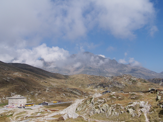
Oberalp Pass is a high mountain pass in the Swiss Alps connecting the cantons of Graubünden and Uri between Disentis/Mustér and Andermatt.

<span class="mw-page-title-main">San Bernardino Pass</span> Mountain pass in the Swiss Alps

San Bernardino Pass is a high mountain pass in the Swiss Alps connecting the Hinterrhein and the Mesolcina (Misox) valleys between Thusis and Bellinzona. Located in the far eastern side of the Western Alps it is not to be confused with the Great St Bernard Pass and the Little St Bernard Pass. The top of the pass represents both the Italo-German language frontier and the watershed between the Po basin and the Rhine basin. Marscholsee is within the pass at an elevation of 2,053 m (6,736 ft).

<span class="mw-page-title-main">Vue des Alpes</span>

Vue des Alpes is a high mountain pass in the Jura Mountains in the canton of Neuchâtel, Switzerland.

<span class="mw-page-title-main">Loibl Pass</span> Mountain pass between Austria and Slovenia

The Loibl Pass or Ljubelj Pass is a high mountain pass in the Karawanks chain of the Southern Limestone Alps, linking Austria with Slovenia. The Loibl Pass road is the shortest connection between the Carinthian town of Ferlach and Tržič in Upper Carniola and part of the European route E652 from Klagenfurt to Naklo.

<span class="mw-page-title-main">Col de la Forclaz</span> Mountain pass in the Swiss Alps

Col de la Forclaz is a mountain pass in the Alps in the Canton of Valais in Switzerland. It connects Martigny at 471 m (1,545 ft) and Le Châtelard (Finhaut). The road from Martigny to the Col has an average gradient of 6% but in parts is closer to 8%. After the Col, and Le Châtelard, the road leads to Chamonix in France via Vallorcine and the Col des Montets.

<span class="mw-page-title-main">Col des Montets</span> Mountain pass in the French Alps

Col des Montets is a mountain pass in the French Alps in the Haute-Savoie department of France. It is on the road between Chamonix, the Swiss Col de la Forclaz and Martigny in the canton of Valais, Switzerland.

<span class="mw-page-title-main">Stelvio Pass</span> Mountain pass in Italy, 200 m south of the Swiss border

The Stelvio Pass is a mountain pass in northern Italy bordering Switzerland at an elevation of 2,757 m (9,045 ft) above sea level. It is the highest paved mountain pass in the Eastern Alps, and the second highest in the Alps, 7 m (23 ft) below France's Col de l'Iseran.

<span class="mw-page-title-main">Evolution of motorway construction in European Union member states</span>

The evolution of motorways construction in European Union member states by total number of kilometres existing in that year. This is a list of the total number of Motorways by country, member of the European Union. It includes motorways, classified as such by the Eurostat.

References

  1. The highest towns with over 1000 inhabitants are St. Moritz (1,822 m), Silvaplana (1,815 m), Pontresina (1,805 m) and Saas-Fee (1,803 m).
  2. Cantons where the road is below 1,850 metres are indicated in small letters.
  3. Only roads of which both ends are connected to the main European road network are indicated as "Pass".