| Hajo | |
|---|---|
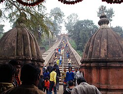  Entrance of Hayagriva Madhab mandir, Hajo Powa Mecca (Poa Mecca) | |
| Location | Hajo, Assam, India |
| Nearest city | Guwahati |
| Coordinates | 26°14′55″N91°31′32″E / 26.24861°N 91.52556°E |
| Built | 10th–18th century CE |
| Architectural styles | Hindu, Buddhist and Indo-Islamic-Mughal architecture [1] [2] |
| Governing body | Archaeological Survey of India |
 Location of Hajo  Hajo (India) | |
Hajo is a historic town set in the hills northwest of Guwahati, Assam, India. It is a meeting point of Buddhists, Hindus and Muslims due to the various pilgrimage sites on the different hills of Hajo. To the Hindus, the Manikut Parbat of Hajo is the site of the 10th-century temple ruins and the 11th- to 16th-century temples complex for Vaishnavism as well as shrines of Shaivism and Shaktism. To the Buddhists, particularly from Bhutan and Tibet, Assam is where the Buddha died and the Hayagriva temple in Hajo is a part of the sacred geography of the Buddha. To the regional Muslims, the Mughal era Poa-Mecca shrine on another hill of Hajo has the tomb of Giyasuddin Aulia built in the 17th century. [1] [2]
Contents
- Location hajo
- Etymology
- Monuments
- Ancient to 16th century
- 17th century
- Cultural relation with Bhutan
- Others
- Politics
- Notable people
- See also
- References
- External links
Hajo is one of the important historical and archaeological sites in northeast India as it preserves the history, inscriptions and architecture in a range of temples and monuments over about 1200 years. [1] [2] It is also a site known for its tradition of preserving rare species of tortoises, with Hindus believing that they are a form of Kurma avatar of Vishnu. [3]


