
Port Phillip or Port Phillip Bay is a horsehead-shaped enclosed bay on the central coast of southern Victoria, Australia. The bay opens into the Bass Strait via a short, narrow channel known as The Rip, and is completely surrounded by localities of Victoria's two largest cities — metropolitan Greater Melbourne in the bay's main eastern portion north of the Mornington Peninsula, and the city of Greater Geelong in the much smaller western portion north of the Bellarine Peninsula. Geographically, the bay covers 1,930 km2 (750 sq mi) and the shore stretches roughly 264 km (164 mi), with the volume of water around 25 km3 (6.0 cu mi). Most of the bay is navigable, although it is extremely shallow for its size — the deepest portion is only 24 m (79 ft) and half the bay is shallower than 8 m (26 ft). Its waters and coast are home to seals, whales, dolphins, corals and many kinds of seabirds and migratory waders.

HMVS Cerberus is a breastwork monitor that served in the Victoria Naval Forces, the Commonwealth Naval Forces (CNF), and the Royal Australian Navy (RAN) between 1871 and 1924.

The Mornington Peninsula is a peninsula located south of Melbourne, Victoria, Australia. It is surrounded by Port Phillip to the west, Western Port to the east and Bass Strait to the south, and is connected to the mainland in the north. Geographically, the peninsula begins its protrusion from the mainland in the area between Pearcedale and an area north of Frankston. The area was originally home to the Mayone-bulluk and Boonwurrung-Balluk clans and formed part of the Boonwurrung nation's territory prior to European settlement.

Port Melbourne is an inner-city suburb in Melbourne, Victoria, Australia, 3 km (2 mi) south-west of the Melbourne central business district, located within the Cities of Melbourne and Port Phillip local government areas. Port Melbourne recorded a population of 17,633 at the 2021 census.

Palm Beach is a suburb in the Northern Beaches region of Sydney, in the state of New South Wales, Australia. Palm Beach is located 41 kilometres (25 mi) north of the Sydney central business district, in the local government area of Northern Beaches Council. Palm Beach sits on a peninsula at the end of Barrenjoey Road near Pittwater and is the northernmost beach in the Greater Sydney Metropolitan area. The population of Palm Beach was 1,593 as at the 2016 census.

Hastings is a town on the Mornington Peninsula in Melbourne, Victoria, Australia, 58 km (36 mi) south-east of Melbourne's Central Business District, located within the Shire of Mornington Peninsula local government area. Hastings recorded a population of 10,369 at the 2021 census.

HMAS Cerberus is a Royal Australian Navy (RAN) base that serves as the primary training establishment for RAN personnel. The base is located adjacent to Crib Point on the Mornington Peninsula, south of the Melbourne City Centre, Victoria, Australia. The base is also an official bounded locality of the Shire of Mornington Peninsula and is the only naval base to have a specific listing in the Australian census. HMAS Cerberus recorded a population of 1,124 at the 2021 census. A section of the base centred around the Parade Ground was added to the Australian Commonwealth Heritage List on 22 June 2004, known as the HMAS Cerberus Central Area Group.

Portsea is a seaside town on the Mornington Peninsula in Melbourne, Victoria, Australia, approximately 60 kilometres (37 mi) south-west of Melbourne's Central Business District, located within the Shire of Mornington Peninsula local government area. Portsea recorded a population of 787 at the 2021 census.
Somers is a small coastal town on the Mornington Peninsula in Melbourne, Victoria, Australia, 67 km (42 mi) south-east of Melbourne's Central Business District, located within the Shire of Mornington Peninsula local government area. Somers recorded a population of 1,857 at the 2021 census.
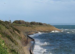
Black Rock is a suburb in Melbourne, Victoria, Australia, 18 km south-east of Melbourne's Central Business District, located within the City of Bayside local government area. Black Rock recorded a population of 6,389 at the 2021 census.

Edithvale is a beachside suburb in Melbourne, Victoria, Australia, 28 km south-east of Melbourne's Central Business District, located within the City of Kingston local government area. Edithvale recorded a population of 6,276 at the 2021 census.

Mentone is a suburb in Melbourne, Victoria, Australia, 21 km south-east of Melbourne's Central Business District, located within the City of Kingston local government area. Mentone recorded a population of 13,197 at the 2021 census.

Western Port, commonly but unofficially known as Western Port Bay, is a large tidal bay in southern Victoria, Australia, opening into Bass Strait. It is the second largest bay in the state. Geographically, it is dominated by two large islands; French Island and Phillip Island. At the time it was renamed, its position was west of other known ports and bays, but Western Port has become something of a misnomer as it lies just to the east of the larger Port Phillip and the city of Melbourne. It is visited by Australian fur seals, whales and dolphins, as well as many migratory waders and seabirds. It is listed under the Ramsar Convention as a wetland of international significance.

Apollo Bay is a coastal town in southwestern Victoria, Australia. It is situated on the eastern side of Cape Otway, along the edge of the Barham River and on the Great Ocean Road, in the Colac Otway Shire. The town had a population of 1,790 at the 2021 census.
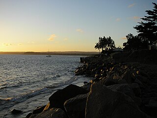
Indented Head is a small coastal township located on the Bellarine Peninsula, east of Geelong, in the Australian state of Victoria. The town lies on the coast of the Port Phillip bay between the towns of Portarlington and St Leonards.

Surf Life Saving Australia (SLSA) is an Australian not-for-profit community organisation that promotes water safety and provides surf rescue services.

Breamlea, Victoria, Australia, is a secluded seaside hamlet located on the south coast of the Bellarine Peninsula, 18 kilometres south of Geelong, and halfway between Barwon Heads and Torquay. It is divided between the City of Greater Geelong and the Surf Coast Shire. In the 2016 census, Breamlea had a permanent population of 162.

Port Phillip, sometimes referred to as Port Phillip Bay, is a large bay in southern Victoria, Australia, 1,930 km2 in area, with a coastline length of 264 km (164 mi). The bay is extremely shallow for its size, but mostly navigable. The deepest portion is only 24 m (80 ft), and half the region is shallower than 8 m. Its volume is around 25 km³. The city of Melbourne is located at its northern end, near the mouth of the Yarra River.

Port Phillip is in Victoria, Australia. It has many beaches, most of which are flat, shallow and long, with very small breaks making swimming quite safe. This attracts many tourists, mostly families, to the beaches of Port Phillip during the summer months and school holidays. Water sports such as body boarding and swimming are common, though waves are very rarely large enough for surfing. A number of lifesaving clubs operate along Port Phillip’s beaches.
Mentone Beach is a beach located in Mentone, on Port Phillip Bay, Victoria, Australia, 21 kilometres south from the Melbourne City Centre. Mentone beach is the northern section of a beach that extends alongside Beaumaris Bay from the cliffs at Rickett's Point in Beaumaris to Frankston in the south on the eastern shoreline of Port Phillip Bay.

