
Roebuck Bay is a bay on the coast of the Kimberley region of Western Australia. Its entrance is bounded in the north by the town of Broome, and in the south by Bush Point and Sandy Point. It is named after HMS Roebuck, the ship captained by William Dampier when he explored the coast of north-western Australia in 1699. The Broome Bird Observatory lies on the northern coast of the bay.

Eighty Mile Beach, also spelled Eighty-mile Beach or 80-mile Beach, and formerly called 90-mile Beach, lies along the north-west coast of Western Australia about half-way between the towns of Broome and Port Hedland. It is a beach some 220 kilometres (140 mi) in length, forming the coastline where the Great Sandy Desert approaches the Indian Ocean. It is one of the most important sites for migratory shorebirds, or waders, in Australia, and is recognised as a wetland of international importance under the Ramsar Convention on Wetlands.
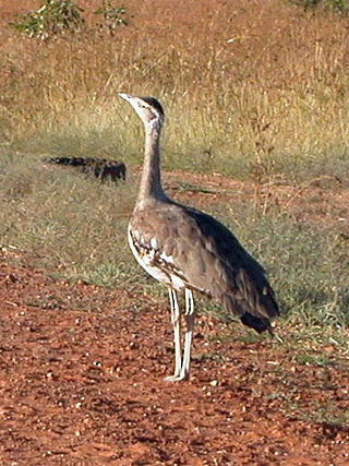
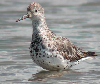
Yanakie Isthmus is a sandy isthmus that connects Wilsons Promontory to mainland Victoria, south-eastern Australia. The small holiday town of Sandy Point and nearby Shallow Inlet lie on the western side of the isthmus.

The Swan Bay is a shallow, 30-square-kilometre (12 sq mi) marine embayment at the eastern end of the Bellarine Peninsula in Port Phillip, Victoria, Australia. The township of Queenscliff lies at its southern end, and St Leonards at its northern. It is partly separated from Port Phillip by Swan Island, Duck Island and Edwards Point. Most of the area is included in the Port Phillip Heads Marine National Park as well as being listed as a wetland of international importance under the Ramsar Convention as part of the Port Phillip Bay and Bellarine Peninsula Ramsar Site. The bay is part of the Swan Bay and Port Phillip Bay Islands Important Bird Area, identified as such by BirdLife International because of its importance for orange-bellied parrots, waders and seabirds.

Edwards Point is a 4 km long sand spit extending southwards between Swan Bay and Port Phillip Bay, at the eastern end of the Bellarine Peninsula, Victoria, Australia. It is about 115 km by road south-west of Melbourne and 40 km east of Geelong.
Yanakie is a small, coastal township and district on the Yanakie Isthmus in South Gippsland, in the state of Victoria, south-eastern Australia.

The Corner Inlet is a 600-square-kilometre (230 sq mi) bay located 200 kilometres (120 mi) south-east of Melbourne in the South Gippsland region of Victoria, Australia. Of Victoria's large bays it is both the easternmost and the warmest. It contains intertidal mudflats, mangroves, salt marsh and seagrass meadows, sheltered from the surf of Bass Strait by a complex of 40 sandy barrier islands, the largest of which are Snake, Sunday and Saint Margaret Islands.
The Port Phillip Bay and Bellarine Peninsula Ramsar Site is one of the Australian sites listed under the Ramsar Convention as a wetland of international importance. It was designated on 15 December 1982, and is listed as Ramsar Site No.266. Much of the site is also part of either the Swan Bay and Port Phillip Bay Islands Important Bird Area or the Werribee and Avalon Important Bird Area, identified as such by BirdLife International because of their importance for wetland and waterbirds as well as for orange-bellied parrots. It comprises some six disjunct, largely coastal, areas of land, totalling 229 km2, along the western shore of Port Phillip and on the Bellarine Peninsula, in the state of Victoria. Wetland types protected include shallow marine waters, estuaries, freshwater lakes, seasonal swamps, intertidal mudflats and seagrass beds.
The Gulf Plains Important Bird Area comprises 8868 km2 of the low-lying coastal plains bordering the south-eastern corner of the Gulf of Carpentaria in north-west Queensland, Australia. It was identified by BirdLife International as an Important Bird Area (IBA) because of its importance to global populations of waders and other birds.
The Gulf St Vincent Important Bird Area comprises land extending along the coast of Gulf St Vincent, north of Adelaide, South Australia.
The Marion Bay Important Bird Area is on the south-western side of Marion Bay, south-eastern Tasmania, Australia. It includes two sandy, high-energy, oceanic beaches, Marion Bay Beach and North Bay Beach, encompasses the privately owned Long Spit Nature Reserve, and extends through the entrance of Blackman Bay to the intertidal mudflats within. The beaches and mudflats form a single system used by waders, or shorebirds; the storm-swept beaches of the outer bay contrast with and complement the sheltered mudflats and sand-bars of the inner bay.

The Melaleuca to Birchs Inlet Important Bird Area comprises a 2315 km2 section of coast and sub-coastal land in South West Tasmania. It stretches southward from the southern end of Birchs Inlet, encompasses Melaleuca and Port Davey, and extends to Louisa Bay on the coast facing the Maatsuyker Island group. The area is rugged, with extensive beaches and coastal plains rising to rocky mountains. It contains a mosaic of temperate rainforest, eucalypt forest, moorland and buttongrass plains.
The Milingimbi Islands Important Bird Area comprises 94 km2 of land in the Milingimbi, or Crocodile Islands group, of the Northern Territory of Australia. The area is traditionally owned Aboriginal land. The mudflats are an important staging site for migratory waders, or shorebirds.

The North-west Tasmanian Coast Important Bird Area comprises a 2438 km2 stretch of coastal and subcoastal land covering the northern section of the coast of western Tasmania, south-eastern Australia.
The Port Hedland Saltworks Important Bird Area is a 103 km2 tract of originally intertidal land, now containing a saltern, lying about 20 km east of the port of Port Hedland on the coast of the Pilbara region of north-west Western Australia. The salt processing facility is operated by Dampier Salt Ltd, part of the Rio Tinto Group.
The Robbins Passage and Boullanger Bay Important Bird Area is a 238 km2 tract of land at the western end of the north coast of Tasmania, south-eastern Australia. It comprises extensive areas of intertidal mudflats and saltmarsh with adjacent farmland. It is an important site for waders, or shorebirds.
Shoal Bay is a shallow bay lying adjacent to, and north of, the city of Darwin in the Northern Territory of Australia. Encompassing Hope Inlet at its eastern end, it is characterised by extensive areas of intertidal mudflats and mangroves and is an important site for waders, or shorebirds. The bay is situated within the Shoal Bay Coastal Reserve, a protected area that was established in 2000.

The Werribee and Avalon Important Bird Area comprises some 37 km2 of coastal land along the northwestern shore of Port Phillip in the state of Victoria, in southeastern Australia. It is important for a wide variety of waterbirds.
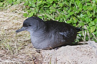
The Wilsons Promontory Islands Important Bird Area comprises a loose cluster of 19 small, granite islands, with a collective area of 658 ha, scattered around Wilsons Promontory in the state of Victoria, south-eastern Australia. The three southernmost islands are part of the state of Tasmania. They are important for their breeding seabirds.

The Fog Bay and Finniss River Floodplains comprise the floodplain of the lower reaches of the Finniss River with the adjoining intertidal mudflats of Fog Bay in the Top End of the Northern Territory of Australia. It is an important site for waterbirds.

