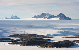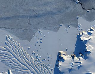
Lambert Glacier is a major glacier in East Antarctica. At about 80 km (50 mi) wide, over 400 km (250 mi) long, and about 2,500 m (8,200 ft) deep, it is the world's largest glacier. It drains 8% of the Antarctic ice sheet to the east and south of the Prince Charles Mountains and flows northward to the Amery Ice Shelf. It flows in part of Lambert Graben and exits the continent at Prydz Bay.
Fisher Glacier is a glacier in Mac. Robertson Land, Antarctica. It is a major tributary of the Lambert Glacier. The glacier is unusual in periodically surging.
Mawson Peninsula is a high, narrow, ice-covered peninsula on the George V Coast, on the west side of the Slava Ice Shelf, Antarctica, terminating in Cape Hudson. It extends for over 30 nautical miles (56 km) in a northwesterly direction. The peninsula was photographed from the air by U.S. Navy Operation Highjump, 1946–47, and was sketched and photographed by Phillip Law of the Australian National Antarctic Research Expeditions who flew along it to its northern end in February 1959. It was named by the Antarctic Names Committee of Australia for Sir Douglas Mawson.
The Scott Mountains are a large number of isolated peaks lying south of Amundsen Bay in Enderby Land of East Antarctica, Antarctica. Discovered on 13 January 1930 by the British Australian New Zealand Antarctic Research Expedition (BANZARE) under Sir Douglas Mawson. He named the feature Scott Range after Captain Robert Falcon Scott, Royal Navy. The term mountains is considered more appropriate because of the isolation of its individual features.

The David Range (67°54′S62°30′E is a mountain range that extends for 26 kilometres in the Framnes Mountains of Mac.Robertson Land in Antarctica. The range is surrounded by, and largely covered by, an ice sheet. Only the peaks are visible.
Cape Yevgenov is an ice-covered cape midway along the northeast side of Krylov Peninsula, forming the west entrance to Lauritzen Bay, Antarctica. Photographed by U.S. Navy Operation Highjump (1946–47), Soviet Antarctic Expedition (1957–58), and ANARE (1959). Named by Soviet Antarctic Expedition after Russian hydrographer Nikolay I. Yevgenov (1888–1964).
Kichenside Glacier is a glacier, 15 nautical miles (28 km) long and 3 to 5 nautical miles wide, flowing northeast into the southern part of the Hannan Ice Shelf on the coast of Enderby Land, Antarctica. It was charted from air photos taken from an Australian National Antarctic Research Expeditions aircraft in 1956, and was named by the Antarctic Names Committee of Australia for Squadron Leader James C. Kichenside, RAAF, officer commanding the Antarctic Flight at Mawson Station in 1960.
Ob' Bay is a bay lying between Lunik Point and Cape Williams in Antarctica. Lillie Glacier Tongue occupies the east part of the bay. The bay was charted by the Soviet Antarctic Expedition (1958) and named after the expedition ship Ob'.
On the continent of Antarctica, the Aramis Range is the third range south in the Prince Charles Mountains, situated 11 miles southeast of the Porthos Range and extending for about 30 miles in a southwest–northeast direction. It was first visited in January 1957 by Australian National Antarctic Research Expeditions (ANARE) southern party led by W.G. Bewsher, who named it for a character in Alexandre Dumas' novel The Three Musketeers, the most popular book read on the southern journey.
Bain Nunatak is one of the Manning Nunataks, on the east side of the Amery Ice Shelf. The nunataks were photographed by U.S. Navy Operation Highjump (1946–47) and Australian National Antarctic Research Expeditions (ANARE) (1957). They were visited by the Soviet Antarctic Expedition in 1965 and by the ANARE Prince Charles Mountains survey party in 1969. This feature was named for C.J. Bain, weather observer at Mawson Station in 1969 and a member of the 1969 ANARE survey party.
Nemesis Glacier is a large glacier which flows northeast through the center of the Aramis Range, Prince Charles Mountains. Discovered in January 1957 by ANARE southern party under W.G. Bewsher, and named after Homer's Nemesis because considerable difficulty was experienced in traversing the region due to the glacier.
Waratah Islands is a pair of small islands lying close to the coast about 1 nautical mile (1.9 km) northwest of Hannan Ice Shelf, Enderby Land. Plotted from air photos taken from ANARE aircraft in 1956. Named by Antarctic Names Committee of Australia (ANCA) after the Australian native plant Waratah.

Matusevich Glacier is a broad glacier about 50 nautical miles long, with a well developed glacier tongue, flowing to the coast of East Antarctica between the Lazarev Mountains and the northwestern extremity of the Wilson Hills.
Molle Glacier is a glacier, 4 nautical miles (7 km) wide, flowing north-northeast into the northern part of the Hannan Ice Shelf, Enderby Land, Antarctica. It was charted from air photos taken by Australian National Antarctic Research Expeditions in 1956, and was named by the Antarctic Names Committee of Australia for J.D. Molle, a radio officer at Davis Station in 1960.
Foster Nunatak is a horseshoe shaped rock outcrop in the south part of the Manning Nunataks, on the east side of the Amery Ice Shelf, Antarctica. The Manning Nunataks were photographed by U.S. Navy Operation Highjump (1946–47) and Australian National Antarctic Research Expeditions (ANARE) (1957). They were visited by the Soviet Antarctic Expedition in 1965 and ANARE in 1969. This nunatak was named by the Antarctic Names Committee of Australia for A.L. Foster, an electronics engineer at Mawson Station in 1970, and a member of an ANARE glaciological traverse party on the Amery Ice Shelf in January 1970.
The Linton-Smith Nunataks are a group of nunataks between Jennings Promontory and the Reinbolt Hills on the east side of the Amery Ice Shelf, Antarctica. They were first photographed by U.S. Navy Operation Highjump (1946–47), and the position was fixed by intersection from the Corry Rocks and Rubeli Bluff by Australian National Antarctic Research Expeditions (ANARE) surveyors in 1968. The group was named by the Antarctic Names Committee of Australia for N. Linton-Smith, senior technical officer with the Antarctic Division, Melbourne, a member of the ANARE Amery Ice Shelf glaciological traverse in 1970.
Single Island is a high ice-covered island on the west side of the Amery Ice Shelf about 26 kilometres (14 nmi) south of Landon Promontory. First plotted by ANARE from air photos taken in 1956, but incorrectly shown as a promontory. Later mapped by ANARE as an island. Named by Antarctic Names Committee of Australia (ANCA) for M. Single, senior diesel mechanic at Mawson Station in 1962, a member of the ANARE field party which visited the area in December 1962.
Tester Nunatak is the southernmost of a group of three nunataks in the northern part of the Manning Nunataks, in the east part of Amery Ice Shelf. The nunataks were photographed by U.S. Navy Operation Highjump (1946–47) and ANARE (1957). They were visited by the Soviet Antarctic Expedition in 1965 and by ANARE in 1969. Named by Antarctic Names Committee of Australia (ANCA) for J. Tester, aircraft engineer with the ANARE Prince Charles Mountains survey party in 1969.
Luff Nunatak is a narrow nunatak, 3 nautical miles (6 km) long, located west of Foster Nunatak in the Manning Nunataks of Antarctica, in the eastern part of the Amery Ice Shelf. The Manning Nunataks were photographed by U.S. Navy Operation Highjump (1946–47) and the Australian National Antarctic Research Expeditions (ANARE) (1957). They were visited by the Soviet Antarctic Expedition in 1965 and ANARE in 1969. The nunatak was named by the Antarctic Names Committee of Australia for T.S. Luff, a senior diesel mechanic at Mawson Station in 1970, and a member of the ANARE glaciological traverse party on the Amery Ice Shelf in January 1970.


