
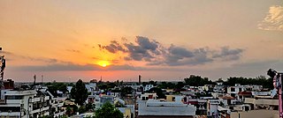
Rajgarh is a city and a municipality in the state of Madhya Pradesh in India. It is the administrative headquarters of Rajgarh District, and was a princely state under the British Raj, named Rajgarh State. The old city belongs to the Malwa region and is surrounded by a battlemented wall. Rajgarh is now known for NTPC solar power plant and dam projects running over here, as a result companies like Tata and Reliance power have shown interest.Rajgarh is also famous for Jalpama temple

Shajapur District is a district of Madhya Pradesh state of central India. The town of Shajapur is the district headquarters. It belongs to Ujjain Division.
Kanad is a town and a nagar parishad in Agar Malwa district in the Indian state of Madhya Pradesh. It comes under Kanad Parishad. It belongs to Ujjain Division. It is situated along the Agar–Sarangpur SH-41 highway. It is located 18 km (11 mi) towards east from the district headquarters of Agar Malwa, 83 km (52 mi) from Ujjain, 186 km (116 mi) from the state capital of Bhopal.

Guna district is one of the 52 districts of Madhya Pradesh in central India. Its administrative headquarters is Guna. The district has a population of 1,241,519. It has an area of 6390 km², and is bounded on the northeast by Shivpuri District, on the east by Ashoknagar District, on the southeast by Vidisha District, on the southwest by Rajgarh District, on the west and northwest by Jhalawar and Baran districts of Rajasthan state. The Sindh River flows northward along the eastern edge of the district, forming part of the boundary with Ashoknagar District, and the Parvati River flows northwestward through the southern portion of the district, forming part of the boundary with Baran District before flowing into Rajasthan.

Rajgarh district is a district of Madhya Pradesh in central India. The city of Rajgarh is the administrative headquarters of the district. The old name of Rajgarh was Jhanjhanipur. Rajgarh in Madhya Pradesh is one of the aspirational districts selected by Government of India. The district has an area of 6,154 km² and the population is 1,545,814. The district lies on the northern edge of the Malwa plateau, and the Parbati River forms the eastern boundary of the district, while the Kali Sindh River forms the western boundary. The district has seven tehsils, Rajgarh, Khilchipur, Jirapur, Biaora, Narsinghgarh, Sarangpur and Pachore. The district is bounded by Rajasthan state to the north, and by the districts of Guna to the northeast, Bhopal to the east, Sehore to the southeast, and Shajapur to the south and west. It is part of Bhopal Division. There are 1728 villages in Rajgarh.

Sehore District is a district of Madhya Pradesh state in central India. The town of Sehore is the district headquarters. The district is part of Bhopal Division.
Bareli is a town and a Municipality in Raisen district in the state of Madhya Pradesh, India. It is located in the Bareli tehsil. Bareli is a town in the Raisen district. There is a sub-jail in Bareli. Bareli is located on bank of Barna River. Bareli has National Krishi Upaj Mandi and it produces Wheat, Soyabean, Rice and different vegetable in different seasons. Bareli is connected with National Highway that connects to Bhopal and Jabalpur via NH-12(or NH-45)
Bhainsdehi is a city and a Nagar Parishad in Betul district in the state of Madhya Pradesh, India. According to mythological beliefs, Bhainsdehi was known as Mahishmati, the capital of Raghuvanshi King Gaya. Which later changed from Mahishmati to Mahishvati and then to Mahishadehi and then to Bhainsdehi. Kukru is the second highest point of Mahadeo hills. Bhainsdehi is the originating place of the river Purna. It is predominantly a tribal tehsil. Bhainsdehi is surrounded by the mountain ranges of Satpura. Prachin Shiv mandir one of the most beautiful place in Bhainsdehi city
Jirapur is a town and a nagar panchayat in Rajgarh district in the Indian state of Madhya Pradesh. In 2022 Janpad Panchayat election held across Madhya Pradesh, Congress won the election and secure position as a Janpad Adhyaksh under the leadership of Khilchipur vidhayak Shri Priyavrat Singh Ji. He put all the efforts to win this election and doing great work for Khilchipur constituency. He won 2018 assembly election of Madhya Pradesh with huge margin of 30,000+ votes by defeating Kunwar Hajarilal Dangi of Bharatiya Janata Party (BJP) candidate.
Kukshi is a town in Dhar district of Madhya Pradesh state, India. Kukshi has population of around 37,482 making it a Tier-3 city and a Semi-Urban centre. It is a Nagar Parishad. Kukshi is famous for the business of cotton, chilli, gold and silver, and ready made garments.
Nalkheda is a town (Tehsil) and a nagar Parishad in Agar Malwa district in the Indian state of Madhya Pradesh. Nalkheda is situated on the bank of river Lakhunder.
Pachore is a Tahsil Place and a nagar panchayat in Rajgarh district of Madhya Pradesh in India. It is situated on Agra-Bombay Road - NH 52 at the bank of the river Nevaj. Pachore Mandi is the biggest Mandi of Rajgarh District.
Sarangpur is a city and tehsil in Rajgarh district in the Indian state of Madhya Pradesh. It is situated at the bank of the river Kali Sindh.
Soyat Kalan or Soyat is a town and a Nagar Parishad in Agar Malwa district in the Indian state of Madhya Pradesh.
Narsinghgarh is a town and a municipality, near Rajgarh city in Rajgarh district in the Indian state of Madhya Pradesh.
Boda is a town and a Nagar Parishad in Rajgarh district in the state of Madhya Pradesh, India.

Dabra is a town and municipality in Gwalior district in the state of Madhya Pradesh, India located near NH-44 national highway. It serves the headquarters for both a tehsil and a coterminous community development block.
Banapura is a small town in the Hoshangabad District of Madhya Pradesh, India. Banapura is a twin city of Seoni Malwa.
Kalapipal Mandi or Pankhedi is a City in Shajapur district of Madhya Pradesh, India. It is located on Western railways Bhopal - Ujjain section and is connected by railway to some major city's of Madhya Pradesh like Bhopal, Indore and Ujjain. Nearest airport Bhopal.

Malwas is a village and post in the Churu district of northern Rajasthan state, India.


