Hard Bargain Airport | |||||||||||
---|---|---|---|---|---|---|---|---|---|---|---|
Summary | |||||||||||
Airport type | Public | ||||||||||
Serves | Long Island | ||||||||||
Location | Bahamas | ||||||||||
Elevation AMSL | 5 ft / 2 m | ||||||||||
Coordinates | 23°0′40.3″N74°54′21.2″W / 23.011194°N 74.905889°W Coordinates: 23°0′40.3″N74°54′21.2″W / 23.011194°N 74.905889°W | ||||||||||
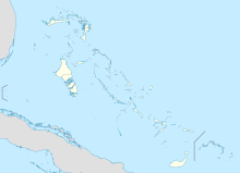
Map | |||||||||||
Runways | |||||||||||
| |||||||||||
Hard Bargain Airport( ICAO : MYLR) is a public use airport located near Long Island, the Bahamas.
The ICAOairport code or location indicator is a four-letter code designating aerodromes around the world. These codes, as defined by the International Civil Aviation Organization and published in ICAO Document 7910: Location Indicators, are used by air traffic control and airline operations such as flight planning.
[[File:EK tERMINAL 3 Trip 2009 242.jpg|thumb|Terminal 3 of the thumb|Solar panels at the international airport at Kochi, India, the world's first airport to be fully powered by solar energy.
Long Island is an island in the Bahamas that is split by the Tropic of Cancer. It is one of the Districts of the Bahamas and is known as the most scenic island in the Bahamas. Its capital is Clarence Town. The population of Long Island is 3,094 inhabitants.
Mores Island Airport is a public use airport located near Moore's Island, the Bahamas.
Scotland Cay Airport is a private use airport located near Scotland Cay, the Bahamas.
Walker's Cay Airport is a public use airport located near Walker's Cay, the Bahamas.
Big Whale Cay Airport is a public use airport located near Big Whale Cay, the Bahamas.
Little Whale Cay Berry Islands Airport is a public use airport located on Little Whale Cay, the Bahamas.
Cat Cay Airport is a private airport located on North Cat Cay, the Bahamas. The airport is for the exclusive use of the Cat Cay Yacht Club and requires permission to land. It has the 21st shortest runway in the world, and the 2nd shortest for an ICAO named airport.
Ocean Cay Airport is a private use airport located near Ocean Cay, the Bahamas.
Cutlass Bay Airport is a public use airport serving Cutlass Bay, on the Cat Island in The Bahamas.
Hawk's Nest Creek Airport is a public use airport located near Hawk's Nest Creek, The Bahamas.
Cay Sal Airport was an airport located on Cay Sal, the Bahamas. The airstrip which was built there during WWII is now abandoned according to aerial imagery.
Pitts Town Point Airport is a public use airport located near Pitts Town Point, the Bahamas.
Cape Eleuthera Airport was a public use airport located 3 nm east-southeast of Cape Eleuthera, The Bahamas. The airport is closed, and the runway is not usable.
Black Point Airport is a public use airport located near Black Point, the Bahamas.
Darby Island Airport is a private use airport located near Darby Island, the Bahamas.
Lee Stocking Airport is a public use airport located near Lee Stocking, the Bahamas.
Rudder Cut Cay Airport is a public use airport located near Rudder Cut Cay, the Bahamas.
Big Sampson Cay Airport is a private use airport located near Big Sampson Cay, the Bahamas.
Cape Santa Maria Airport was a public use airport located near Cape Santa Maria, the Bahamas.
New Providence Airport was a private use airport located on Paradise Island, the Bahamas. It closed in 1999 and the land incorporated into the island resort.
Twin Lakes Airport was a public use airport located 15 nm north of Andros Central, the Bahamas. The airport is closed.
This article about a Caribbean airport is a stub. You can help Wikipedia by expanding it. |
This article about a Bahamian building or structure related topic is a stub. You can help Wikipedia by expanding it. |