
Gadchiroli district is an administrative district in Maharashtra, India. The city of Gadchiroli is the administrative headquarters of the district.

Yavatmal districtpronunciation (help·info), formerly known as Yeotmal, is a district of the Indian state of Maharashtra. It is located in the region of Vidarbha, in the east-central part of the state. It is Vidarbha's third-largest district by population, after Nagpur and Amravati. Yavatmal town is the administrative headquarters of the district.

Chandrapur district is a district in the Nagpur Division in the Indian state of Maharashtra. Chandrapur was the largest district in India until the Gadchiroli and Sironcha tehsils were split into separate districts in 1981. In 2011, the district population was 2,204,307.

Gondia district is an administrative district in the state of Maharashtra in India. The district headquarter is located at Gondia. The district occupies an area of 5,431 km2 (2,097 sq mi) and has a population of 1,322,507 of which 11.95% were urban. The district is part of Nagpur Division. There are 8 Talukas in Gondia District. Gondia Airport is second airport in Vidharbha region and serves city of Gondia.
Amravati district is a district of Maharashtra state in central India. Amravati is the administrative headquarters of the district.

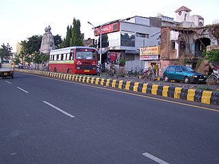
Yavatmal (pronunciation is a city and municipal council in the Indian state of Maharashtra. It is the administrative headquarters of Yavatmal District. Yavatmal is around 90 km away from divisional headquarters Amravati while it is 670 km away from the state capital Mumbai. The name is derived from the Marathi Yavat and mal. It is famous for the grand celebration of Durga festival. It ranks 2nd after Kolkata in the enormous decorations of Durga mandapam.
The Dhangar is a herding caste of people found in Indian states such as Maharashtra and Uttar Pradesh.

Muktainagar is a town in the eastern part of Jalgaon district in northern Maharashtra. and administrative seat of Muktainagar taluka.
Pusad is a town in the Yavatmal district located in Vidarbha region of Maharashtra state of India. It is named after the Pus river. Its ancient name was 'Pushpawanti'.
Sillod is a city and also name of a Taluka in the Aurangabad District of the Indian state of Maharashtra with an average elevation of 612 metres (2,008 ft).
Kannad is a Taluka and a municipal council city in Aurangabad district in the Indian state of Maharashtra. It is located 30 km away from the Ellora Caves.
Morshi is the second largest town in the Amravati district of Maharashtra. It is located 55 km north-east of Amravati, Situated very close to Madhya Pradesh Border, in the scenic southern foothills of Satpura ranges. Morshi and the surrounding region is also known for the cultivation of famous Nagpur oranges.
Nilanga is a town with a municipal council in Latur District in the Indian state of Maharashtra. It is also the headquarters for Nilanga Taluka. The city being small is the Taluka Headquarter.
Warud is a city and a municipal council in Amravati district in the Indian state of Maharashtra
Ralegaon is Tehsil place town in Yavatmal District of Maharashtra (India). It is located in Vidarbha region of Maharashra. Geographically it is located northwest from Yavatmal. It is located 42 km away from Yavatmal and 21 km away from the Kalamb which is on Nagpur-Yavatmal road. And just 41 km from city Wardha.
Peth is the smallest tehsil of Nashik subdivision of Nashik district in Maharashtra, India. It belongs to Khandesh and Northern Maharashtra region. It belongs to Nashik Division. Peth is a Taluka headquarter. It is located 54 km to the north of District headquarters Nashik. It is also called as Peth. Peth Pin code is 422208 and postal head office is Peth.
Khandala is a taluka in the Satara district in Maharashtra, India. The Nira River passes through the region. Khandala Taluka is situated on the northern side of Satara district. Khandala, Shirwal and Lonand are large towns in the taluka. Khandala got separated from Wai Taluka along with Mahabaleshwar for easier administration. The Nira River flows from the northern border of the taluka. "VEER" is the largest dam on the Nira River in Khandala. The southern border is covered with "MAHADEVACHE DONGAR", meaning Mahadev Hills.
Ashti is a major village in Partur taluka of Jalna district in Maharashtra state of India.
Bori is a village in Jintur taluka of Parbhani district in Maharashtra state of India.
Manwath Road is a village in Manwath taluka of Parbhani district of Indian state of Maharashtra. Village is mainly known for being a major railway station on Nanded-Aurangabad rail route. Station code of Manwath road is MVO. It is 8 km away from taluka headquarter Manwath.

