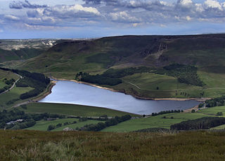
Dove Stone Reservoir lies at the convergence of the valleys of the Greenfield and Chew Brooks above the village of Greenfield, on Saddleworth Moor in Greater Manchester, England. Historically part of the West Riding of Yorkshire, the reservoir is on the western edge of the Peak District National Park. It supplies drinking water to the surrounding area and is a tourist attraction, providing several walks amongst picturesque landscapes.
The Pentland Hills are a range of hills southwest of Edinburgh, Scotland. The range is around twenty miles in length, and runs southwest from Edinburgh towards Biggar and the upper Clydesdale.
Bonaly is an area on the south-western outskirts of Edinburgh and the northern slopes of the Pentland Hills, lying within the Parish of Colinton. It is a mix of mainly post-war housing, woodland, pasture-land and heather moorland. Bonaly Burn has its sources in the hills above Bonaly and flows towards Oxgangs, where it becomes the Braid Burn. The Edinburgh City Bypass passes through Bonaly.
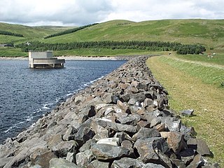
Megget Reservoir is an impounding reservoir in the Megget valley in Ettrick Forest, in the Scottish Borders. The 259 hectares reservoir is held back by the largest earth dam in Scotland. The reservoir collects water from the Tweedsmuir Hills, which is then conveyed 28 miles (45 km) via underground pipelines and tunnels to Edinburgh. The pipelines are routed through the Manor Valley and the Meldon Hills, to Gladhouse Reservoir and Glencorse Reservoir in the Pentland Hills. These two reservoirs store the water until such times as it is required. Excess water which overflows from the reservoir is returned to the Megget Water, and hence into St. Mary's Loch.

West Water Reservoir is an artificial reservoir in the Pentland Hills, Scottish Borders, 3 kilometres west of West Linton, and 26 kilometres south west of Edinburgh. It is a drinking water reservoir for Edinburgh and the Lothians and is located 320 metres (1,050 ft) above sea level. It is an important site for wildfowl and is designated as a SSSI and a Ramsar site.

Piethorne Reservoir is the largest of several reservoirs in the Piethorne Valley above Newhey, by Milnrow, in the Metropolitan Borough of Rochdale, Greater Manchester, England. It was built between 1858 and 1868.

Gladhouse Reservoir, formerly known as Moorfoot Loch, is a reservoir in Midlothian, Scotland, five miles (8 km) south of Penicuik. It is the most southerly reservoir in Midlothian, as well as being the largest area of freshwater in the Lothians. It is used to supply Edinburgh with drinking water.

Loganlea Reservoir is a small reservoir in the Pentland Hills, Midlothian, Scotland, UK. The Logan Burn connects the reservoir with Glencorse Reservoir.

Bavelaw Castle is a historic house in the City of Edinburgh Council area, Scotland. It is north of Hare Hill in the Pentland Hills, four miles west of Penicuik, and two miles south of Balerno, above Threipmuir Reservoir. It was designated as a Category A listed building in 1971.

Threipmuir Reservoir is a reservoir in the City of Edinburgh Council area, Scotland, UK. It is situated to the south of Edinburgh at the base of the Pentland Hills, two miles south of Balerno.
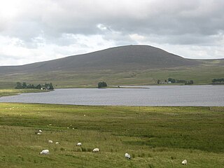
Harperrig Reservoir is a reservoir in West Lothian, Scotland, to the north of the Pentland Hills, four miles (6.4 km) south of Mid Calder. The Water of Leith flows through it, and nearby are Harlaw Reservoir and Threipmuir Reservoir. It has been proposed that the reservoir be designated as a local nature reserve to be managed by West Lothian Council.
Cobbinshaw Reservoir is a reservoir in West Lothian, Scotland. It is situated near the Pentland Hills, 5 km south of West Calder. The 310-acre (1.3 km2) site is a Site of Special Scientific Interest (SSSI) and is popular with wildfowl.

Baddinsgill Reservoir is a small reservoir in the Scottish Borders area of Scotland close to Carlops, West Linton, and the boundary with Midlothian. It is close to Baddinsgill House. The Lyne Water is dammed to form the reservoir, not the Baddinsgill Burn, which joins the Lyne Water further south, below the reservoir. The earth dam was faced with concrete blocks. In time these eroded and they were capped with 100 millimetres (3.9 in) of tarmac.
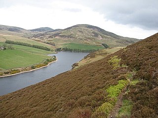
Glencorse Reservoir is a reservoir in Midlothian, Scotland, two miles west of Glencorse, in the Pentland Hills.

Waun Lefrith is a top of Picws Du and is also the westernmost of the Carmarthen Fans, a group of peaks within the Black Mountain of the Brecon Beacons National Park. It lies within Carmarthenshire, Wales. The summit plateau of the mountain reaches a height of 2221 feet above sea level. Picws Du and Fan Foel are the other, higher summits of the Carmarthen Fans. The glacial lake of Llyn y Fan Fach dominates the panorama to the north of the peak. Beyond the lake to the north lies the Usk Reservoir and then the Cambrian Mountains on the horizon. Swansea Bay and the Bristol Channel are visible to the south across the undulating dip slope of the mountain. The Towy (Tywi) valley lies to the west, with Llandovery and Llandeilo as important market towns nearest to the hills.

The Moffat Hills are a range of hills in the Southern Uplands of Scotland. They form a roughly triangular shape with a west facing side, a north facing side, and a south-east facing side. It is 17 kilometres from east to west across this triangle and some 16 kilometres north to south. The highest point is White Coomb at 821 m (2694 ft). The town of Moffat lies just south of the Moffat hills and along with Tweedsmuir, at the northern extremity, is the only centre of population around these hills. In some older maps, the northern part of the Moffat Hills is called the Tweedsmuir Hills, but can also be known by the title Manor Hills.
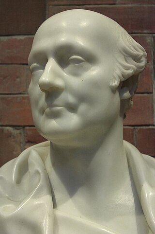
James Jardine was a Scottish civil engineer, mathematician and geologist. He was the first person to determine mean sea level. He built tunnels and bridges, including for the Innocent Railway, and built reservoirs including Glencorse, Threipmuir, Harlaw for Edinburgh Water Company, and Cobbinshaw for the Union Canal.
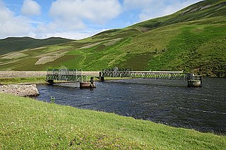
Edinburgh Water Company and its successors have provided a public water supply and latterly sewerage and sewage treatment services to the Scottish capital of Edinburgh since 1819. The original company was established to supply drinking water and did so until 1870, when it was taken over by a public Water Trust, with representatives from Edinburgh, Leith and Portobello. That in turn was taken over by Edinburgh Corporation and in 1975, responsibility passed to the Lothian Regional Council, as did the duty to provide sewerage and sewage treatment services. Both services were moved out of local authority control, and taken over by the East of Scotland Water Authority in 1996. The three Scottish regional water authorities were merged to form Scottish Water in 2002.
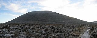
East Cairn Hill is a hill in the Pentland Hills range of Scotland. With a height of 567 m (1,860 ft), it is the highest hill in the City of Edinburgh council area and is located on the western flank of the approximately 20 mi (32 km) long chain of hills. The East Cairn Hill has two knolls, of which the higher one is on the east side and the 561 m (1,841 ft) high side knoll is 800 m (2,600 ft) to the west.

Cauldstane Slap is a pass located in the Pentland Hills of Scotland. It marks the border between the neighboring council areas of West Lothian and Scottish Borders and historically the border between Edinburghshire and Peeblesshire.


